|
|
 |
|
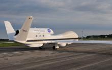
AV-1 Global Hawk aircraft arriving at WFF
|
 |
|||
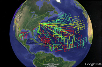
This image shows the flight tracks of the NASA GlobalHawk (GH) unmanned aircrafts flown during the NASA Hurricane and Severe Storm Sentinel (HS3) field campaign (2012,2013,2014).
|
1) What impact does the Saharan air layer (SAL) have on intensity change?
2) How do storms interact with shear produced by large-scale wind systems?
3) How does the outflow layer interact with the environment?
1) What is the role of deep convective towers (bursts) in intensity change? Are they critical to intensification?
2) What changes in storm structure occur prior to and during genesis and rapid intensification?
3) How do intrusions of dry air impact intensity change?
Measurements
| Environment Payload | Over-storm Payload | |
|---|---|---|
|
S-HIS
High-resolution Interferometer Sounder
|
HIWRAP
High-Altitude Imaging Wind and Rain Airborne Profiler
|
|
|
AVAPS
Airborne Vertical Atmospheric Profiling System
|
HIRAD
Hurricane Imaging Radiometer
|
|
|
CPL
Cloud Physics Lidar
|
HAMSR
High-Altitude MMIC Sounding Radiometer
|
|
Five of the above instruments were mounted on one or the other of the two Global Hawk UAS aircraft, and each measured the atmosphere from flight altitude. The sixth, the Automated Vertical Atmospheric Profiling System (AVAPS) on the environment Global Hawk, is unique in that it contained hardware mounted on the aircraft for automated release of dropsondes which measured the atmospheric characteristics of temperature, pressure, humidity and winds during their descent. Up to 88 dropsondes could be released on each Global Hawk flight. These dropsonde data were essential for validation activities.
- World Wide Lightning Location Network (WWLLN) lightning data for the observed storms
- Statistical Hurricane Intensity Prediction Scheme (SHIPS) model data
- NASA Global Modeling and Assimilation Office (GMAO) Dust Aerosol Optical Thickness (AOT) data
- Various satellite data obtained from the Naval Research Lab cropped to storm locations
- Cloud top height, overshooting tops, and brightness temperatures from the Cooperative Institute for Meteorological Satellite Studies (CIMSS)
Aircraft navigation data, instrument reports and flight reports are included in the collection. These additional data contain satellite imagery, instrument retrieval plots, and maps of flight tracks and dropsonde locations.
A specialized data system was developed for HS3 that simplified access to the many heterogeneous data included in the campaign collection. A tool, called FCX, was developed for visual data exploration and was integrated into the data system catalog. FCX was built to allow for visually augmenting airborne data with analyses and simulation data to address the important science questions. The tool remains under development, however, users can see FCX capability in a NASA Webinar presented in 2017.
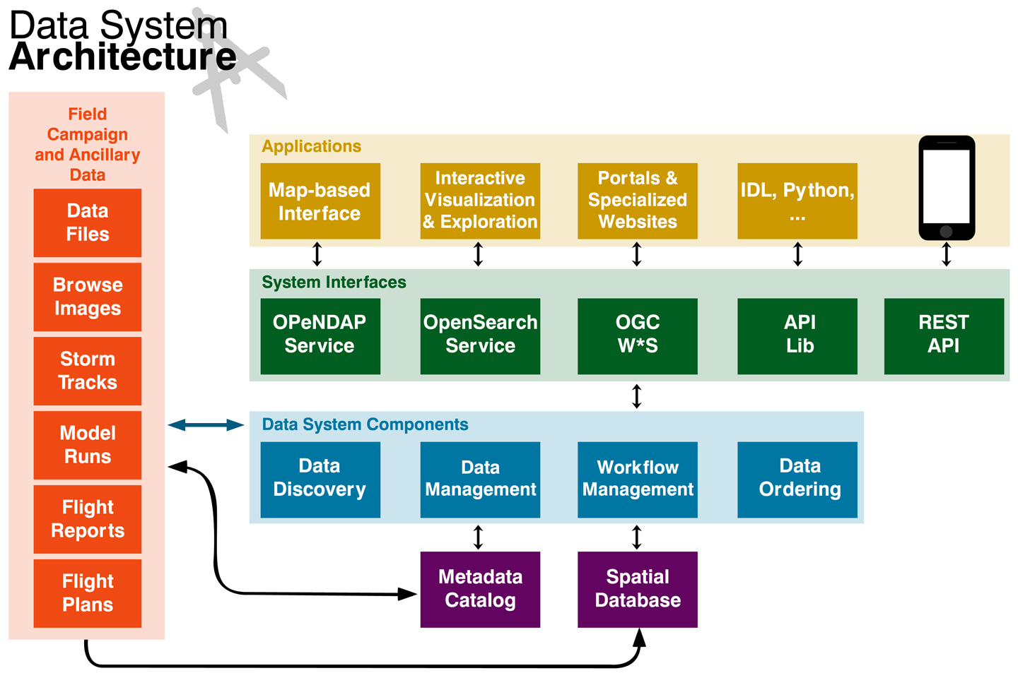
The HS3 data system architecture is shown below. Please click to view a larger version:
Get HS3 Datasets:
NASA's GHRC DAAC Data Search
HS3 Collection DOI:
http://dx.doi.org/10.5067/HS3/DATA101
BAMS Publication:
NASA’s Hurricane and Severe Storm Sentinel (HS3) Investigation (DOI)
https://journals.ametsoc.org/doi/pdf/10.1175/BAMS-D-15-00186.1 (PDF)
GHRC DAAC Micro Articles:
Hurricane and Severe Storm Sentinel (HS3) Field Campaign
Assessing Wind and Rain in Hurricane Ingrid during Hurricane and Severe Storm Sentinel (HS3) Field Campaign
NASA Webinars:
Atmospheric Event based Research using NASA GHRC Tools and Services
Earthdata Webinar: Explore, Discover and Use Field Campaign & Related Data
HS3 Mission Movie:
Hurricane and Severe Storm Sentinel (HS3) Mission
