Temperature can vary greatly at different levels of Earth's atmosphere. Measuring atmospheric temperatures is essential for many forms of scientific work including weather forecasting and studying climate processes, and for conducting human activities such as flying aircraft, agriculture, and controlling pollution. 

NASA collects atmospheric temperature data using ground, airborne, and space-based instruments, such as the Microwave Sounding Unit (MSU) and Advanced Microwave Sounding Unit (AMSU). Our datasets include the AMSU/MSU Day/Month Temperature Anomalies and Annual Cycle records, which measure global temperatures at multiple atmospheric levels going back to 1978. Temperature data has also been supplied by NASA's Global Precipitation Measurement Mission Ground Validation (GPM GV) program, and field campaigns including the Hurricane and Severe Storm Sentinel (HS3) study.

Get Atmospheric Temperature Data

Access a range of datasets and data tools to further your atmospheric temperature research.

Learn How to Use Atmospheric Temperature Data
Access a range of webinars, tutorials, data recipes, and data stories to enhance your knowledge of Earth Observation data.
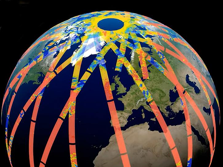
image of Prefire data around Earth
PREFIRE Data at ASDC to Improve Polar System Observations
Data from Polar Radiant Energy in the Far-InfraRed Experiment (PREFIRE), hosted by the Atmospheric Science Data Center (ASDC), will help to bridge a critical knowledge gap in climate science.
An artist's conception of the TROPICS SmallSat constellation in space over a tropical cyclone
Provisional TROPICS Data Now Available
Time-Resolved Observations of Precipitation structure and storm Intensity with a Constellation of SmallSats (TROPICS) Pathfinder data released.
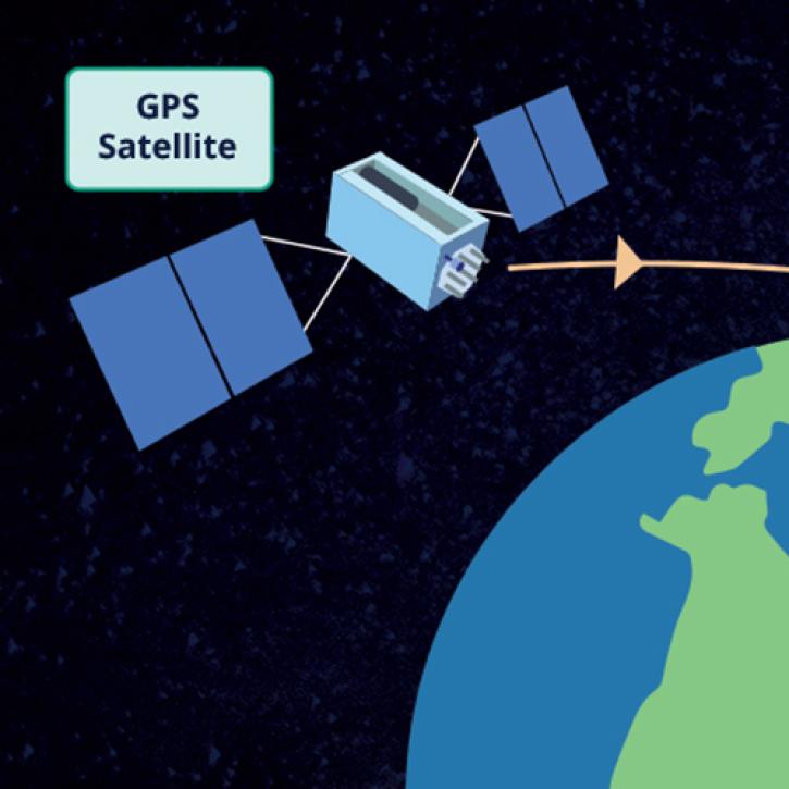
This graphic shows a global positioning system satellite beaming a signal through Earth's atmosphere. The navigation satellite is on the far left of the image and has an orange-colored signal line extending in a straight line to the right. A light blue box with the words GPS Satellite is in the upper left corner. In the lower right corner of the image is Earth colored in blue and green. The image background is colored black.
Weather Ballooning From Space
A NASA-funded project is creating a cloud-based radio occultation data archive for atmospheric researchers.
image of globe on top of chart data
New Version 6 AVHRR Long-Term Data Records Available at LAADS DAAC
Version 6 of the Advanced Very High Resolution Radiometer (AVHRR) Long-Term Data Record (LTDR) Products has been released by NASA's Level-1 and Atmosphere Archive and Distribution System Distributed Active Archive Center (LAADS DAAC).
Discover and Visualize Atmospheric Temperature Data
NASA data help us understand Earth's changing systems in more detail than ever before, and visualizations bring these data to life, making Earth science concepts accessible, beautiful, and impactful.
Data visualization is a powerful tool for analysis, trend and pattern recognition, and communication. Our resources help you find world-class data visualizations to complement and enhance your research. We also have tools and tutorials to help you translate atmospheric temperature data into compelling visuals.
Image
image of TROPICS data over southeast Asia
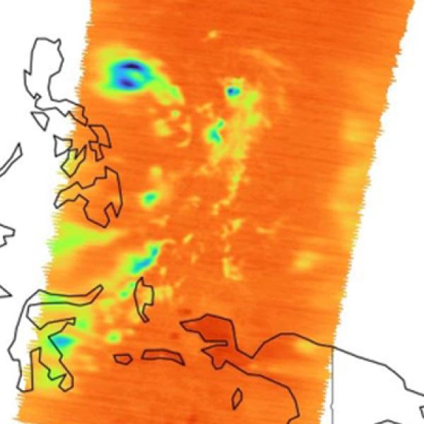
This is a visualization of Time-Resolved Observations of Precipitation structure and storm Intensity with a Constellation of SmallSats (TROPICS) brightness temperature data from the TROPICS Millimeter-wave Sounder (TMS). Brightness temperature is a passive measurement of radiance from the microwave radiation emitted by the atmosphere. Areas colored in yellow and red indicate atmosphere with relatively warmer temperatures. Credit: NASA's GES DISC.

Join Our Community of NASA Data Users

While NASA data are openly available without restriction, an Earthdata Login is required to download data and to use some tools with full functionality.

Learn About the Benefits of Earthdata Login

Frequently Asked Questions

Earthdata Forum

Our online forum provides a space for users to browse thousands of FAQs about research needs, data, and data applications. You can also submit new questions for our experts to answer.

Submit Questions to Earthdata Forumand View Expert Responses

Earthdata
Forum