| |
CAMEX-4 GOES-8 Products Table of Contents
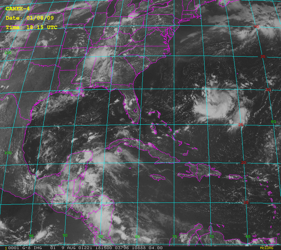
GOES-8 imagery was collected at the Global Hydrology and Climate Center (http://wwwghcc.msfc.nasa.gov) throughout the experiment. Images from the satellite were saved as McIdas areas and cropped to show the region of the globe from about 60 to 100 degrees West, and 10 to 40 degrees North-- as is shown in the image to the right. Generally, images are available for all dates between 3 August and 21 September, 2001 at times h+00:15 and h+00:45 UTC. Three channels were archived: channel 1-- visible (0.65 microns), channel 2-- infrared (11 microns) and channel 3-- known as the water vapor channel (6.75 microns). Data are archived in McIdas format. [NOTE: If you do not have McIdas software installed on your machine, reading these data becomes difficult! See the references below for obtaining McIdas software.] In addition to the McIdas areas are browse images which are saved in .gif format. Data resolution for visible imagery is 1 km. at nadir, IR is 4 km., and water vapor is 8 km. File Naming ConventionBoth the McIdas area files and the .gif browse images are similarly named and maintained. In each case, one UTC day worth of data is tarred together yielding a file name which looks like:
In each of the above examples 'ddd' represents the day of year. Once 'untarred' using the unix command 'tar -xvf [filename]' each of these yields the individual data or browse image files. The filename format for these appears as:
Note that once again 'ddd' means day of year, and as one would surmise, 'hhmm' represents the hour and minute UTC of the image/data. Since there are three channels worth of data available at each image time, 'xx' represents the channel: 'vs' indicates visible wavelengths, 'ir' is infrared, and 'wv' is water vapor. Thus, assuming that all images were collected for the given day, you would have 48 images each of infra-red and watervapor, and between 35 and 40 visible images (no nighttime visible images were archived) per day for both data and browse imagery.Also note that the data files are compressed, via the unix "compress" command, and will have to be un-compressed by using the "uncompress" command. Data FormatMentioned previously, data is in McIdas areas. If you have McIdas, you know what you are dealing with. If not, then unless you have custom software which allows you to extract information from McIdas areas these data will be of little use to you. See reference #1 below. Browse products are helpful in visualization, and because the CAMEX-4 browse imagery are all 'cropped' to the same dimensions with the same corner points, it is a trivial matter to construct .gif movies/animations and the like. ReferencesThere are no specific technical references for these data, but here are some potentially useful URLs:
The Global Hydrology Resource Center (GHRC) User Services Office staff is the point of contact for all questions, comments, and inquiries about the GHRC on-line system and all other GHRC services. Contact InformationTo order these data or for further information, please contact:
|