|
|
TCSP Aerosonde Table of Contents
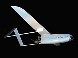
The Aerosonde system was operated in 'field deployment mode' in which a specialized crew was deployed to the field to operate the aircraft locally under the direction of a Principal Investigator. In this mode, the team worked with the PI during the field program and provided all Aerosonde operations, including regulatory approvals and support services. The Aerosonde team for the TCSP 2005 mission consisted of Brenda Mulac (Team Leader and Mission Scientist), Ryan Vu (Pilot), Dave Smith (Technician), Nick Logan (Ground control), Dave Easmunt (NASA Mission Manager), Fabian Garcia (Interpretor), and Jason Roadman (Observer). The NASA Principal Investigator was Anthony Guillory. Mission ObjectivesThe TCSP Field Experiment was held during the month of July, 2005, in Costa Rica. The mission was to study the processes associated with tropical waves passing over Central America to the Pacific ocean, where they would eventually form tropical cyclones. The NASA ER2 aircraft, the NOAA P-3 aircraft, and Aerosonde were to provide complimentary measurements in and around cloud systems associated with the waves. The Aerosonde operations were based out of Quepos, located on the Pacific Coast of Costa Rica. Eight flights were successfully flown, for a total of 75 flight hours. The flights were designed to document the boundary layer both near shore and over the open ocean. Measurements of pressure, air temperature, humidity, and sea surface temperature were made during each flight. The Aerosonde Flights consisted of soundings along track from 500ft up to 8600ft and varied in length from 8 hours to 18 hours. Naming ConventionsData files created during the Aerosonde flights are bundled into daily files using the unix tar command, one for each flight. A typical file name is:
where "aerosonde" is the dataset identifier, "2005.188" is the year.'day-of-year' and ".tar" shows the type of file. Each tar file contains the following types of files: File Formats There are five data files associated with each flight, a PTU file (*.ptu), a wind file (*.wnd), an Aerosonde file (*.as), a GPS file (*.GPS), and a metdump file (m*.txt). File names are of the form XmmddaaY.*, where X is a single letter indicating phase of flight (L=local, E=enroute (TDMA), R=returning, I=iridium), “mm” and “dd” are two digit numbers indicating respectively the month and day that the flight launch took place; “aa” is a two digit number identifying the aircraft that performed the flight; and “Y” is a letter used to differentiate files when an aircraft has made multiple flights on a single day (“A” for first flight of the day, “B” for second flight of the day, etc..). Note: This mission has no multiple flights per day. The naming convention of metdump files is the same as for other files, except “m” is used at the beginning of the file name in lieu of the flight phase designator. A brief description of each file type and its contents is given below: Additional documentation Additional documentation for the Aerosonde aircraft, the missions and data collected may be found in the following documents:
Here are some other useful web sites for in depth information on the Aerosonde, and the TCSP mission: References Cione, J.J., and E. W. Uhlhorn 2003: Sea surface temperature variability in hurricanes: Implications with respect to intensity change. Mon. Wea. Rev., v.131, pp.1783-1796 Data can be ordered and questions addressed at http://ghrc.nsstc.nasa.gov. To order these data or for further information, please contact:
|