
|
|
TCSP High Altitude MMIC Sounding Radiometer (HAMSR) Table of Contents
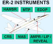
The High Altitude MMIC Sounding Radiometer (HAMSR) data were collected in support of the Tropical Cloud Systems and Processes (TCSP) mission, conducted by NASA and the National Oceanic and Atmospheric Administration (NOAA), in Costa Rica throughout July 2005. The goal of this mission was to help us better understand how hurricanes and other tropical storms are formed and intensify. HAMSR is a microwave atmospheric sounder, a small but accurate instrument that is well suited for hurricane and tropical storm studies. It provides measurements that can be used to infer the 3-D distribution of temperature, water vapor, and liquid water in the atmosphere, even in the presence of clouds. Parameters related to scattering from ice particles aloft as well as precipitation can also be inferred. During the TCSP experiment, HAMSR was mounted in a wing pod of a NASA ER-2 research aircraft, which was used to overfly storms at high altitude (~ 65,000 feet). HAMSR is a 25-channel microwave atmospheric sounder operating as a cross-track scanner. it operates in three frequency bands centered around 53, 118 and 183 GHz. HAMSR functionality is similar to AMSU-A/B, but with additional channels. There are three bands: an 8-channel band near 50-GHz, used for primary temperature sounding; a 10-channel band near 118 GHz, used for secondary temperature sounding and assessment of scattering; a 7-channel band near 183 GHz, used for water vapor (humidity) sounding. The instrument is continuously self-calibrating using internal calibration targets. Radiometric sensitivity at the composite sampling cells provided in the archive is typically 0.1 K and ranges up to 0.25 K for the stratospheric channels. Calibration accuracy is estimated at better than 1 K for temperature sounding and better than 2 K for water vapor sounding. Temperature weighting function peaks are distributed between the surface and the flight altitude. The scan mirror makes a full revolution in a little more than 1 second, for a temporal resolution of one cross-track scan set every 10.4 seconds. During that period it obtains a number of overlapping spatial samples of the scene below and several views of two internal calibration targets. From an altitude of 20 km the scan width is about 40 km wide on the ground with a single field of view of 2 km at nadir. Sampling intervals are 1 km cross-track. Additional information about the HAMSR instrument may be found in the PDF document Hurricane Studies With HAMSR. The primary derived measurements are vertical profiles of temperature, water vapor and liquid water, from the surface to 100 mb in 2-4 km layers. Data are in HDF format. There is one data file for each ER-2 flight (mission). The File naming convention for the data files is:
where tcsp identifies the field experiment, hamsr identifies the instrument, yyyymmdd is the year, month and day, nnnn is the number of data records, and the file extension is hdf for HDF format files. There are quicklook browse image files which look like:
where HAMSR identifies the instrument, fff is the frequency in gigahertz, yymmdd is the year,month and day, hhMMss is the hour, minute and second (first is start time and second is stop time), and the file extension is jpg which is the type of browse file. For additional information about these data files, refer to: HAMSR HDF File Description. The HDF format may be read using any common HDF reader. More information about HDF may be found at the HDF homepage. Data can be ordered and questions addressed at http://ghrc.nsstc.nasa.gov/. To order these data or for further information, please contact:
|
 Introduction