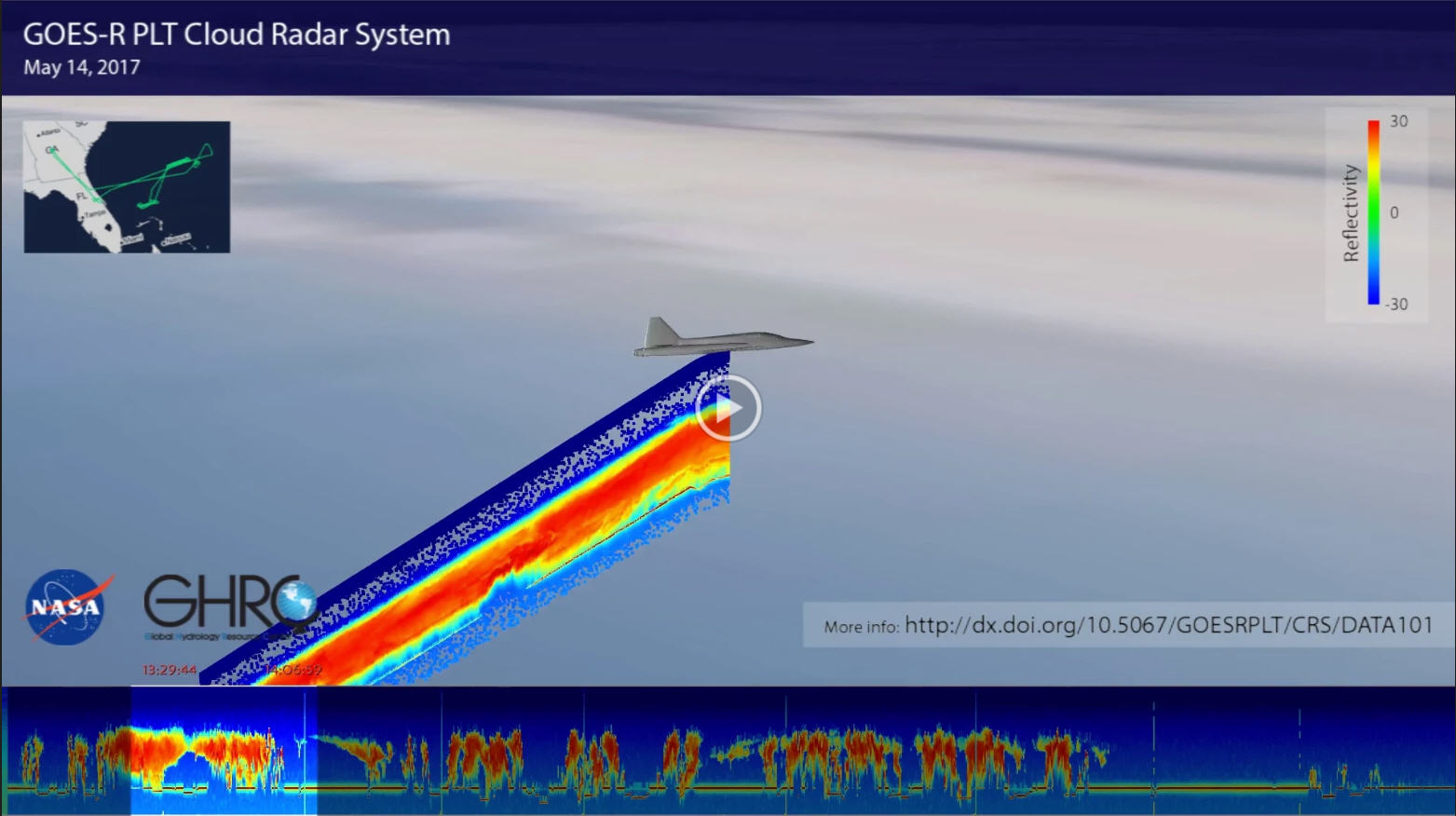
The NASA Global Hydrology Resource Center (GHRC) DAAC was selected to host many of the datasets associated with the GOES-R Post Launch Test field campaign. The campaign took place from March to May 2017. This was a joint NASA / NOAA effort with several NASA resources being used to support the calibration and validation of the Advanced Baseline Imager (ABI) and Geostationary Lightning Mapper (GLM). This included the NASA ER-2 aircraft that carried a number of instruments, such as the Cloud Radar System (CRS) shown here. The CRS is a nadir pointing radar that provides high-resolution profiles of reflectivity and Doppler velocity observations. It is capable of detecting cirrus clouds, precipitation, and other features from the aircraft’s location to the surface. This video is a demonstration of GHRC working to visualize the CRS data as part of the larger Field Campaign Explorer project. The video follows the ER-2 from 1256 UTC to 1903 UTC on May 14, 2017 as the aircraft flew over storms in the Atlantic Ocean east of Florida. As the ER-2 moves, the CRS nadir pointing observations are added. Furthermore, at the bottom of the video are the CRS data “unrolled” from start to stop (and moving in time from left to right) in a cross sectional view that is perpendicular to the flight track. As the video progresses, a highlight bar covering 37 minutes of time shows the observations in relation to the ER-2 animation. The upper left shows the full ER-2 flight track for this day.
