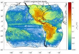
 The Global Hydrometeorology Resource Center (GHRC) DAAC has successfully published the Geostationary Lightning Mapper (GLM) Level 3 gridded products dataset. This publication is significant for several reasons. First, this is the culmination of effort to archive these data that came out of a previous GLM science team meeting. Additionally, the GLM Level 3 data will serve as an excellent companion dataset to GHRC’s existing lightning data, particularly the International Space Station Lightning Imaging Sensor. The main milestone with this publication is that it represents the first ever end-to-end cloud publication of an...
GHRC News & Features
06/09/2023 - 15:17
06/09/2023 - 14:56
![]() The Global Hydrometeorology Resource Center (GHRC) DAAC has completed archiving all datasets for the Convective Processes Experiment - Aerosols and Wind (CPEX-AW) field campaign. This clears the way to wrap up the older CPEX campaign that GHRC has received data for and to prepare for the incoming CPEX-Cabo Verde data.
The Global Hydrometeorology Resource Center (GHRC) DAAC has completed archiving all datasets for the Convective Processes Experiment - Aerosols and Wind (CPEX-AW) field campaign. This clears the way to wrap up the older CPEX campaign that GHRC has received data for and to prepare for the incoming CPEX-Cabo Verde data.
04/07/2021 - 13:55
 |
|
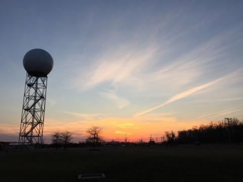
(Image Credit: Famartin, CC BY-SA 4.0, Wikimedia Commons)
Image Source - Wiki Commons: https://commons.wikimedia.org/wiki/File:2016-03-08_18_09_23_Sunset_at_the_WSR-88D_NEXRAD_Doppler_Radar_in_Sterling,_Virginia.jpg Sunset at the WSR-88D NEXRAD Doppler Radar in Sterling,... |
03/31/2021 - 11:19
 |
|
(Image Credit: Famartin, CC BY-SA 4.0, Wikimedia Commons)
Image Source - Wiki Commons: https://commons.wikimedia.org... |
03/26/2021 - 10:12
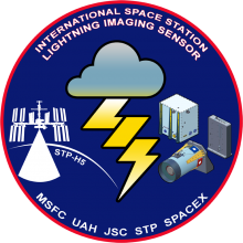 The NASA Global Hydrology Resource Center (GHRC) DAAC published the Quality Controlled Lightning Imaging Sensor (LIS) on International Space Station (ISS) Science Data and the Quality Controlled Lightning Imaging Sensor (LIS) on International Space Station (ISS) Backgrounds datasets. These datasets were collected by the LIS instrument mounted on the ISS and are used to detect the distribution and variability of total lightning occurring in the Earth’s tropical and subtropical regions. The LIS instrument makes measurements during both day and night with high detection efficiency. The Science Data consists of...
 03/23/2021 - 10:12
|
|
|
(Image Credit: Famartin, CC BY-SA 4.0, Wikimedia Commons)
Image Source - Wiki Commons: https://commons.wikimedia.org... |
03/11/2021 - 10:16
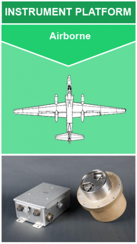 The NASA Global Hydrology Resource Center (GHRC) DAAC published the newest version of the Lightning Instrument Package (LIP) IMPACTS dataset. This dataset consists of electrical field measurements of lightning and navigation data collected by the Lightning Instrument Package (LIP) flown onboard the NASA ER-2 aircraft during the Investigation of Microphysics and Precipitation for Atlantic Coast-Threatening Snowstorms (IMPACTS) field campaign. IMPACTS was a three-year sequence of winter season deployments conducted to study snowstorms over the U.S. Atlantic coast (2020-2022). IMPACTS aimed to (1) Provide observations...
 03/04/2021 - 14:43
02/24/2021 - 08:53
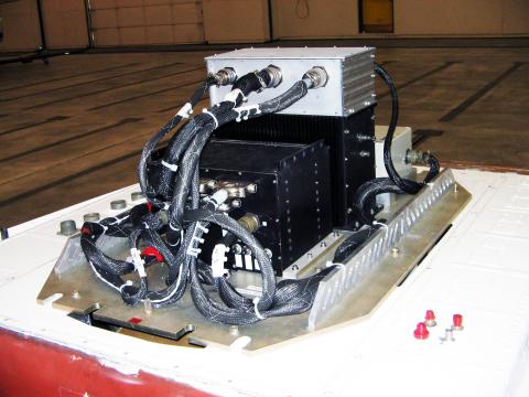 The NASA Global Hydrology Resource Center (GHRC) DAAC published the Advanced Microwave Precipitation Radiometer (AMPR) IMPACTS dataset. This datasets consists of passive microwave observations at four frequencies; 10.7, 19.35, 37.1, and 85.5 GHz. With high spatial and temporal resolution, AMPR can derive cloud, precipitation, water vapor, and surface properties. This dataset was collected during the Investigation of Microphysics and Precipitation for Atlantic Coast-Threatening Snowstorms (IMPACTS) field campaign. IMPACTS was a three-year sequence of winter season deployments conducted to study snowstorms over the U.S...
 02/11/2021 - 15:00
