HS3
The Hurricane and Severe Storm Sentinel (HS3) was a NASA airborne field campaign focused on better understanding the physical processes that control hurricane intensity change. HS3 helped to answer questions related to the roles of environmental conditions and internal storm structures to storm intensification. Due to the nature of the questions that HS3 mission addressed, it involved a variety of in-situ, satellite observations, airborne data, meteorological analyses, and simulation data. HS3 was a 5-year mission with three observation years (2012, 2013, 2014). The primary aircraft used in the campaign were two high altitude, long-duration flight unmanned airborne systems (UAS). Each Global Hawk UAS was outfitted with instruments capable of measuring various storm and environmental parameters.
DISCOVER - MEaSUREs
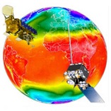
MEaSUREs (Making Earth Science Data Records for Use in Research Environments) supports the NASA Earth Science research community in providing Earth science data products and services driven by NASA’s Earth Science goals. The Distributed Information Services for Climate and Ocean Products and Visualizations for Earth Research (DISCOVER) is a NASA Earth Science MEaSUREs project. The major objective of DISCOVER is to provide highly accurate, multi-decadal geophysical products derived from satellite microwave sensors.
LIS
The lightning team has focused on investigating the causes and effects of lightning as well as analyzing a wide variety of atmospheric measurements related to thunderstorms. Here you will find lightning-related information and datasets as well as additional material concerning space-based lightning detection instruments such as LIS, OTD, and LMS.
SANDS
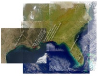
The Sediment Analysis Network for Decision Support (SANDS) project helped resolve Gulf of Mexico Alliance (GOMA) priority issues by generating decision support from MODIS and Landsat data. NASA Earth science products used in this project include:
- Landsat 7 ETM+ all bands for years 2000 through 2002
- Landsat 5 TM all bands for years 2003 through 2008
- MODIS Aqua surface reflectance bands 8 through 16
LANCE
The Land, Atmosphere Near real-time Capability for EOS (LANCE) system provides access to near real-time data (less than 3 hours from observation) from AIRS, AMSR2, MLS, MODIS, and OMI instruments. Users, operational agencies, and researchers utilize these products for a wide range of purposes (such as weather forecasting and monitoring natural hazards).


