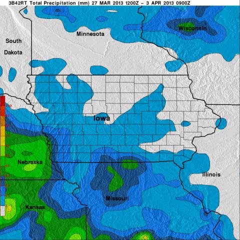
 The NASA Global Hydrology Resource Center (GHRC) DAAC published the GPM Ground Validation Global Flood Monitoring System (GFMS) Flood Maps IFloodS dataset. This dataset contains global flood estimates on a 0.25 degree spatial resolution every 3 hours, from March 26, 2013 through June 30, 2013. These data are provided in support of the Iowa Flood Studies (IFloodS) experiment conducted in eastern Iowa. The goals of the IFloodS campaign were to collect detailed measurements of precipitation at the Earth’s surface using ground instruments and advanced weather radars and to simultaneously collect data from satellites passing overhead. The data are available in netCDF-4 and ASCII formats. Flood map and rain graph files are available in KMZ, JPG, and GIF formats.
GPM GV GFMS Flood Maps IFloodS dataset now available
The NASA Global Hydrology Resource Center (GHRC) DAAC published the GPM Ground Validation Global Flood Monitoring System (GFMS) Flood Maps IFloodS dataset. This dataset contains global flood estimates on a 0.25 degree spatial resolution every 3 hours, from March 26, 2013 through June 30, 2013. These data are provided in support of the Iowa Flood Studies (IFloodS) experiment conducted in eastern Iowa. The goals of the IFloodS campaign were to collect detailed measurements of precipitation at the Earth’s surface using ground instruments and advanced weather radars and to simultaneously collect data from satellites passing overhead. The data are available in netCDF-4 and ASCII formats. Flood map and rain graph files are available in KMZ, JPG, and GIF formats.