Waypoint Planning Tool
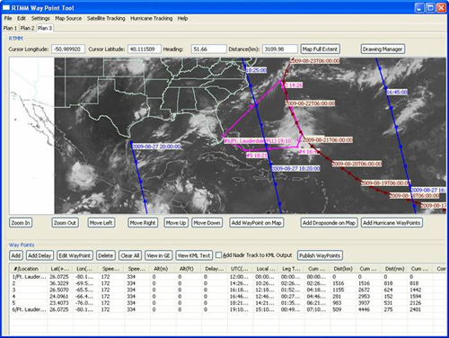
The Waypoint Planning Tool (WPT) is a Java application that enables aircraft mission scientists to easily develop flight plans for future missions through an interactive point-and-click interface. Individual flight legs are automatically calculated for altitude, latitude, longitude, leg distance, cumulative distance, leg time, cumulative time, etc. The resultant flight plan can then be posted to the Google Earth-based RTMM for all interested scientists to view and track actual flight progress compared to the planned flight track.
The WPT will be utilized by GRIP mission planners during the 2010 field campaign. It will be exercised during the GRIP Dry Run which will take place in September of 2009.
Download the Waypoint Planning Tool