GPM GROUND VALIDATION SATELLITE SIMULATED ORBITS LPVEX
GPM GROUND VALIDATION SATELLITE SIMULATED ORBITS LPVEX
GPM GROUND VALIDATION SATELLITE SIMULATED ORBITS LPVEX
GPM GROUND VALIDATION SPECIAL SENSOR MICROWAVE IMAGER/SOUNDER (SSMI/S) LPVEX
GPM GROUND VALIDATION WYOMING CLOUD RADAR (WCR) LPVEX
GPM GROUND VALIDATION WYOMING KING AIR CLOUD MICROPHYSICS LPVEX
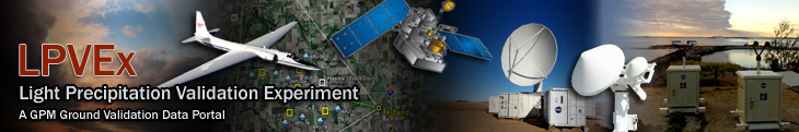
The Light Precipitation Evaluation Experiment (LPVEx) took place in the Gulf of Finland during September and October, 2010. Microphysical properties, associated remote sensing observations, and coordinated model simulations of high latitude precipitation systems to drive the evaluation and development of precipitation algorithms for current and future satellite platforms were collected. LPVEx consisted of coordinated aircraft flights within an extensive network of ground-based observations that included three dual-polarization, C-band, Doppler radars, a network of surface weather and sounding stations, several micro-rain radars, and surface rainfall and drop size distribution (DSD) measurements from a large number of rain gauges and disdrometers. LPVEx was a collaborative effort between CloudSat, the GPM Ground Validation (GV) program, the Finnish Meteorological Institute (FMI), Environment Canada (EC), the United Kingdom National Environmental Research Council, Vaisala Inc., and the University of Helsinki (UH). The GHRC is the archive and distribution center for data collected during the LPVEx experiment.
GHRC has published two datasets from Light Precipitation Evaluation Experiment (LPVEx): GPM Ground Validation Wyoming Cloud Radar (WCR) LPVEx and GPM Ground Validation Wyoming King Air Cloud Microphysics LPVEx. Both of these datasets’ instruments gathered data while aboard the University of Wyoming King Air (UWKA) during September and October 2010 in the Gulf of Finland. The Wyoming Cloud Radar, a Doppler radar, has reflectivity observations and doppler velocity measurements. The Cloud Microphysics dataset has measurements for static pressure, dew point temperature, relative humidity, mixing ratio, liquid water content and droplet concentration from multiple instruments. Both datasets contain aircraft navigational parameters.
GHRC has published 4 satellite simulated orbit datasets for GPM Ground Validation research as part of the Global Precipitation Measurement mission. The GPM Ground Validation Satellite Simulator Orbits Database datasets are available for several campaigns: Light Precipitation Evaluation Experiment (LPVEX), Midlatitude Continental Convective Clouds Experiment (MC3E) , Canadian Cloudsat/Calipso Validation Project (C3VP), and Tropical Warm Pool - International Cloud Experiment (TWP-ICE). This orbital database takes account for the atmospheric profiles, the cloud/rain profiles, and the detailed surface/terrain information from the Cloud-Resolving Model (CRM) database. Unique geometry and antenna gain patters of each sensor (GMI imager, GMI sounder, DPR Ku, DPR Ka_MA, DPR Ka_HS) are considered. The Orbital database consists of satellite orbit parameters, geolocation of IFOV/EFOV and satellite location, and simulated L1B/L2-like parameters in satellite orbital grid. Orbital data covers a portion of sampling right over the Cloud-resolving model (CRM) domain. All orbital data format is NetCDF3, and contains dimensions, parameter descriptions, and parameter units. Each project's data is distributed as a separate dataset. MC3E occurred in Oklahoma, USA in 2011; LPVEX took place in Finland in 2010; C3VP experiment was held in Canada in 2007; and TWP-ICE took place in Australia in 2006.
Collected microphysical properties, associated remote sensing observations, and coordinated model simulations of high latitude precipitation systems. Helsinki, Finland, fall-winter 2010, partnered with CloudSat.
https://doi.org/10.5067/GPMGV/LPVEX/DATA101
Have you used our data? Register for updates
