
Validation Network (VN)
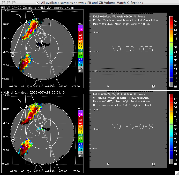
The animation above illustrates some of the products and features of the VN dataset. Top left is a planimetric view of a set of storms imaged by the TRMM Precipitation Radar. Bottom left is the same storm imaged by the Melbourne, Florida (KMLB) WSR-88D radar. Both views show data along the 2.4-degree-elevation sweep surface of the KMLB radar. The two panels on the right illustrate vertical slices through all sweep surfaces of the corresponding datasets along the A-B line shown in the plan-view images, with the radar volumes of the two data types geometrically matched to one another. The horizontal and vertical size, and the location of the matched radar volumes, are determined by the intersections of the stepped conical sweeps of the ground radar with the quasi-vertical radar beams of the TRMM PR as they are viewed along the A-B lines.
