Integrated Precipitation and Hydrology Experiment (IPHEx) Field Campaign

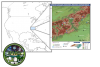
The Integrate Precipitation and Hydrology Experiment (IPHEx) was a NASA field campaign that took place in the summer of 2014 to support the Global Precipitation Measurement (GPM) Ground Validation (GV) project. The study area for the field campaign was in the Southern Appalachians of North Carolina in the Southeastern United States. The goal of the field campaign was to gain further understanding of how mountainous areas influence and interact with summertime precipitation before, during, and after rainfall occurs. This includes how rain runoff behaves in mountainous regions. To accomplish this goal, radars, weather stations, and other precipitation measuring instruments were set up throughout the mountainous region and out into the Piedmont and Coastal Plain regions. Simultaneous data were collected using instruments on scientific research aircraft and satellites. This was the first GPM GV field campaign after the launch of the GPM Core Satellite and therefore, results from IPHEx played an important role in improving algorithms used to retrieve rainfall data from space.  

Scientific Objectives

The primary objectives of IPHEx field campaign included:

  • The development, evaluation, and improvement of remote-sensing precipitation algorithms in support of the Global Precipitation Measurement Mission (GPM)
  • The evaluation of Quantitative Precipitation Estimation (QPE) products for hydrologic forecasting and water resource applications in the Upper Tennessee, Catawba-Santee, Yadkin-Pee Dee and Savannah river basins
  • To characterize warm season orographic precipitation regimes and the relationship between precipitation regimes and hydrologic processes in regions of complex terrain
     
Spatial Coverage
[N: 38.0, W:-86.0, E: -75.0, S:32.0] degrees
Time Range
May 5, 2014 - July 15, 2014
PHENOMENA STUDIED
Precipitation

Instruments Used

Multiple instruments were flown on the UND Citation II and NASA ER-2 aircrafts, as well as installed on ground stations, during the IPHEx field campaign. The instruments included particle probes, the Advanced Microwave Precipitation Radiometer (AMPR), a High Altitude Imaging Wind and Rain Airborne Profiler (HIWRAP), a Cloud Radar System (CRS), ER-2 X-band Radar (EXRAD), Conical Scanning Millimeter-wave Imaging Radiometer (CoSMIR) , and many different types of parsivels, disdrometers, and radars. Support data were also collected during the IPHEx field campaign, consisting of various satellite, model output, and operational datasets.

PLATFORM TYPE PLATFORM RELEVANT INSTRUMENT DATASETS HOW ARE THE DATA USED?


Ground-based


Ground

Microwave Radiometers

Cloud liquid water content

Radars

Precipitation type

Storm movement

Disdrometers

Precipitation size

Precipitation distribution

Precipitation rate


Airborne


UND-Citation II

Cloud Microphysics Instruments

NCAR Particle Probe

Cloud particle measurement


NASA ER-2

AMPR

CoSMIR

EXRAD

CRS

HIWRAP

Doppler velocity

Radar reflectivity

Cloud detection

Brightness temperature


Events of Interest

This section highlights events within the field campaign of particular scientific interest.

Major Findings

All of the data collected during the field campaign provided a deeper and more detailed description of how precipitation occurs in mountainous regions. By using a wide variety of instruments in strategic locations, researchers were able to see the differences between such events from mountain slopes to flat coastal plains. These data were also crucial to support of the GPM Ground Validation mission to improve algorithms used to estimate precipitation from space-based platforms.

Related Publication(s)

Field Campaign Publication:
Barros, A. P., Petersen, W., & Wilson, A. M. (2016). Integrated Precipitation and Hydrology Experiment (IPHEx)/Orographic Precipitation Processes Study Field Campaign Report. Retrieved from https://www.osti.gov/servlets/purl/1248894

Barros, A. P., Petersen, W. A., Schwaller, M., Cifelli, R., Mahoney, K., Peters-Liddard, C., … Kim, E. (2014). NASA GPM-Ground Validation Science Plan. Retrieved from http://iphex.pratt.duke.edu

Erlingis, J. M., Gourley, J. J., Kirstetter, P.-E., Anagnostou, E. N., Kalogiros, J., Anagnostou, M. N., … Petersen, W. (2018). Evaluation of Operational and Experimental Precipitation Algorithms and Microphysical Insights during IPHEx. Journal of Hydrometeorology, 19(1), 113–125. https://doi.org/10.1175/JHM-D-17-0080.1

IPHEx Notable Publications:
Angulo-Martinez, M, and Barros, A.P. (2015). Measurement Uncertainty in rainfall kinetic energy and intensity relationships for soil erosion studies: an evaluation using PARSIVEL disdrometers in the Southern Appalachian Mountains. Geomorphology, 228, 28-40. https://doi.org/10.1016/j.geomorph.2014.07.036

Arulraj, M., and Barros, A.P., 2019: Improving Quantitative Precipitation Estimates in Mountainous Regions by Modeling Low Level Seeder-Feeder  nteractions constrained by GPM DPR Measurements.  Rem. Sen.of the Environ., 231, 111213. https://doi.org/10.1016/j.rse.2019.111213

Arulraj, M., Barros, A. P., Arulraj, M., & Barros, A. P. (2017). Shallow Precipitation Detection and Classification Using Multifrequency Radar Observations and Model Simulations. Journal of Atmospheric and Oceanic Technology, 34(9), 1963–1983. https://doi.org/10.1175/JTECH-D-17-0060.1

Barros, A.P. , and Arulraj, M. (2019): Remote Sensing of Orographic Precipitation.  In Remote Sensing of Precipitation, Chapter 4.6, Elsevier (Pub.), in press.

D’Adderio, L. P., Porcù, F., Tokay, A., D’Adderio, L. P., Porcù, F., & Tokay, A. (2015). Identification and Analysis of Collisional Breakup in Natural Rain. Journal of the Atmospheric Sciences, 72(9), 3404–3416. https://doi.org/10.1175/JAS-D-14-0304.1

Dolan, B., Fuchs, B., Rutledge, S. A., Barnes, E. A., Thompson, E. J., Dolan, B., … Thompson, E. J. (2018). Primary Modes of Global Drop Size Distributions. Journal of the Atmospheric Sciences, 75(5), 1453–1476. https://doi.org/10.1175/JAS-D-17-0242.1

Duan,Y.,and Barros, A.P. (2017). Understanding how low-level clouds and fog modify the diurnal cycle of orographic precipitation using in situ and satellite observations. Remote Sensing, 9(9), 920. https://doi.org/10.3390/rs9090920
 
Duan, Y., Petters, M. D., and Barros, A. P. (2019). Understanding aerosol-cloud  interactions through modelling the development of orographic cumulus congestus during IPHEx, Atmos. Chem. Phys., 19, 1-25. https://doi.org/10.5194/acp-19-1413-2019
 
Duan, Y., Wilson, A.M., and Barros, A.P. (2015). Scoping a Field Experiment: Error Diagnostics of TRMM Precipitation Radar Estimates in Complex Terrain as a basis for IPHEx 2014. Hydrol. Earth Sys. Sci., 19,1501-1520. https://doi.org/10.5194/hess-19-1501-2015
 
Miller, D., Miniat,C.F., Wooten, R., and Barros, A.P. (2019). An Expanded Investigation of  Atmospheric Rivers in the Southern Appalachian Mountains and their Connection to Landslides.  Atmosphere, 10, 71. https://doi.org/10.3390/atmos10020071
 
Nogueira, M., and Barros, A.P. (2015). Transient Stochastic Downscaling of Quantitative Precipitation Estimates for Hydrological Applications.  J. Hydrology, No. 529, 1407-1421. https://doi.org/10.1016/j.jhydrol.2015.08.041

Porcacchia, L., Kirstetter, P. E., Gourley, J. J., Maggioni, V., Cheong, B. L., Anagnostou, M. N., … Anagnostou, M. N. (2017). Toward a Polarimetric Radar Classification Scheme for Coalescence-Dominant Precipitation: Application to Complex Terrain. Journal of Hydrometeorology, 18(12), 3199–3215. https://doi.org/10.1175/JHM-D-17-0016.1

Prat, O., and Barros, A. P. (2010a). Ground Observations to Characterize the Spatial Gradients and Vertical Structure of Orographic Precipitation – Experiments in the Inner Region of the Great Smoky Mountains , J. Hydrology. https://doi.org/10.1016/j.jhydrol.2010.07.013
 
Prat , O., and Barros, A.P. (2010b). Assessing satellite-based precipitation estimates in the Southern Appalachian Mountains using raingauges and TRMM PR.  Adv. Geosci., 25, 143–153. https://doi.org/10.5194/adgeo-25-143-2010
 
Tao, J., and Barros, A.P. (2019). Multi-Year Surface Radiative Properties and Vegetation  Parameters for Hydrologic Modeling in Regions of Complex Terrain – Methodology and Evaluation over the IPHEx2014 Domain. J. Hydrology-Reg. Studies, 22.  https://doi.org/10.1016/j.ejrh.2019.100596
 
Tao, J., Wu, D., Gourley, J., Zhang, S.Q., Crow, W., Peters-Lidard, C.,and Barros, A.P. (2016). Operational Hydrological Forecasting during the IPHEx-IOP Campaign- Meet the Challenge.  J. Hydrology. https://doi.org/10.1016/j.jhydrol.2016.02.019

Wilson, A. M., and Barros, A.P. (2014). An investigation of warm rainfall microphysics in the Southern Appalachians: orographic enhancement via low-level seeder-feeder interactions.  J. Atmos. Sci., Vol. 5, No.5, 1783-1805. https://doi.org/10.1175/JAS-D-13-0228.1

Wilson, A. M., & Barros, A. P. (2015). Landform controls on low level moisture convergence and the diurnal cycle of warm season orographic rainfall in the Southern Appalachians. Journal of Hydrology, 531, 475–493. https://doi.org/10.1016/J.JHYDROL.2015.10.068

Wilson, A. M., Barros, A. P., Wilson, A. M., & Barros, A. P. (2017). Orographic Land–Atmosphere Interactions and the Diurnal Cycle of Low-Level Clouds and Fog. Journal of Hydrometeorology, 18(5), 1513–1533. https://doi.org/10.1175/JHM-D-16-0186.1

DATE UPDATED
Jul 16th, 2019
AUTHOR(S)
Rebecca Kollmeyer
Leigh Sinclair
MICRO ARTICLE TYPE
Field Campaign

Have you used our data? Register for updates