![]() The Global Hydrology Resource Center (GHRC) published the GPM Ground Validation Vaisala Ceilometer IPHEx dataset. This dataset provides vertical profiles of aerosol backscatter, boundary layer structure, and cloud detection status and height collected during the GPM Ground Validation Integrated Precipitation and Hydrology Experiment (IPHEx) by the NASA Goddard Space Flight Center (GSFC) ACHIEVE ground-based mobile laboratory. Data files in the netCDF3 format are available for May 6, 2014 through June 16, 2014.
The Global Hydrology Resource Center (GHRC) published the GPM Ground Validation Vaisala Ceilometer IPHEx dataset. This dataset provides vertical profiles of aerosol backscatter, boundary layer structure, and cloud detection status and height collected during the GPM Ground Validation Integrated Precipitation and Hydrology Experiment (IPHEx) by the NASA Goddard Space Flight Center (GSFC) ACHIEVE ground-based mobile laboratory. Data files in the netCDF3 format are available for May 6, 2014 through June 16, 2014.
GHRC News & Features
07/21/2015 - 16:55
07/09/2015 - 14:19
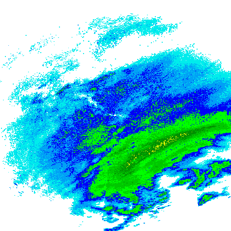
![]() The Global Hydrology Resource Center (GHRC) has published three Global Precipitation Measurement (GPM) Ground Validation datasets from the Integrated Precipitation and Hydrology EXperiment (IPHEX) field campaign held in North Carolina from May 1, 2014 through June 14, 2014. These include the Autonomous Parsivel Unit (APU), the Conical Scanning Millimeter-wave Imaging Radiometer (CoSMIR) and version 2 of the ...
The Global Hydrology Resource Center (GHRC) has published three Global Precipitation Measurement (GPM) Ground Validation datasets from the Integrated Precipitation and Hydrology EXperiment (IPHEX) field campaign held in North Carolina from May 1, 2014 through June 14, 2014. These include the Autonomous Parsivel Unit (APU), the Conical Scanning Millimeter-wave Imaging Radiometer (CoSMIR) and version 2 of the ...
07/09/2015 - 14:12
Full resolution imagery from the NASA Land Atmosphere Near real-time Capability for EOS (LANCE) Advanced Microwave Scanning Radiometer 2 (AMSR2) processing system at the Global Hydrology Resource Center (GHRC) is now available through the NASA Global Image Browse Service (GIBS) and visible in Worldview. These images include Columnar Cloud Liquid Water, Columnar Water Vapor and Wind Speed over oceans, as well as Surface Precipitation Rate and Surface Rain Rate over land and oceans. More information about LANCE AMSR2 near real-time data is available at http://lance.nsstc.nasa.gov/.
06/24/2015 - 10:31
The Advanced Microwave Scanning Radiometer 2 (AMSR2) element of NASA’s Land, Atmosphere Near real-time Capability for Earth Observing Systems (LANCE) generates a suite of Rain and Ocean products from Level-1R resampled brightness temperature data provided by the Japan Aerospace Exploration Agency (JAXA). On June 9, the AMSR Science Investigator-led Processing System (SIPS) reconfigured LANCE AMSR2 processing to use JAXA’s new near-real time (NRT) Level-1R product as input rather than the standard Level-1R product. While the NRT data stream experiences occasional data loss, latency is generally much lower than for the standard data, meaning that AMSR2 products are now consistently generated within three hours of observation, as required by LANCE.
06/09/2015 - 16:48
 The Global Hydrology Resource Center (GHRC) has published seven ground-based radar datasets in the Global Precipitation Measurement (GPM) mission Ground Validation (GV) collection for the GPM Cold-season Precipitation Experiment (GCPEx) which occurred in Ontario, Canada. These data were collected from seven radar stations between January 9, 2012 and March 12, 2012. The National Weather Service’s Next Generation Weather Radar system (NEXRAD) comprises 159 Weather Surveillance Radar-1988 Doppler (WSR-88D) sites throughout the United States and select overseas locations. The GPM Ground...
05/15/2015 - 14:20
GHRC has published Version 2 of the GPM Ground...
05/15/2015 - 14:20
GHRC has published its first HS3 dataset, Hurricane and Severe Storm...
05/01/2015 - 10:31
The Advanced Microwave Scanning Radiometer – Earth Observing System Science Investigator-led Processing System (AMSR-E SIPS) at the Global Hydrology Resource Center (GHRC DAAC) would like to announce the availability of AMSR-E near real-time data products. The AMSRE-SIPS at the GHRC DAAC has generated climate research quality data products, since the launch of Aqua in the spring of 2002. Now, with the implementation of the Land Atmosphere Near-Real-Time Capability for EOS (LANCE) at the processing facility in Huntsville, the LANCE AMSR-E near-real-time products, with noted...
05/01/2015 - 10:31
![]() The AMSR-E SIPS at the GHRC DAAC has implemented incremental daily processing for our AMSR-E near real-time Level 3 daily (Ocean, Land, Snow, Sea Ice ) products. Partial products are created several times per day (currently every 3 hours) using whatever L2 data is available at the time of creation, in order to reduce latency for these products.
The AMSR-E SIPS at the GHRC DAAC has implemented incremental daily processing for our AMSR-E near real-time Level 3 daily (Ocean, Land, Snow, Sea Ice ) products. Partial products are created several times per day (currently every 3 hours) using whatever L2 data is available at the time of creation, in order to reduce latency for these products.
These partial products (identified by "P") will be available in the same FTP directories as the...
05/01/2015 - 10:31
![]() The near real-time LANCE AMSR-E system at the AMSR-E SIPS and GHRC DAAC is pleased to announce that we have integrated a new Version 11 L2A near real-time algorithm from Remote Sensing Systems (RSS) into our processing systems. These much improved version 11 brightness temperatures, as well as the corresponding L2B and L3 daily derived products, are available in the operational areas on our lance servers.
The near real-time LANCE AMSR-E system at the AMSR-E SIPS and GHRC DAAC is pleased to announce that we have integrated a new Version 11 L2A near real-time algorithm from Remote Sensing Systems (RSS) into our processing systems. These much improved version 11 brightness temperatures, as well as the corresponding L2B and L3 daily derived products, are available in the operational areas on our lance servers.
This new near...
