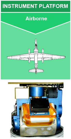
Instrument: Conical Scanning Millimeter-wave Imaging Radiometer (CoSMIR)

Description
The Conical Scanning Millimeter-wave Imaging Radiometer (CoSMIR) instrument is an airborne, 9-channel total power radiometer originally developed to calibrate and validate the Special Sensor Microwave/Imager/Sounder (SSMIS) for the Defense Meteorological Satellite Project (DMSP) F-series satellites. CoSMIR has four receivers near 50, 91, 150, and 183 GHz which measure horizontally polarized radiation with vertically polarized measurement capability at 89.0 and 165.5 GHz.  CoSMIR was flown for calibration/validation of the SSMIS in 2004-2005 off coastal California. Currently, CoSMIR has been modified to play the role as an airborne high-frequency simulator for the GPM Microwave Imager (GMI). The 9 channels of CoSMIR for GMI validation are at the frequencies of 50.3, 52.6, 89 (H & V), 165.5 (H & V), 183.3±1, 183.3±3, and 183.3±7 GHz. All channels besides 89 and 165.5 GHz will be horizontally polarized.
 
CoSMIR performs both conical and cross-track scanning from left to right with conical scanning in the forward direction (aircraft direction of travel) only. The footprint size of CoSMIR measurement varies with aircraft altitude and instrument look direction. Receivers and radiometer electronics on the CoSMIR instrument are housed in a 21.5 cm diameter and 28 cm long cylindrical scan head, which is rotated by a two-axis gimbaled mechanism. There are two in-flight external calibration targets at cruising altitude: one heated to 328 K, and the other maintained at ambient temperature. Due to these onboard calibration targets, the data between 50 to 183 GHz have an accuracy of ±1 K. More information about the CoSMIR instrument can be found on the Mesoscale Atmospheric Processes webpage.
Measurements

CoSMIR measures microwave brightness temperatures at 9 microwave frequencies between 50 to 183 GHz. With two in-flight external calibration targets at cruising altitude (one heated to 328 K, and the other maintained at ambient temperature), the data have an accuracy of ±1 K.

Instrument Platform: Airborne
Applications
Satellite validation
Precipitation, convection and cloud studies
Tropical cyclone research
Climate model improvement
RANGE OF MICROWAVE FREQUENCIES FOOTPRINT AT 11.8 KM AIRCRAFT ALTITUDE SAMPLING FREQUENCY IN-FLIGHT EXTERNAL CALIBRATION TARGETS ACCURACY
50 to 183 GHz
Conical scan: 1.3 km x 1.9 km
Cross-track scan: 0.8 km x 0.8 km
Conical scan: 2 seconds
Cross-track scan: 3 seconds
328 K and ambient temperature ±1 K


Relevant Publications

Wang, J. R., G. M. Skofronick-Jackson, M. R. Schwaller, C. M. Johnson, W. B. Monosmith, and Z. Zhang (2013). Observations of Storm Signatures by the Recently Modified Conical Scanning Millimeter-Wave Imaging Radiometer. IEEE Trans. Geosci. Remote Sens., 51(1), 411-424. doi: https://doi.org/10.1109/TGRS.2012.2200690

Wang, J. R., P. E. Racette, J. E. Piepmeier, B. Monosmith, and W. Manning (2007). Airborne CoSMIR Observations Between 50 and 183 GHz over Snow-Covered Sierra Mountains. IEEE Trans. Geosci. Remote Sens., 45(1), 55-61. doi: https://doi.org/10.1109/TGRS.2006.885410

Wang, J. R., P. E. Racette, and J. R. Piepmeier (2008). A comparison of Near Concurrent Measurements from the SSMIS and CoSMIR for some Selected Channels over the Frequency Range of 50-183 GHz. IEEE Trans. Geosci. Remote Sens., 46(4), 923-933. doi: https://doi.org/10.1109/TGRS.2007.904038


Have you used our data? Register for updates