Making Earth Science Data Records for Use in Research Environments (MEaSUREs)
NASA, through its Earth Science Data Systems, supports the NASA Earth Science research community in providing Earth science data products and services driven by NASA’s Earth Science goals. NASA’s Earth Science Program is dedicated to advancing Earth remote sensing and pioneering the scientific use of satellite measurements to improve human understanding of our home planet in order to inform economic and policy decisions and improve operational services of benefit to the Nation. Through the MEaSUREs Program, NASA is continuing its commitment to expand understanding the Earth system using consistent records. Emphasis is placed into linking together multiple satellites into a constellation, developing the means of utilizing a multitude of data sources to form coherent time series, and facilitating the use of extensive data in the development of comprehensive Earth system models.
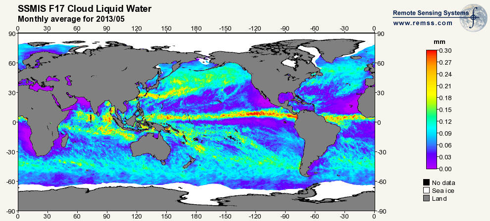
The Distributed Information Services for Climate and Ocean Products and Visualizations for Earth Research (DISCOVER) is a NASA Earth Science MEaSUREs project. MEaSUREs supports the NASA Earth Science research community in providing Earth science data products and services driven by NASA’s Earth Science goals. The major objective of DISCOVER is to provide highly accurate, multi-decadal geophysical products derived from satellite microwave sensors. These products are suitable for some of the most demanding Earth research applications and are available via easy-to-use display and data access tools. Most of the products are generated in near real-time, so they also are suitable for some weather applications and field campaigns.
DISCOVER is a collaboration of Remote Sensing Systems (RSS) , NASA Marshall Space Flight Center, and the University of Alabama in Huntsville (UAH). RSS, located in Santa Rosa, California, specializes in satellite microwave remote sensing. Information Technology researchers at UAH and the MSFC Earth Science Department jointly manage the GHRC, which provides a suite of data services and other technologies. For the past 10 years, RSS and GHRC have provided the Earth science community with research-quality data products and services while leading the evolution of distributed, heterogeneous, and collaborative processing and distribution environments.