Mission Scientist Report for 20 May 2011
Mission Summary for 20 May 2011
In short, this was a fantastic mission.
The weather presented itself as a very large Mesoscale Convective System. Of course the models did not give any hint to this development whatsoever. We arrived at SGP at 10Z with heavy rain imminent and vivid lightning and rumbles of thunder.
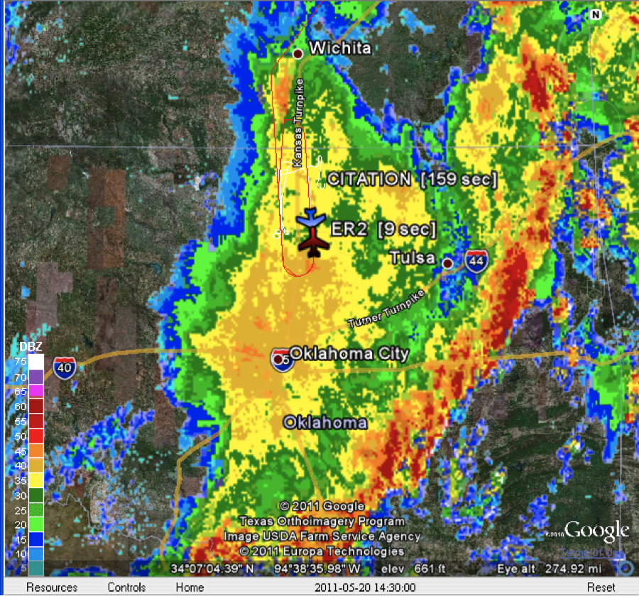
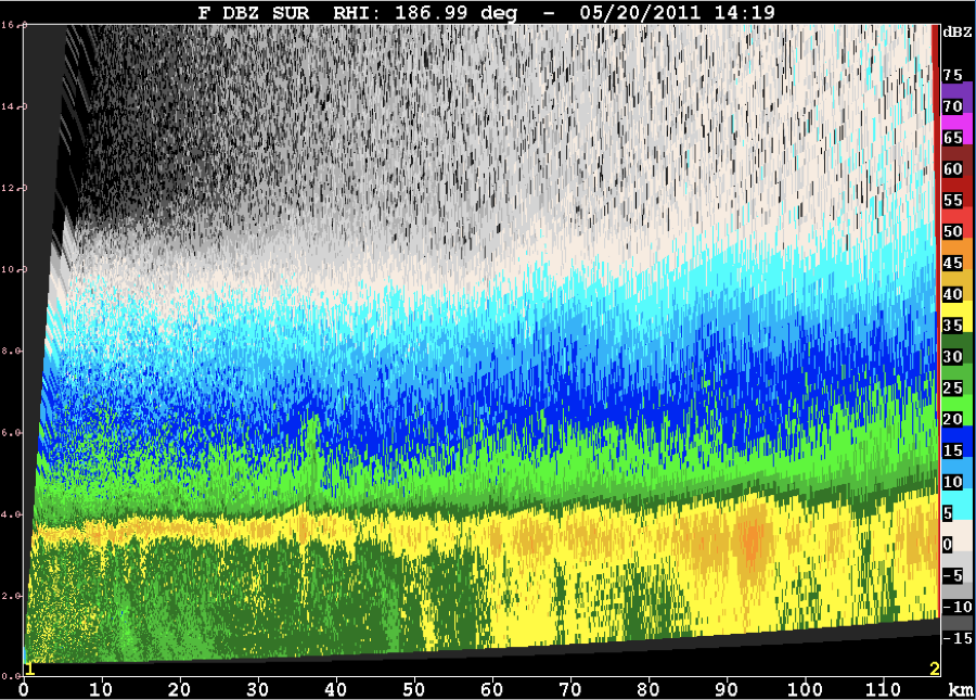
After the convective line over ran us, a massive stratiform region blossomed. UND launched at 1310 UTC and first flew a step up pattern along a N-S line with the CF at the centerpoint of this line. Lowest leg at 10K feet and highest leg at 25K feet, in 3K foot increments. We had C-SAPR support with a RHI sector centered on this flight line. The ER-2 was airborne at 1315 UTC and headed immediately to join the party here. For its firt pattern, the ER-2 did a racetrack pattern along the same (extended) line that UND was on, with the return leg offset 14 nm to the east (Fig 1). Fantastic aircraft coordination was obtained in a deep, extensive stratiform region. Since the flight legs for the step up were basically along a 180 radial from C-SAPR, we had C-SAPR support with a RHI sector. Even though we did not have N-pol for this mission, this became a “dream scenario” with the aircraft along a radar radial (in this case C-SAPR). Fig. 2 shows a RHI sweep from C-SAPR showing the deep s/f echo with attendant radar bright band. After the first step up by the UND, we shifted their line to the east to stay in good s/f precipitation. This second line was actually the same line as the east offset being flown by the ER-2. UND then did a step down pattern from 25K to 10K feet, stepping down in 3K foot increments. The ER-2 continued to do a racetrack pattern. Excellent coordination again!
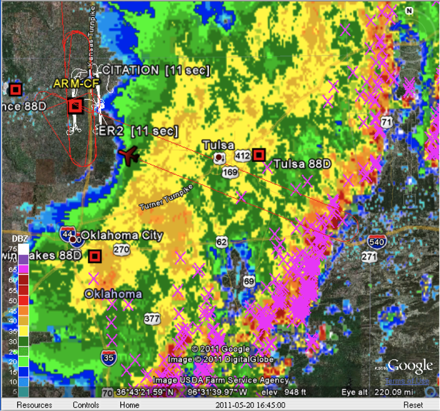
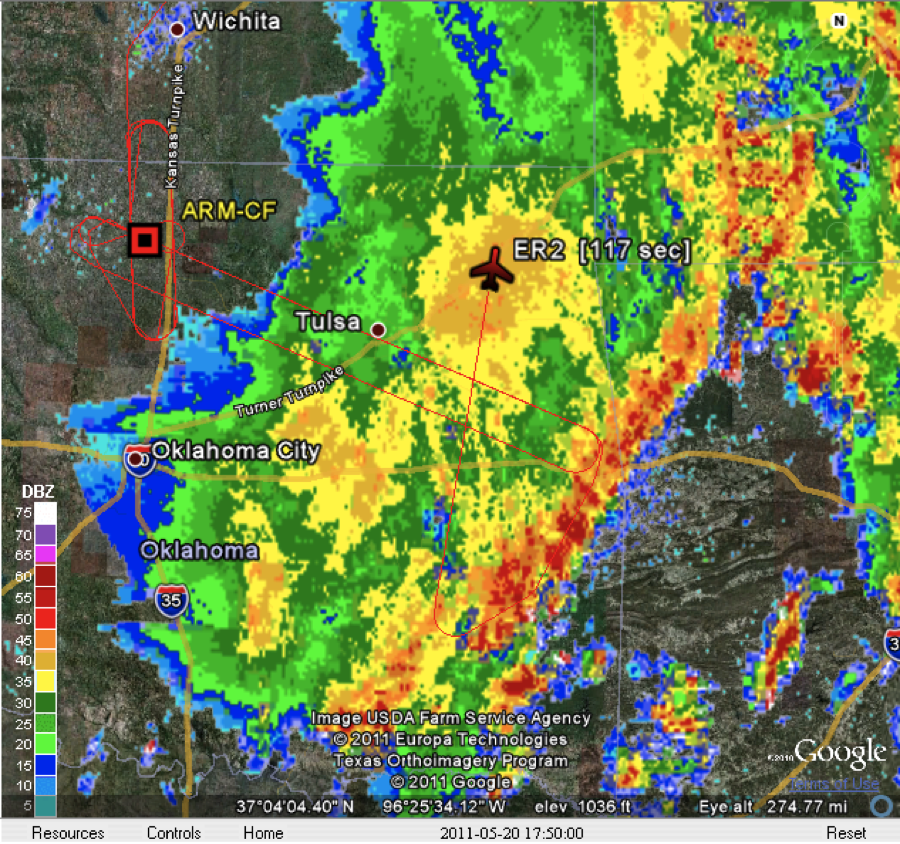
After this step down pattern, UND did a spiral up over the CF with ER-2 doing a bow tie centered on the CF. UND then did a spiral down to the east of the CF, then returned to base. In both spirals, UND covered the same altitude block from 10-25K feet. ER-2 was then set on a racetrack along a NW-SE line(towards the Arkansas border) to overfly the stratiform, transition zone and convective line of this large MCS (Fig. 3). After 1.5 racetracks, the ER-2 was directed on a NE-SW run to overfly the hardest convection in the remaining convective line to the south. The ER-2 was then directed NNE to overfly the heaviest stratiform NE of Tulsa, and then was directed to return to base (Fig. 4).
This was an A-1 case. Excellent aircraft patterns, great instrument coordination. Thanks all.
Rutledge/Carey/Nesbitt
| Attachment | Size |
|---|---|
| Fig. 1.png | 1.48 MB |
| Fig.2.png | 376.52 KB |
| Fig. 3.png | 1.37 MB |
| Fig.4.png | 1.45 MB |
