May 27 Mission Science Report
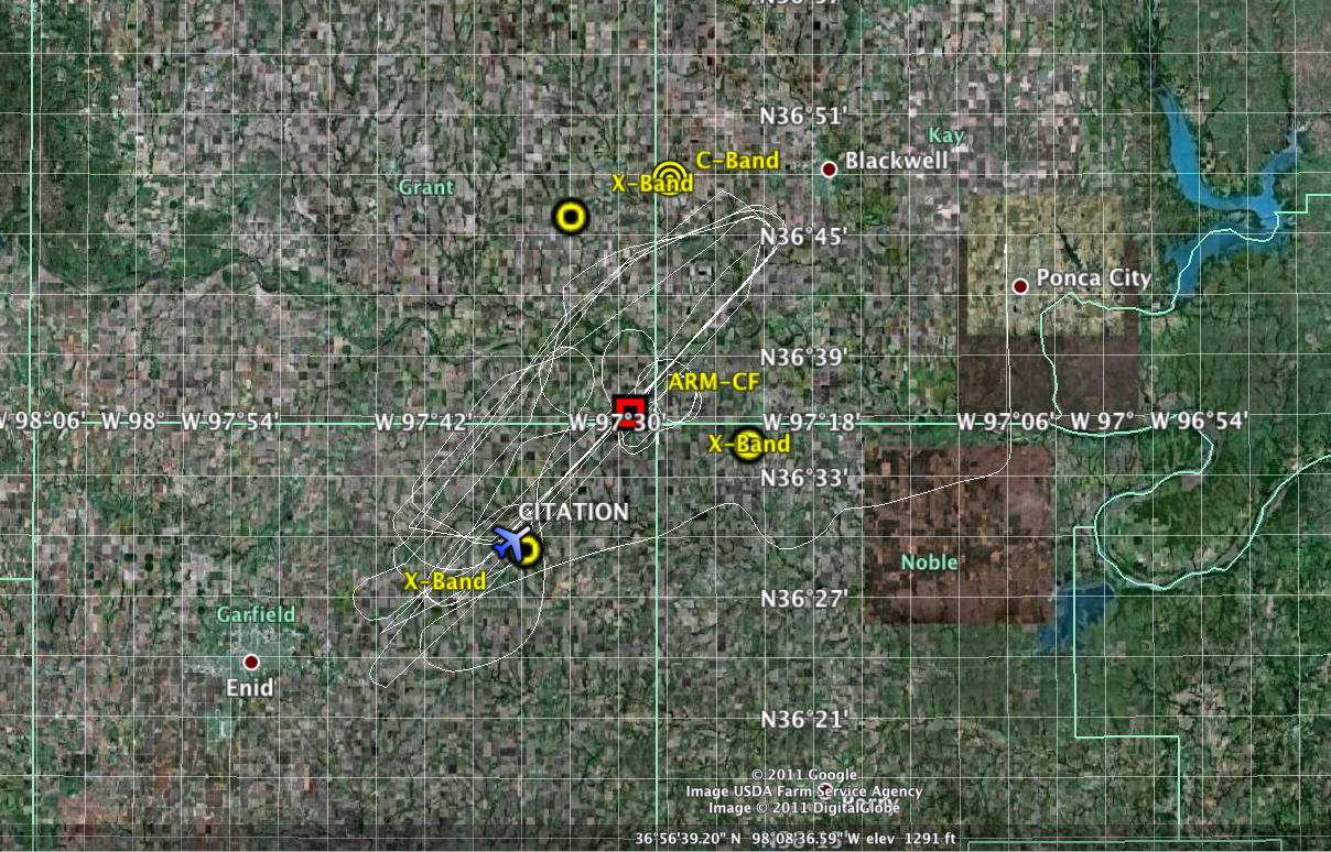
Today’s weather forecast involved low chances of precipitation in Colorado and Oklahoma. The ER-2 tentative take time was 23:00 UTC but eventually the mission was cancelled due to lack of targets. As a result, the UND Citation did a cloud mission around the ARM CF in shallow cumulus clouds. The Citation launched at 21:03 UTC and first did an aerosol profile up to 5 km and then headed to the CF. At the CF, the Citation did a upward spiral from the subcloud layer to 3 km height. Then, position the aircraft for along wind racetracks from a SW to a NE direction. The total length of the racetracks was 30 km. Three flight heights levels were used: 100 m below the average cloud base height, 30 meters above the cloud base height and 30-50 m below the variable cloud tops height. The Citation did several overpasses over the site (Fig. 1). At 22:03 UTC Citation started the last SW-NE leg in the dissipating cumuli layer and then head back to Ponca City airport. Landed at 00:04 UTC
Kollias/Nesbitt/Heymsfield
| Attachment | Size |
|---|---|
| may27_cloudmission.png | 1.78 MB |
