Afternoon Update, May 18
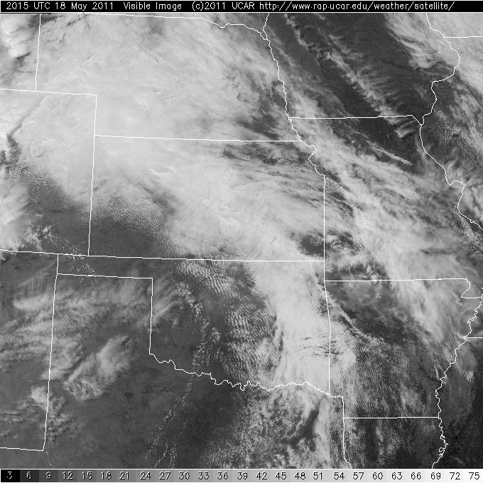
Current visible imagery shows clearing skies in western Oklahoma behind the dryline, which is draped across western Oklahoma and the OK/TX panhandles.
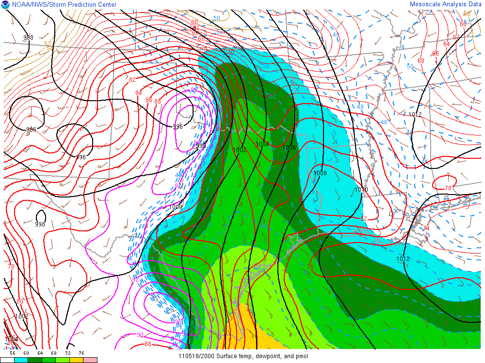
The triple point of the dryline and a warm front is located just to the southwest, in the Caddo-Blaine county region. SPC just issued a MD for most of western and central Oklahoma in anticipation of convective initiation in the 20-22 UTC time frame. Moisture convergence is greatest in this region.
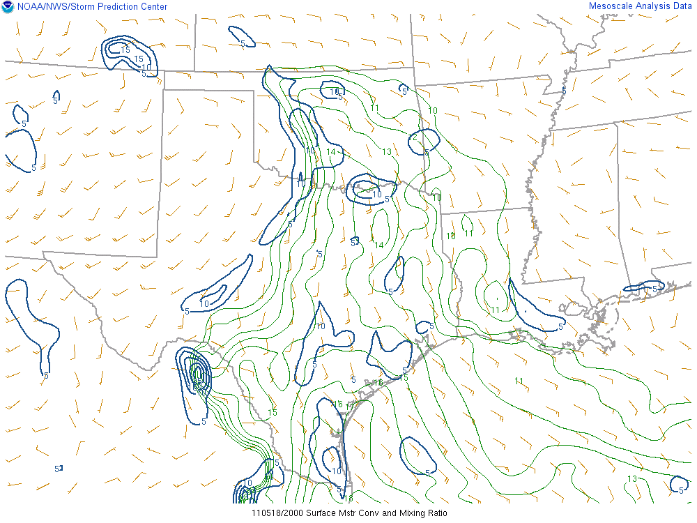
Surface moisture is increasing from the south. Storm relative winds in the steering levels show that anything that develops will move directly to the east. The likelihood of storms developing to the south seems greater than the chance of anything developing to the west- if convection forms in central Oklahoma, it will cut off moisture to any possible development to the west of the central facility.
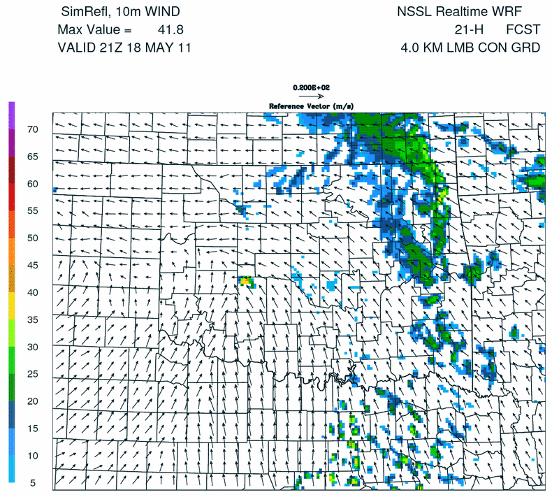
NSSL WRF shows convective initiation in the Caddo-Blaine area by 21 UTC.