Evolution of Easterly Waves
The initial recommendation would be target waves with vorticity centers as follows:
- For systems with likely precipitation systems north of 13 N: 15-19 W, 21-25W, 33-39 W.
- For systems with precipitation expected to be south of 13 N: 13-19 W, 25-31 W, 31-37 W. (Note: The Guinea coast is about 10 N 13 W, so if a strong system is expected to exit the coast there, it may be desirable to sample it shortly after it emerges.)
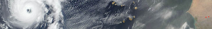
Note that precipitation is far more likely near NPOL than near TOGA for any wave and often between waves; e.g. squall lines.
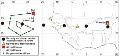
Note: There are many different flight tracks possible, and if desired more examples can be provided. They all share the objective of dropping sondes covering the N-S and E-W extent of the wave, to include any embedded vortex, the AEJ, and crossing into the SAL. If most of these objectives can be covered in 5-7 hours, modules for PP or SAL objectives can be inserted. If a CS/C orbit is within the pattern, a segment for an underflight can be programmed into the pattern.
Figure courtesy of Mike Douglas illustrating one possible flight pattern for an EW mission. Obviously, if the African Easterly Jet (AEJ) was north of Sal, the pattern would be extended northward. If there is evidence of a vortex, a possible option is for an in situ module at lower levels as illustrated. If there is convective weather near the TOGA radar, more time would be spent in that vicinity. Altitudes would be mostly 35-40Kft to get best science output from dropsondes.
