Forecasting

NAMMA Banner

NAMMA weather forecast Sept 12 2006

September 12th, 2006

NAMMA forecast Sept 12 2006

Today is a fly day. The massive convective system has come off the coast and is moving to the west at 10 to15 knots. Based on satellite imageries, the circulation center at 06UTC today is located approximately at 11.5N/20W.  Newly developed strong convection with a lot of lightning can be seen northwest to the center starting at 0230 UTC. Dust and dry air is entrained into the system from west and northwest. GFS 00Z run predicted the system propagates rapidly to 12.7N/31W at 12Z Sept 13th, to 12.5N/38W at 12Z Sept 14th and to 14N/45W at 12Z Sept 15th.

Forecast for Monday Sept 11

September 11th, 2006


A strong AEW exists just inland, primarily over Senegal.  Meteosat imagery shows strong convection ahead of the wave, and the wave circulation center is at approximately 17N 12W.  The wave exhibits strong cylconic circulation in the 925mb isotachs and the wave axis is clearly visible in the 700mb level.  Strong winds (~22 m/s) exist in the 700mb level above the area that the center of circulation is found in the lower levels.  Meteosat imagery also shows a well defined dust layer to the north and northeast extending to north of the Cape Verde islands.  A cloud band proceeds the dust layer and helps to distinguish the boundary.  Currently, the ITCZ is also well defined in the Meteosat imagery and appears more active in convection than what has been observed recently. 

ECMWF, UKmet, and GFS all show the wave exiting the coast early tomorrow morning.  ECMWF shows the wave a little ahead of the other models, and may even be initialized a little too far to the west currently.  At 12Z tomorrow, GFS shows the center of circulation just off the coast of Dakar at 14N, 20W.  By Midnight Wednesday the wave progresses to the west and continues to strengthen.  Fight time on Wednesday the models are merging with current convection and amplifying the wave greatly.  Isotachs suggest the center of circulaion is around 15N 22W.  UK met at this time has the wave blowing up into a major hurricane, GFS also tends to strengthen the wave greatly.  These suggestions are taken lightly and mainly only used for center of circulation predictions.  By flight time Wednesday the wave is just south of the Cape Verde islands.  The belief that this AEW will not only hold together but strengthen throughout the forecast time all the way to a last flight on Thursday is held in confidence. 

Forecast discussion for Sunday, September 10, 2006

September 10th, 2006

The current wave at approximately 27 W has started becoming more disorganized, so the flight plan today has been cancelled. No models are developing anything significant from the current system in the next few days, as the system is being torn apart by southerly shear. A retrograding upper-tropospheric trough at 27 N, 32 W is pulling air from the south above the current wave system; thus, this wave is being abandoned. The next wave shows distinct circulation and is currently located at 13 N, 5 W (near Bamako, Mali), but the models are disagreeing on its translational speed. The model consensus is that the wave will slow down and exit the coast sometime on Tuesday, September 12. The FSU MM5 has its exiting at 06Z, while the FSUSE, GFS, and UKMet have its exiting later in the day between 12Z and 18Z. This wave does appear to be the better choice, as low-level wind analysis indicates that the second wave has more moisture, a favorable location with respect to the African Monsoonal flow, and a dominant role in determining the zonal flow. The first wave is bypassed almost completely by the zonal flow just north of the ITCZ.

 The next few forecast meetings will focus on monitoring and tracking this system as it progresses across the African continent.

Forecast for Friday Sept 8

September 8th, 2006


Visible and Infrared Satellite images show convection just off the coast of Dakar at 15N, 19W.  Because of the system’s positioning, flight passes within 50km of NPOL is planned for today.  Analysis of the GFS winds do not show a significant circulation pattern.  Very weak winds exist that have a cyclonic tendency in the 925mb level, but it is not so apparent.  ECMWF shows a slightly more visible cyclonic circulation than GFS.  The wave is noticeable up to the 700mb level in GFS winds just not as a cyclonic circulation.  Radar images from NPOL showed a circulation last night but it has disspated this morning.  The flight planned for today is to try and find the wave structure.   

GFS winds at 950mb for the 24 hour forecast shows a stronger circulation than the analysis, with the center located between 14 and 15N ; 20 and 21W.  The circulation gets a little weaker as it advances to the 850mb level, and is not apparent at all on the 700mb level.  The 36 hour forecast shows a weak circulation at 925mb, and the wave axis is visible in the 850mb and 700mb level.  The 48 hour forecast is not supportive in following a steady, surviving wave as it has the wave dissapating.  On the 925mb level on Sunday at 00Z the wave is almost non-existent, with just a slight kink in the isotachs aroun 30W.  The 700mb level however still exhibits a more apparent wave pattern with increasing winds from the SE just to the east of the wave axis.   

Forecast for Thursday, September 7, 2006

September 7th, 2006

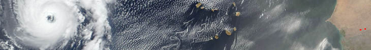
The wave system that looked impressive two days ago has shown signs of weakening. Convection over western Africa and in the ITCZ is being suppressed by a lack of convergent low-level winds and by a lack of moisture. The GFS, ECMWF, CMC, and UKM models all predict a disorganized system that is accompanying the wave that is currently on the coast. Synoptically speaking, a 500-mb low has spun its way back into southern Europe, a feature that was initially thought to be spawned by a north-track wave. In the Atlantic, a frontal boundary is draped across the Atlantic, while upper level flow is being redirected by a split in the jet stream off the coast of Nova Scotia into a low pressure system currently over the Canary Islands. Low-level flow into the ITCZ does not have a significant northerly component off the coast of Africa, as Florence’s circulation and a secondary circulation to its east are dominating the direction of the flow. Closer to the African coast, the low-level winds are in an anomalous westerly direction and are feeding into a wave that is currently located around 15 E – i.e., several days out.

The GFS forecasts indicate a strengthening trough axis, but model output trends indicate a bias towards this development. ECMWF 700-mb forecasts out to four days display a weak wave that does not intensify dynamically. This wave is also slowed in all models by a large mid-tropospheric high pressure system located around 20N and 20W. There is formation of a broad low-level circulation once the wave exits the coast, but this is a standard model prognostication, something we have seen throughout the duration of this campaign. As far as convection is concerned, the zonal pattern of the low-level flow and the presence of extremely dry air do not indicate an imminent convective event resulting from this wave, so the science team is taking a wait-and-see approach. Currently, they are hoping for a 6-hour flight tomorrow. Final preparations will not be made until tomorrow, as this system bears hopeful watching.

NAMMA weather forecast Sept 5 2006

September 5th, 2006

NAMMA forecast Sept 05 2006

Today DC-8 will fly along 19N into African continent to examine the dust source, how its character changes as exiting the coast and its interaction with clouds if there is any. The vortex we sampled yesterday moved to 15N 30W. Model consensus shows no sign of intensification for the next 12 hours. The upper level dry and dusty air ahead of it might contribute to the weakening. Models (MAP06/G5, GFS, UKMAT, and CMC) predict the vortex will merge with TD6 within 72 to 96 hours. Mission scientists decided to not fly it again and will wait for the next wave coming off the coast on Sept 8th. Three dusty regions can be seen from satellite imageries from west to east: ahead of the TD6, between TD6 and the vortex, and east of CV islands. Mission today is focused on the dust just coming off the coast. Shallow cumulus clouds embedded in the dust layer just northwest of Dakar may be an interesting area to examine the dust and cloud interaction. Tomorrow is a hard down day.

Forecast Summary for 9/4

September 4th, 2006

NAMMA forecast Sept 4

The wave sampled by the DC-8 yesterday (Sept 03) has continued to propagate westward while maintaining a cyclonic circulation signature below 500mb.  A decision has been made to fly the system again today.  A QuickScat overpass at 2018UTC Sept 3 places the surface circulation center near 15N 26W.  The position is consistent with NHC Tropical Discussion issued 0600 UTC Sept 4 placing a 1008mb low near 26W/27W and 16N. The circulation center is located 100-200km to the northeast of convective burst within the ITCZ.  It continues to move west at 10-15 knots.   The 00UTC Sept 4 numerical guidance suite (NCEP GFS, MAP06 GEOS-5, Howard Univ and UIUC WRF systems) is in strong agreement on both the track of the system and low-level structure over the next 48h.  Ensemble positions are as follows:  12UTC/4: 16N-27; 00UTC/5: 16N-29W; 12UTC/5: 16N-32W; 00UTC/6: 16N-35W. 

Forecast Summary for 9/3/06

September 3rd, 2006

The wave over the coast yesterday has now moved to a location just south of the Cape Verde islands.  Infrared satellite imagery and 925mb analysis indicates a wave center near 15N/23W.  The wave is moving to the west at 10-15 knots.  Intense convection has been forming with this wave over night, continuing into this morning, and is showing a fairly extensive cloud shield from 26W to 22W.  A second convective burst is also located to the southwest of the wave, as well as a third convection burst to the east around at 14N/20W.  The GFS 18-hour forecast indicates a westward movement to approximately 24W by the middle of today’s flight.  The 36 hour forecast, valid at 12Z tomorrow shows a more east/west closed vorticity center at low-levels, centered around 15N/26W.  The GFS resolves a slower translation speed for the wave, however keeping a similar speed as current, tomorrows position may be farther to the west than indicated by GFS forecasts.  Only slight intensification is indicated over the next 48-hours in the GFS, however the 54-hour forecast shows the beginning of an intensification stage, with the center of the wave located at 14N/29W.  By 72-hours, valid 00Z on Tues., Sept. 5th the circulation center is between 35 and 40W, and remaining at 14-15N.  Arpege and ECMWF confirm a broad circulation forming within the next 48-hours to the west of the islands.  Precipitable water forecasts show a strong moisture convergence into the system, while dry dusty air remains to the north/northwestern regions of this wave.  After the current wave, no significant wave is forecast to exit the coast until Thursday/Friday.

NAMMA weather forecast Sept 2 2006

September 2nd, 2006

NAMMA forecast Sept 2

Today is a no-fly day. The convection embedded in the ITCZ is not expected to intensify until Sept 3. Heavy dust loading can be seen as far as 53W. The southern edge of the dust plume is south of CV near 15W. The dust plume we sampled yesterday is steadily moving west and reached 22W. A small-amplitude AEW is located southeast of the CV embedded in the ITCZ and moderate convection is occurring. Convection associated with the wave is near 14N17W. Due to dry and dusty air ahead, this convection is expected to weaken in the next 12 hours. Another strong convection behind the wave is located near 10N10W. Strong monsoon trough bringing moisture from the southwest may support and strengthen this convection for the next 24 hours. The wave amplitude will increase and gradually form a closed circulation by 06Z Sept 3 centered at 12N20W. Both GFS and UIUC-WRF shows the circulation is well organized and shows sign of intensification for the next 24 hours. By 12Z Sept 3, the center is at 14N22W by GFS and 18N18W by UIUC-WRF. The GFS is taking the wave to the northwest over the island through Monday. General model consensus (GFS, UIUC-WRF, ECMWF, and ARPEGE) is to develop the wave west of the island towards a tropical depression intensity through Sept 3 to 4. Tomorrow is a scheduled fly day.

Forecast Summary for 9/01/06

September 1st, 2006


Please see corresponding powerpoint presentation posted above.

Several convective cells lie along the ITCZ, associated with AEW currently located inland along 5W.  The strongest convective cell lies inland along 6 to 7W.  There is currently a large ridge in the isotachs in the 850mb layer showing the AEW, but there is no cyclonic circulation on the surface besides the cells ahead of the wave.  This wave is forecasted to be on the coast of Afirca along 15W Saturday, Sept 2 at 0Z.  The GFS, ECMWF, CMC, and UKMET all agree in the general strength and timing of the wave, there is a little discrepency on exact location of the wave after it exits the coast of Africa.  Individual cyclonic circulations exist ahead of the wave throughout the forecast period (until at least Monday).  There is one strong cyclonic cell that stands out above the other smaller ones that is located at 26W, 13N on Sunday at 0Z.  This cell has been developing and overtaking the other smaller convective cells since the 0Z forecast on Saturday.  These conditions are setting up for good two to three day consecutive flights.

Have you used our data? Register for updates