TOGA

NAMMA Banner

Summary of TOGA Operations for 15-16 September, 2006

October 14th, 2006

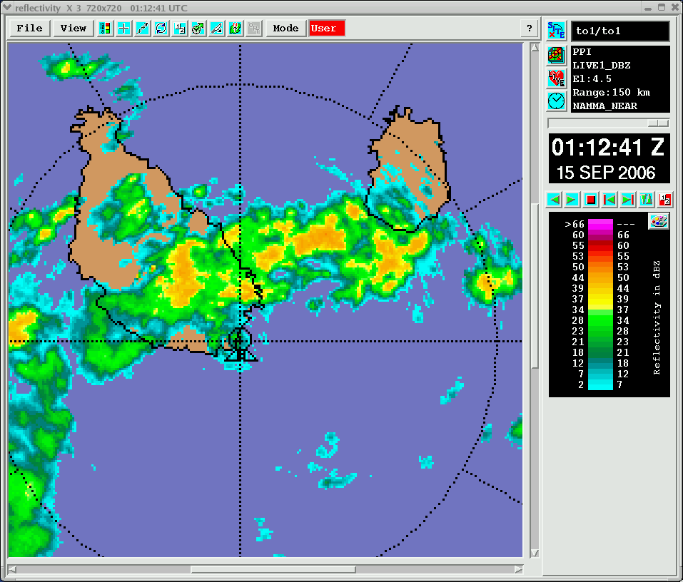
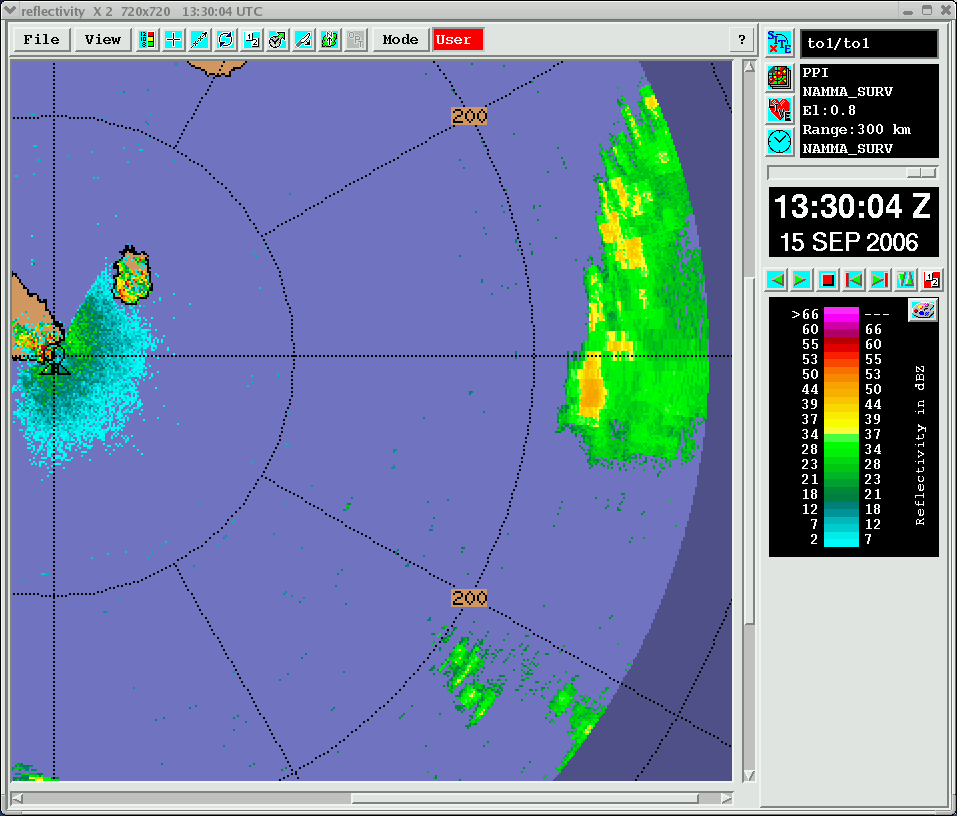
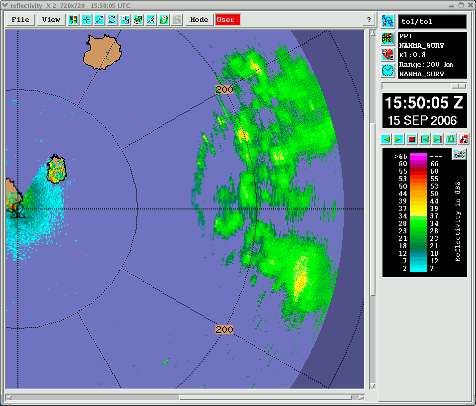
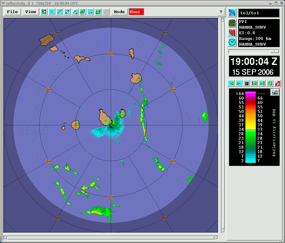
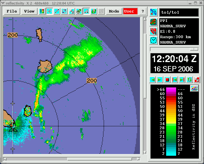
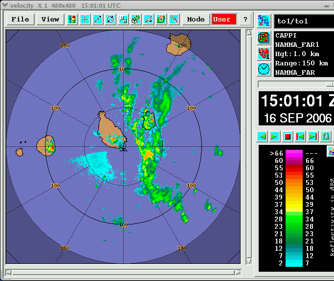
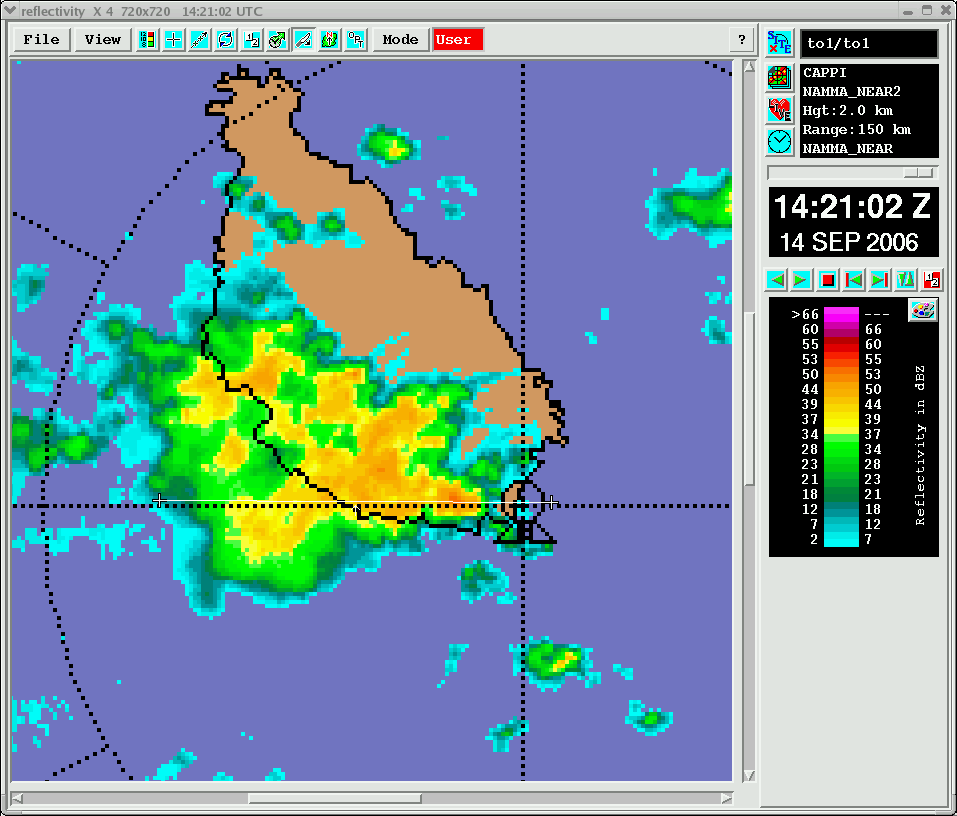
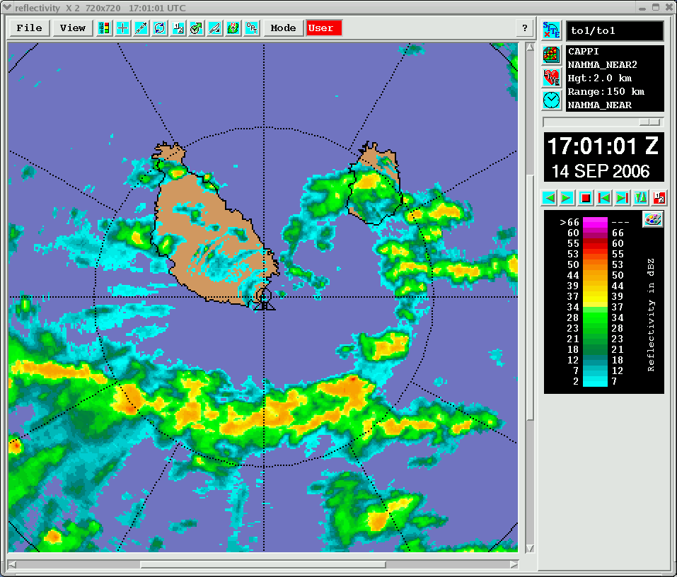
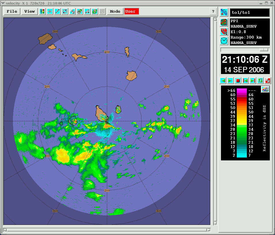
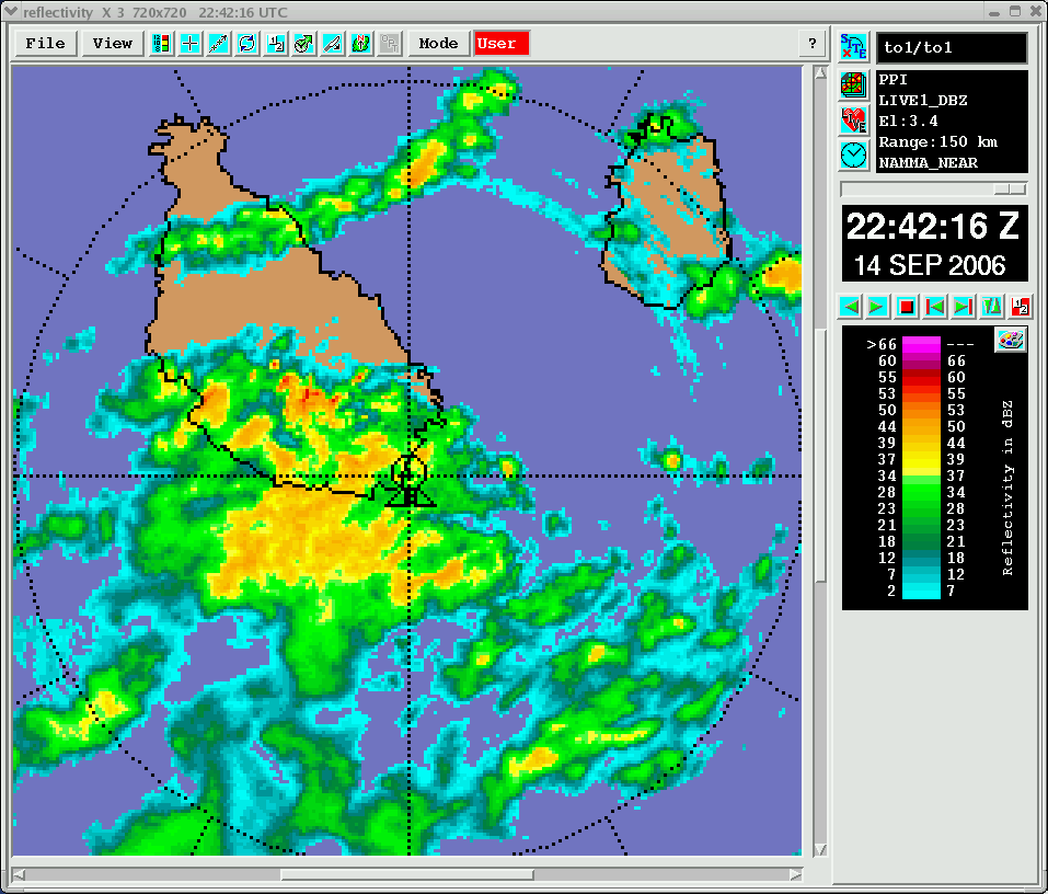
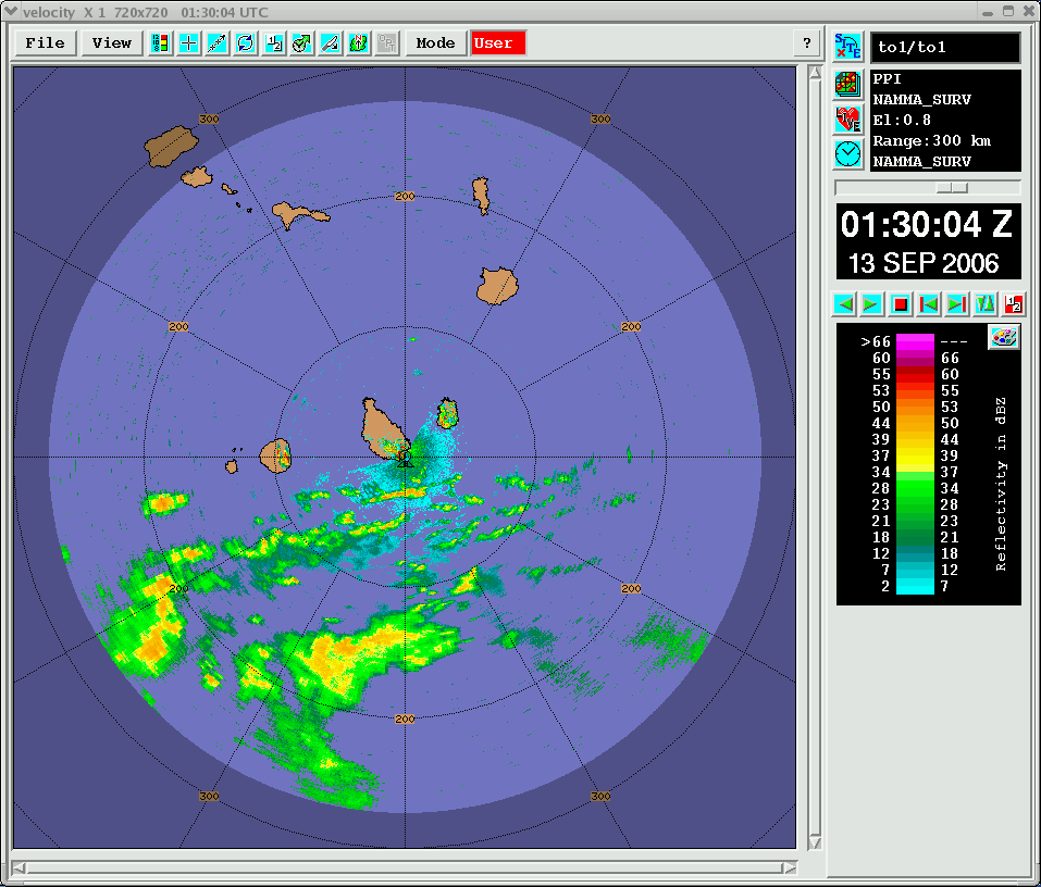
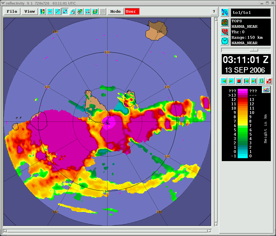
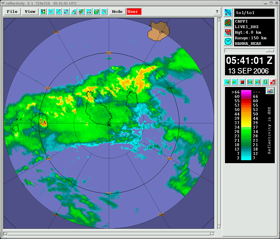
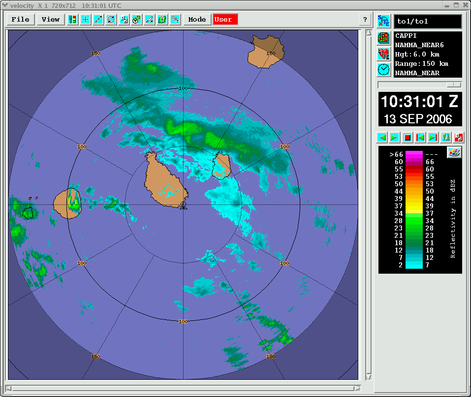
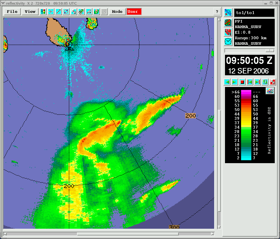
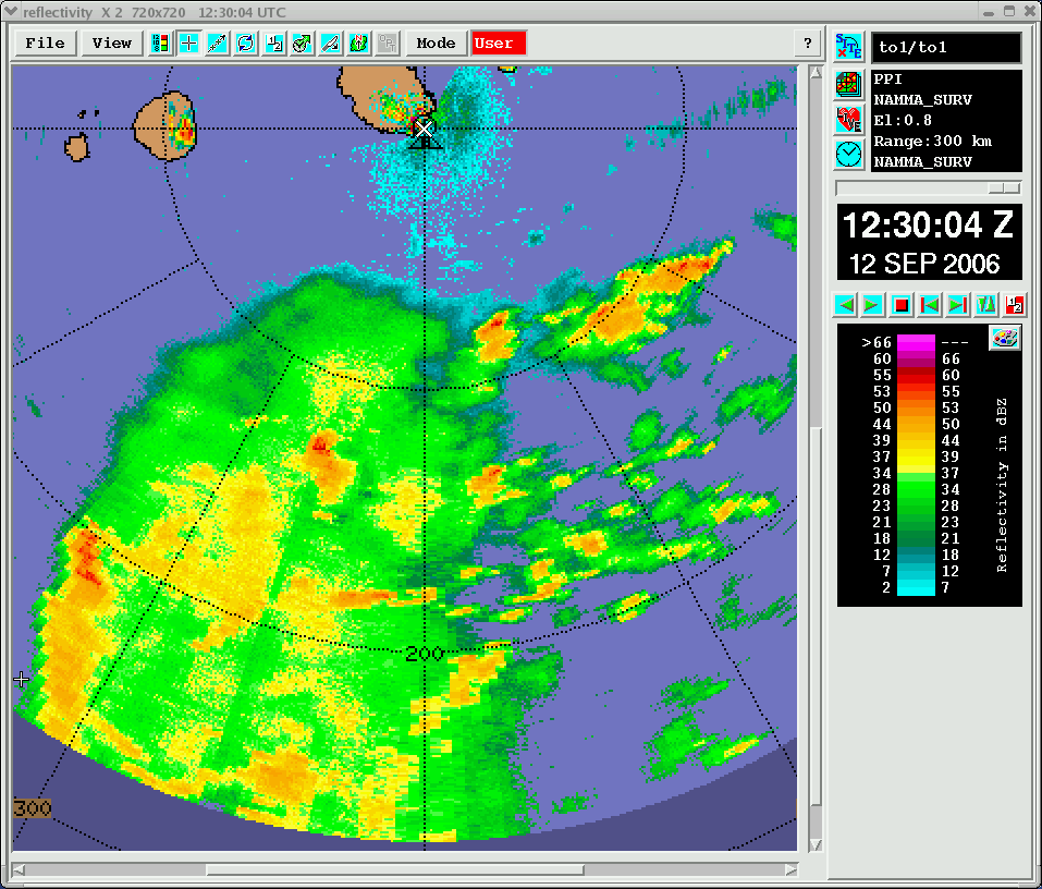
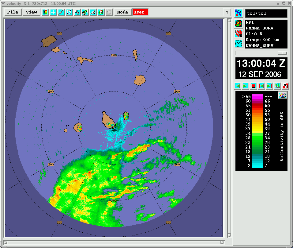
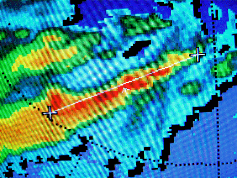
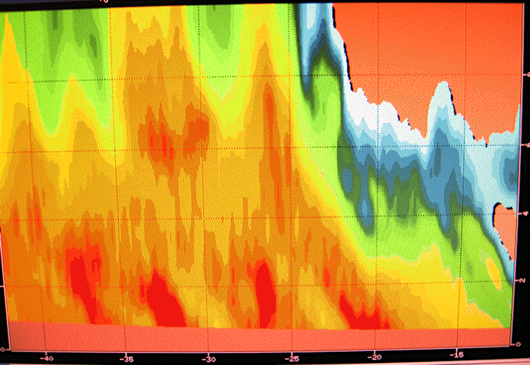
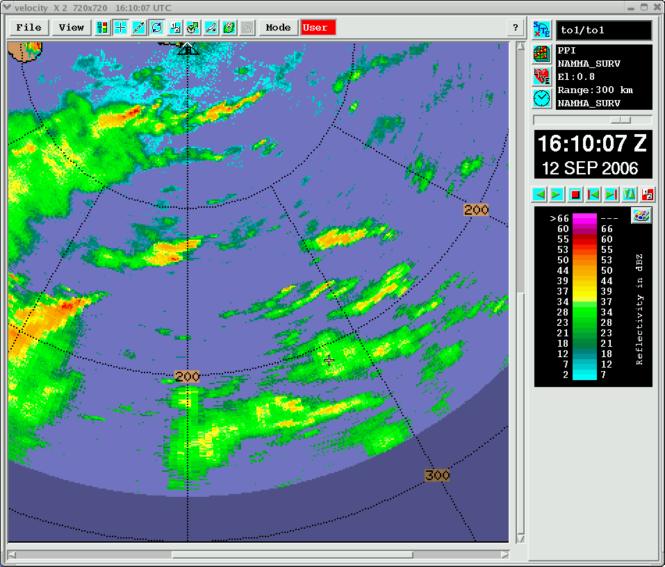
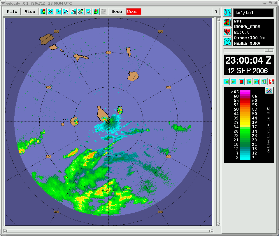
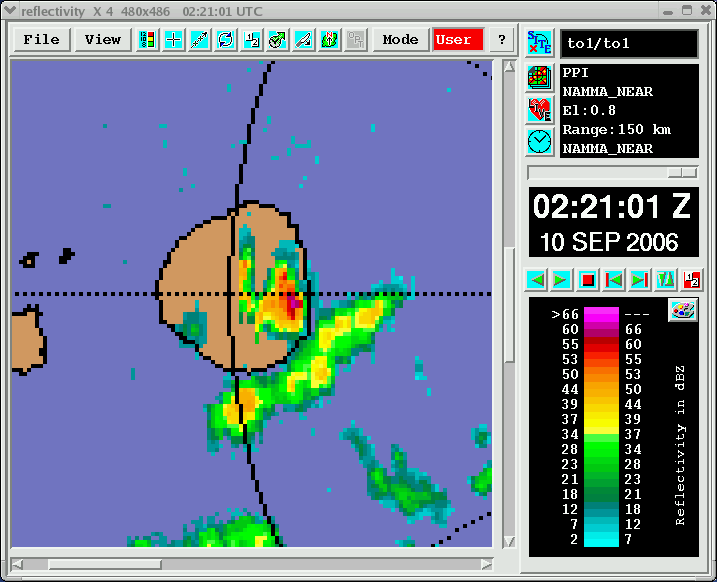
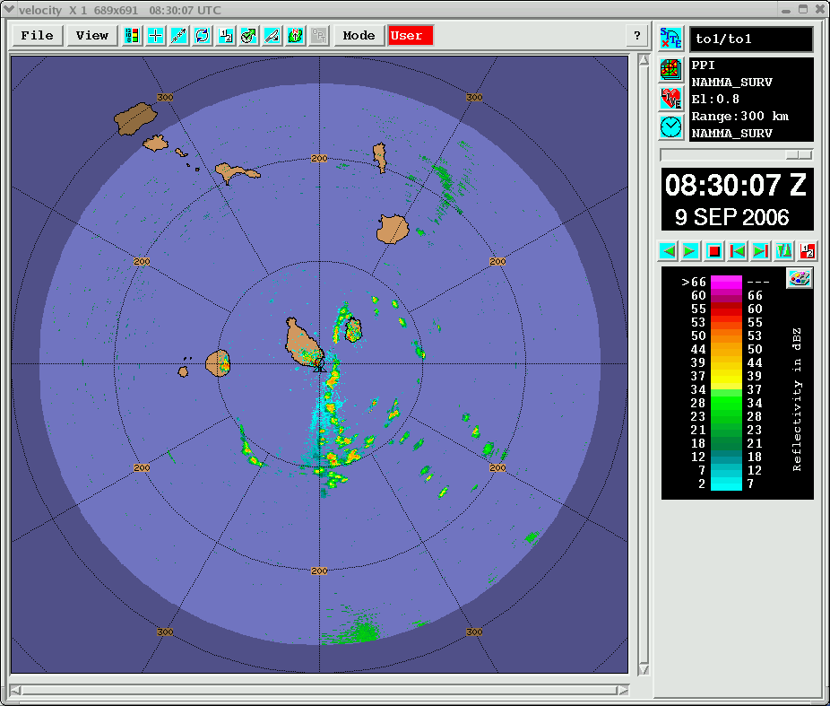
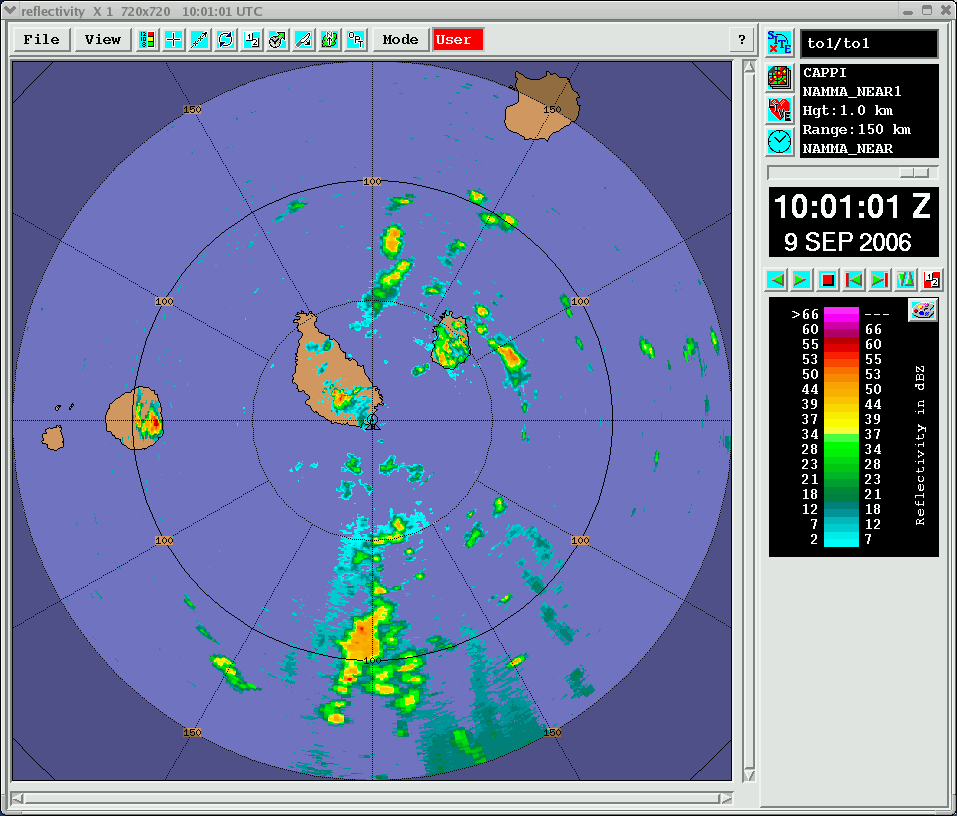
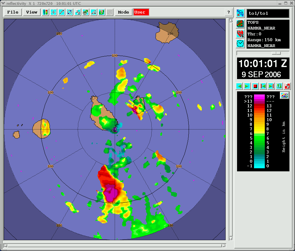
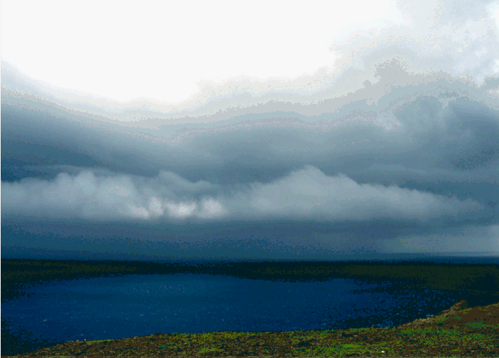
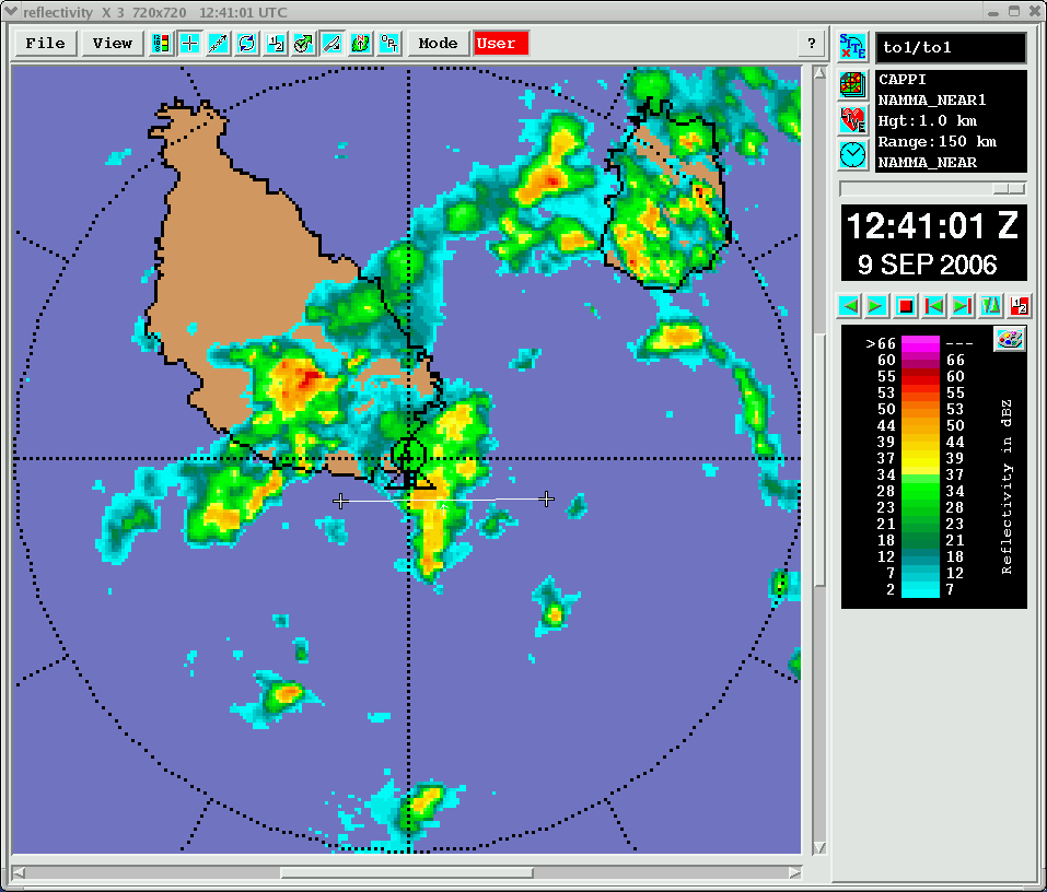
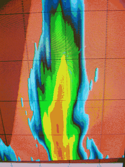
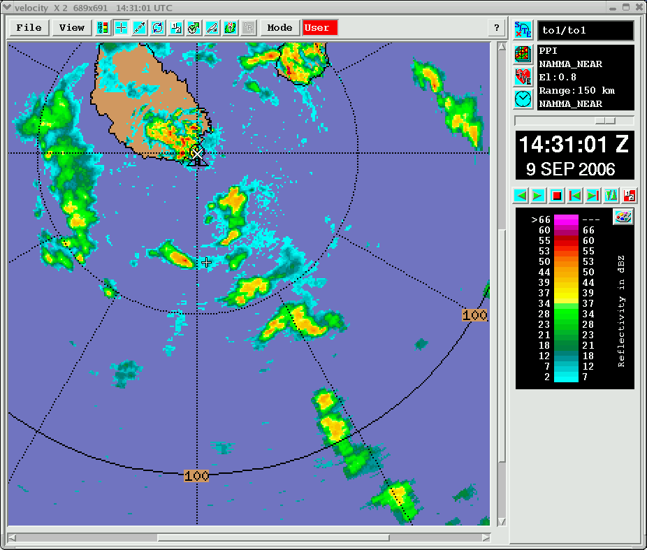
The initial hours (0000-0700 UTC) of 15 September were spent documenting the evolution and demise of a heavy precipitation event over/surrounding Sao Tiago island. An additional E-W band of convection north of Praia (Image-1) appeared poised to pass southward over TOGA, but effectively dissipated in-place before doing so. Midday on the 15th, a weak but tenacious W’ward propagating squall type system entered TOGA’s surveillance domain (Image-2). This squall soon dissipated (Image-3), but generated a solitary wave that was soon accompanied by a line of 40+ dBZ cores (Image-4). This line propagated westward at a slow but steady speed of ~4-5 m/s over a period of 4+ hours before dissipating immediately east of TOGA just before 0000Z 16 September. On the morning of 16 September, TOGA captured the approach of a cyclonically curved band and demonstrably rotating area of stratiform echo (Image-5) associated with a larger scale cyclonic circulation edging W’ward off the African coast. With time, the more distant stratiform echo dissipated but a lengthening N-S band of convective precipitation (along which individual cells were swept rapidly southward by prevailing N’ly flow) neared Sao Tiago island before losing coherence, perhaps due to interference by local terrain (Image-6). Recording was halted at 1600 UTC so that a final suite of calibrations could be performed. This marked the close of TOGA’s scientifically-staffed operations in conjunction w/ NAMMA. (Scroll downward past RHS menus to access attached images) ..

Image-17.gifImage-25.gifImage-35.gifImage-45.gifImage-53.gifImage-63.gif

Summary of TOGA Operations for 14 September, 2006

October 14th, 2006

Returns from widely scattered convection that developed mainly south of TOGA early in the day suggested a regime-shift. Northward-moving cells to our west (in some sense on the very far-trailing fringes of TS Helene) were replaced by southward moving cells to our east, yielding impression of overall anticyclonic curvature in prevailing flow. By late morning, intense convection developed over the higher terrain of Sao Tiago (as well as neighboring islands) and remained locked to the terrain for several hours in classic flash-flood fashion. Stratiform echo eventually streamed SW’ward from these cells (Image-1), which soon collapsed and appeared to send an expanding arc of outflow surging S’ward. Over the interval 1500-1700 UTC, a remarkable up-scale interaction that ultimately culminated in the formation of a 200+ km long E-W band of intense convection (Image-2). Interestingly, contemporaneous NHC analyses showed the ITCZ to be positioned very near TOGA’s latitude. Over time, this band stalled and congealed with scattered nearby shorter (also primarily E-W oriented) convective lines to form a moderately intense MCS in TOGA’s southwest quadrant (Image-3). No rotational tendencies were noted within this echo. At the same time, new convection was breaking out in the zone immediately south of Sao Tiago island. This cluster of storms rapidly expanded and effectively split, with one group backing N’ward over Sao Tiago and leading to an extremely heavy round of sustained convective rains over TOGA (Image-4). This activity persisted up through the 0000 UTC 16 September cutoff for this summary.

Image-16.gifImage-24.gifImage-34.gifImage-44.gif

Summary of TOGA Operations for 13 September, 2006

October 14th, 2006

As introduced in the preceding daily summary, an MCS exhibiting apparently well-organized cyclonic rotation transited TOGA’s southwest sector from 00-03 UTC. This MCS embodied multiple curved bands extending toward an apparent center of rotation that lay south of our scan limit (perhaps corresponding to the westward moving center of TD8, which was later designated TS Helene). During this same period, rapid echo development occurred along a WSW-ENE oriented zone extending eastward from the MCS’s northern reaches into TOGA’s southeast sector. An initial array of multiple, street-like convective lines (Image-1) developed immediately south of TOGA and rapidly congealed into a large and intense band (Image-2), which subsequently swept NNW’ward over the radar site between 03-04 UTC (Image-3). Passage of this feature, which in many respects resembled an outer spiral hurricane rainband, brought frequent and intense lightning/thunder and torrential rains to the southern Cape Verdes and surrounding waters. By 0900 UTC, the surface/low-level echo returns from this band had largely dissipated just before reaching the northern island of Sal, though vertical cross-sections and upper-level CAPPI displays indicated widespread echo well aloft (and implied considerable low-/mid-tropospheric evaporation). Other weak upper-level bands of echo ensued, but failed to yield much precipitation reaching the surface, again evidently owing to the influence of encroaching drier air on the northeastern fringe of TD8. These upper-level bands gradually rotated to be more NW-SE oriented, as would be expected in the presence of a large-scale gyre located to our SW by this time (Image-4). Between 0500-1030 UTC, yet another weaker MCS-like feature with pronounced cyclonic rotational tendencies (not shown) spun westward across TOGA’s southwest sector. Thereafter, spotty precipitation–mainly in the form of loosely-organized NW’ward propagating bands of cells–persisted in TOGA’s SW sector until about 1730 UTC. Lastly, a progressively more dense crop of shallow cells (in which “warm rain” collision/coalescence precip processes evidently dominated) swept north across TOGA from 1830 UTC onwards.

Image-15.gifImage-23.gifImage-33.gifImage-43.gif

Summary of TOGA Operations for 12 September, 2006

October 14th, 2006

This was a very active day in terms of intense convection exhibiting mesoscale organization in range of TOGA. A large westward propagating MCS, which formed in the northern reaches the cyclone officially designated by NHC as TD #8, passed by to our south from 0500-1900 UTC. Its intensely-convective northern edge fell within TOGA’s volumetric scans from 0900-1400 UTC, and was initially characterized by a single dominant WSW-ENE band (Image-1). Several shorter-lived intense bowing segments developed within this band. The overall structure moved obliquely (westward) at a fast clip of 15-17 m/s. A large shield of stratiform rain and embedded convection extended to its southwest off our display. TOGA observed 40 dBZ echoes extending up to 8-10 km MSL in the strongest cells, consistent with abundant mixed-phase processes and relayed reports of numerous frequent lightning. Another hallmark of this intense system was its very high echo tops (>13 km MSL) covering a very broad region. With time, the MCS’s convection re-aligned/developed to yield an ~N-S line along its western edge (Image-2). TOGA provided long-range guidance via cellphone/X-chat relay to assist the DC8 eastbound penetration of this feature along 13 degN (i.e., ~200 km to our south) near the start of their broad-scale pattern. A distinct evolutionary phase emerged around ~1300 UTC during which multiple new WSW-ENE oriented convective bands rapidly developed in the wake of (and arguably somewhat connected to) the initial MCS (Image-3). Even in the presence of continued strong W’ward echo advection, repeated convective redevelopment near the E ends of these “slow-moving” bands lent a quasi-stationary aspect to their behavior. Several were remarkable for their simultaneously narrow yet deep/intense nature (Image-4 & 5). Stratiform precipitation streamed to their west in banner-like fashion, but contained enough embedded convection to discourage further DC8 coordination during their N’bound return. The DC8 was able to independently select locations for two such spirals; the location (cursor) and echo conditions sampled by TOGA at the approximate time of the second spiral (conducted ~150 km north of the cyclone center) are shown in Image-6. Late in the day (2030+ UTC), a second distinct MCS approached from the SE, around the time that the NHC-analyzed cyclone center was due south of TOGA. This MCS exhibited the first (and readily noticeable) signs of mesoscale cyclonic rotation seen on this day as it cartwheeled westward across TOGA’s southern field of view (Image-7).

Image-14.gifImage-22.gifImage-32.gifImage-42.gifImage-52.gifImage-62.gifImage-72.gif

Summary of TOGA Operations for 11 September, 2006

October 14th, 2006

Considerable 2nd/3rd trip echo was detected during this period of
increasing N’ly low-level flow, particularly to the NE-E (and eventually
SE) of TOGA between 1000-1500 UTC. A few 1st trip returns
developed during the afternoon hours, primarily in the form of brief
convective pulses and an elongated “banner echo” downwind of Fogo and
Sao Tiago, respectively. Otherwise this was a relatively quiet period.

Summary of TOGA Operations for 10 September, 2006

September 11th, 2006

The early hours of 10 September saw a continuation of scattered convective activity primarily south and west of TOGA. This activity lay within the northern reaches of an AEW-associated cyclone that passed by to our south during the previous afternoon. Over the interval 0000-0300 UTC, convective echo sizes and lifetimes were limited, but locally intense precipitation was observed (viz. peak reflectivity values in the 40-50 dBZ range).

Observations were obtained of precip-terrain interactions over several islands in the Cape Verde archipelago. Image-1 depicts a NW’ward moving convective segment impacting the volcanic island of Fogo, located ~100 km west of TOGA. Over the subsequent half-hour, this echo was effectively destroyed by this process. (Note that echo returns appearing directly over Fogo at the time of Image-1 correspond to clutter returns from the crater’s eastern face.) Widely scattered showers continued mainly west of TOGA through sunrise, but the last echoes had disappeared by 0930 UTC. Conditions for the remainder of the day were profoundly suppressed–absent any clouds whatsoever except for a few lowly SCu visible over the higher terrain of Sao Tiago, seen through increasingly dusty skies.

Image-1

Summary of TOGA Operations for 9 September, 2006

September 10th, 2006

The end of an extended (~4-day) period of extremely suppressed weather arrived in full force on 9 September, which ranks among the 3-4 most active days for TOGA operations thus far in the project. An arc-shaped line of cells (initially detected at ~1930 UTC 8 September) approached TOGA from the east, but lost definition in the early hours of 9 September as more widely scattered cellular activity gradually expanded across our eastern sector. A rapid crescendo in echo intensities/coverage occurred around sunrise (0600-0830 UTC), with isolated ~60 dBZ returns detected in cells immediately to our SE at 0720 UTC, corresponding to a healthy-looking Cb w/ classic overshooting top seen by day-crew personnel arriving from the hotel. This activity was part of a longer N-S broken arc of convection that swept westward across TOGA around 0830 UTC; also, considerable 2nd trip returns pointed to more extensive MCS-type precipitation well south of TOGA at this time (Image 1). Shear was sufficient to support short but well organized squall-like echo segments with sharply defined NW’ward streaming anvils and tops locally exceeding 12 km MSL (Images 2 & 3).

One such intense segment, accompanied by a middling arcus cloud and gradual but noteworthy drop in sensible temperature, approached TOGA at ~1230 UTC (Images 4-6). Examples of organized multicellular convective structure and convective –> stratiform transitions were noted through the early afternoon. By early afternoon (1430 UTC), convection was somewhat less intense but exhibited a tendency to become focused along several more extensive NW-SE oriented bands (Image 7).

During mid-morning, PPI animations of scattered cells and convective bands to our S pointed to a cyclonic circulation center (located near 13.3N/22.9W at 1030 UTC) that appeared to be drifting W’ward with time. This information was passed via cellphone to DC8 scientists well prior to their 1300 UTC takeoff to assist design of their mission focused on broad-scale wave structure. Brief contact was established w/ DC8 via satphone at ~1620 UTC, which afforded opportunity to consider the possibility of the DC8’s coordination with TOGA enroute back to Sal. Owing to the rapid weakening of echoes near TOGA around that time, this option was however rejected. In fact, the rapidity with which radar echoes dissipated over a broad area surrounding TOGA during the interval 1500-1600Z was a particularly remarkable aspect of the day’s observations.

Image-1

IMAGE-2.gif
IMAGE-3.gif

IMAGE-4.gif

IMAGE-5.gif

Image-6

Image-7

Summary of TOGA Operations for 8 September, 2006

September 10th, 2006

Conditions remained extremely suppressed until 1930 UTC, at which time an initial arc-shaped line of cells was detected approximately 150 km east of TOGA. By the end of the UTC day, this limited activity had neared TOGA’s 100-km range mark, with one or two cells approaching 50 dBZ in intensity, and marked the beginning of an important trend extending into the following day.

Summary of TOGA Operations for 7 September, 2006

September 8th, 2006

No significant meteorological echoes during this period. Suite of solar-cals & Z-autos once again performed to ensure good tracking of TOGA’s calibration. No evidence of seatainer/pedestal-induced pointing angle shifts, which were of at least slight concern in wake of last Sunday’s (3 Sept) rains that fully saturated soils on-site.

Summary of TOGA Operations for 6 September, 2006

September 7th, 2006

No problems. Performed routine generator maintenance (oil/filter changes) early a.m. No echoes of any significance.

Have you used our data? Register for updates