GOES-R Post Launch Test (PLT) Field Campaign
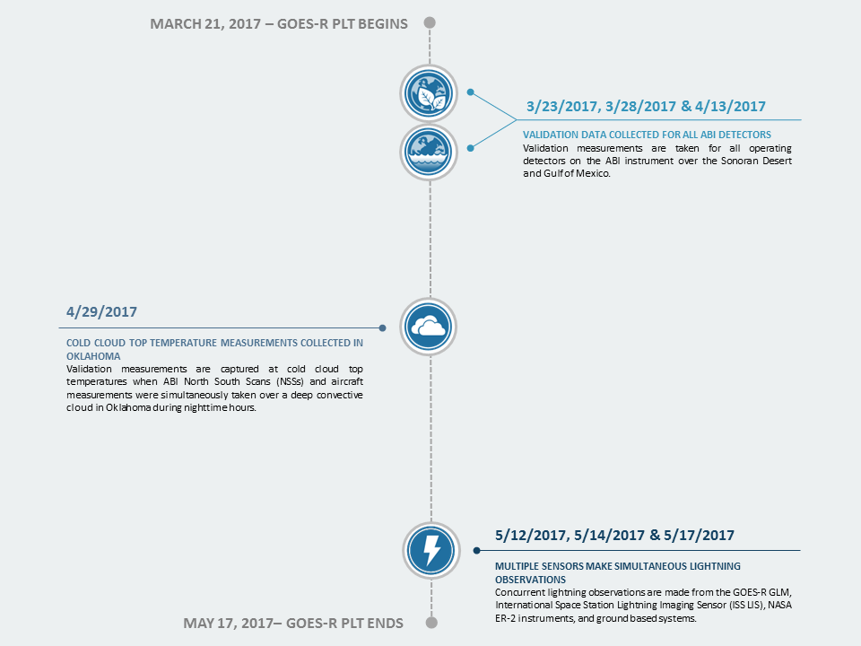
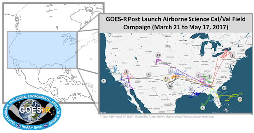
The GOES-R PLT field campaign was a collaborative mission to validate the Advanced Baseline Imager (ABI) and Geostationary Lightning Mapper (GLM) instruments aboard the GOES-R, now GOES-16, satellite. GOES-R is part of NOAA’s geostationary satellite fleet, Geostationary Operational Environmental Satellites - R series, and provides continual observations of primarily North and South America and the Atlantic. The GOES-R PLT campaign lasted roughly 9 weeks from March 21, 2017 to May 17, 2017, with 105.1 mission flight hours. The goal of the campaign was to provide a collection of coincident airborne, satellite, ground based, and near surface measurements of surface weather phenomena to test, validate, and improve the accuracy of GOES-R ABI and GLM measurements. The campaign was comprised of two phases: the first centered on the U.S. west coast, providing tests primarily for the ABI instrument, and the second focused on the central and eastern U.S. with tests primarily for the GLM instrument. Airborne measurements were taken using NASA’s ER-2 aircraft, equipped with spectrometer, radar, lidar, radiometer, and other atmospheric observation instruments to assist with ABI and GLM validation. The target phenomena for validation observations included land and ocean surfaces, active wildfires, and thunderstorms. This campaign provided a blueprint for the operation of future GOES validation projects.
Scientific Objectives
The primary objectives of GOES-R PLT field campaign included:
- Provide high altitude validation of spectral radiance measurements for all ABI spectral bands
- Provide surface and atmospheric geophysical measurements for validation products
- Validate GLM lightning flash detection efficiency over land and ocean
- Validate the location and time accuracy of GLM flash detection
Instruments Used
Multiple instruments were utilized during the GOES-R PLT field campaign to observe phenomena such as lightning, thunderstorms, and wildfires. They were carried on the NASA ER-2 aircraft and at various ground stations. The instruments included the Next-Generation Airborne Visible/Infrared Imaging Spectrometer (AVIRISng), the AVIRIS-Classic (AVIRISc), the Scanning High-resolution Interferometer Sounder (S-HIS), the Fly’s Eye GLM Simulator (FEGS), the Lightning Instrument Package (LIP), the Cloud Physics Lidar (CPL), the Cloud Radar System (CRS), the ER-2 X-band Doppler Radar (EXRAD), the GeoCAPE Airborne Simulator (GCAS), and Lightning Mapping Arrays (LMAs).
Note: This table lists instruments whose datasets are currently published at GHRC DAAC and will be updated as additional GOES-R PLT datasets are published.
Events of Interest
This section highlights events within the field campaign of particular scientific interest.


