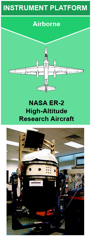
Instrument: Cloud Radar System (CRS)
Measures radar reflectivity, Doppler velocity, linear depolarization ratio, and differential reflectivity. The Doppler velocity values are corrected for the motion and orientation of the aircraft. CRS has two operation modes. When CRS operates in ER-2 mode, it can measure reflectivity, Doppler velocity, and linear depolarization ratio. When it operates in ground-based mode, it can operate with full polarimetric capabilities.
| SENSITIVITY | ANTENNA BEAM WIDTH | PEAK POWER | RANGE RESOLUTION | FREQUENCY/WAVELENGTH | PULSE REPETITION FREQUENCY (PRF) |
|---|---|---|---|---|---|
|
-29 dBZe (airborne) and -46.9 dBZe (ground-based) at 10 km range |
0.6 x 0.8 degrees (airborne) and 0.3 (ground-based) | 1.7 kW | 150 m at 10 km range |
94.155 GHz 3 mm wavelength, W-band |
0.5 - 20 kHz |
The GOES-R CRS Example Video displays a detailed animation of CRS reflectivity data collected from onboard the NASA ER-2 research aircraft during the GOES-R PLT field campaign.
Evans, K. F., Wang, J. R., Racette, P. E., Heymsfield, G., & Li, L. (2005). Ice Cloud Retrievals and Analysis with the Compact Scanning Submillimeter Imaging Radiometer and the Cloud Radar System during CRYSTAL FACE. Journal of Applied Meteorology, 44(6), 839–859. https://doi.org/10.1175/JAM2250.1
Li, L., Heymsfield, G. M., Racette, P. E., Tian, L., & Zenker, E. (2004). A 94-GHz Cloud Radar System on a NASA High-Altitude ER-2 Aircraft. Journal of Atmospheric and Oceanic Technology, 21(9), 1378–1388. https://doi.org/10.1175/1520-0426(2004)021%3C1378:AGCRSO%3E2.0.CO;2
Li, L., Heymsfield, G. M., Tian, L., & Racette, P. E. (2005). Measurements of Ocean Surface Backscattering Using an Airborne 94-GHz Cloud Radar—Implication for Calibration of Airborne and Spaceborne W-Band Radars. Journal of Atmospheric and Oceanic Technology, 22(7), 1033–1045. https://doi.org/10.1175/JTECH1722.1
McGill, M. J., Li, L., Hart, W. D., Heymsfield, G. M., Hlavka, D. L., Racette, P. E., … Winker, D. M. (2004). Combined lidar-radar remote sensing: Initial results from CRYSTAL-FACE. Journal of Geophysical Research, 109(D7), D07203. https://doi.org/10.1029/2003JD004030
Mitrescu, C., Haynes, J. M., Stephens, G. L., Miller, S. D., Heymsfield, G. M., & McGill, M. J. (2005). Cirrus cloud optical, microphysical, and radiative properties observed during the CRYSTAL-FACE experiment: A lidar-radar retrieval system. Journal of Geophysical Research, 110(D9), D09208. https://doi.org/10.1029/2004JD005605
NASA Airborne Science Program (2019). Cloud Radar System (CRS). https://airbornescience.nasa.gov/instrument/CRS
NASA Goddard Space Flight Center (2018). Cloud Radar System (CRS).
https://har.gsfc.nasa.gov/index.php?section=28
Wang, Z., Heymsfield, G. M., Li, L., & Heymsfield, A. J. (2005). Retrieving optically thick ice cloud microphysical properties by using airborne dual-wavelength radar measurements. Journal of Geophysical Research, 110(D19), D19201. https://doi.org/10.1029/2005JD005969

Jun 25th, 2020
Instrument

