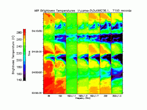
 The NASA Global Hydrology Resource Center (GHRC) DAAC published the CAMEX-3 ER-2 Millimeter-wave Imaging Radiometer (MIR) dataset. This dataset is a browse-only dataset containing plots of brightness temperature measurements collected by the Millimeter-wave Imaging Radiometer (MIR) in support of the third field campaign in the Convection And Moisture EXperiment (CAMEX) series, CAMEX-3. This field campaign took place from August to September 1998 based out of Patrick Air Force Base in Florida, with the purpose of studying various aspects of tropical cyclones in the region. During CAMEX-3, MIR operated onboard the NASA ER-2 high-altitude research aircraft, collecting brightness temperature measurements of water vapor, clouds, precipitation, and other atmospheric features. The MIR browse image files are available from August 8 through September 8, 1998 in GIF format. It should be noted that these data are airborne and flights did not occur each day of the campaign, therefore, data is only available on flight days.
GHRC News
The NASA Global Hydrology Resource Center (GHRC) DAAC published the CAMEX-3 ER-2 Millimeter-wave Imaging Radiometer (MIR) dataset. This dataset is a browse-only dataset containing plots of brightness temperature measurements collected by the Millimeter-wave Imaging Radiometer (MIR) in support of the third field campaign in the Convection And Moisture EXperiment (CAMEX) series, CAMEX-3. This field campaign took place from August to September 1998 based out of Patrick Air Force Base in Florida, with the purpose of studying various aspects of tropical cyclones in the region. During CAMEX-3, MIR operated onboard the NASA ER-2 high-altitude research aircraft, collecting brightness temperature measurements of water vapor, clouds, precipitation, and other atmospheric features. The MIR browse image files are available from August 8 through September 8, 1998 in GIF format. It should be noted that these data are airborne and flights did not occur each day of the campaign, therefore, data is only available on flight days. The NASA Global Hydrology Resource Center (GHRC) DAAC published the ACES Aircraft and Mechanical Data. This dataset consists of aircraft (e.g. pitch, roll, yaw) and mechanical (e.g. aircraft engine speed, tail commands, fuel levels) data recorded by the Altus II Unmanned Aerial Vehicle (Altus II UAV) system during the Altus Cumulus Electrification Study (ACES) based at the Naval Air Facility Key West in Florida. ACES aimed to provide extensive observations of the cloud electrification process and its effects by using the Altus II UAV to collect cloud top observations of thunderstorms. The campaign also worked to validate satellite lightning measurements. The Altus II aircraft and mechanical data files are available from July 10 through August 30, 2002 in MATLAB data format (.mat). It should be noted that the Altus II aircraft and mechanical data are not included for each date during the campaign.
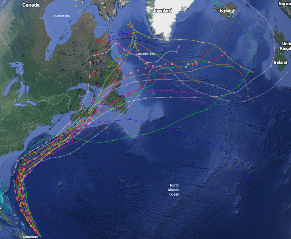
The NASA Global Hydrology Resource Center (GHRC) DAAC published the GRIP Hurricane and Tropical Storm Forecasts dataset. This dataset consists of tropical cyclone model forecast tracks archived during the NASA Genesis and Rapid Intensification Processes (GRIP) field campaign. GRIP was one of three hurricane field campaigns conducted during the 2010 Atlantic/Pacific hurricane season. This tri-agency effort included NASA GRIP, the NSF Pre-Depression Investigation of Cloud-systems in the Tropics (PREDICT) and the NOAA Intensity Forecasting Experiment 2010 (IFEX10). The hurricane and tropical storm forecasts data files are available from August 12 through November 14, 2010 in ASCII text format with browse files in KML format, viewable in Google Earth. The ASCII text files contain 5-day model “consensus” forecasts and the KML browse files contain model forecasts ranging from 5-days to 10-days. It should be noted that the storm track files provided in this dataset do not include all of the tropical weather systems observed during the course of the campaign.
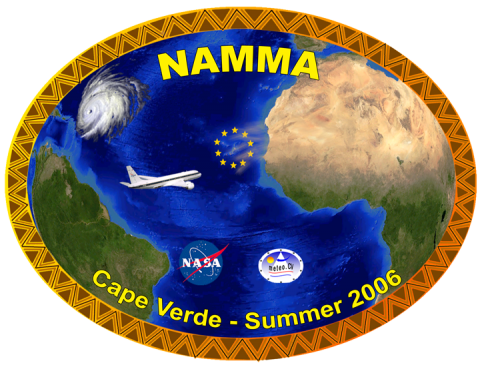 The NASA Global Hydrology Resource Center (GHRC) DAAC published the NAMMA Raw DC-8 Dropsonde dataset. This dataset consists of high-resolution vertical profiles of ambient pressure, temperature, relative humidity, wind speed, and wind direction obtained by the DC-8 dropsonde system during the NASA African Monsoon Multidisciplinary Analyses (NAMMA) field campaign. The NAMMA field campaign was based in the Cape Verde Island, 350 miles off the coast of Senegal in west Africa. Commencing in August 2006, NASA scientists employed surface observation networks and aircraft to characterize the evolution and structure of African Easterly Waves (AEWs) and Mesoscale Convective Systems over continental western Africa, and their associated impacts on regional water and energy budgets. The DC-8 dropsonde system uses an integrated, highly accurate, Global Positioning System (GPS)-located atmospheric profiling dropsonde measuring and recording current atmospheric conditions in a vertical column below the aircraft. Data files are available in ASCII format for the period of August 7, 2006 through September 12, 2006.