GHRC News

EarthCube

Drs. Sara Graves and Rahul Ramachandran represented the Global Hydrology Resource Center at the NSF EarthCube End-User Principal Investigator Workshop. This workshop brought together the PIs of the EarthCube end-user domain workshops along with a small number of cyberinfrastructure specialists and social scientists. A key focus of the meeting was user needs in data discovery, mining and access.

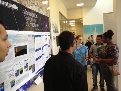
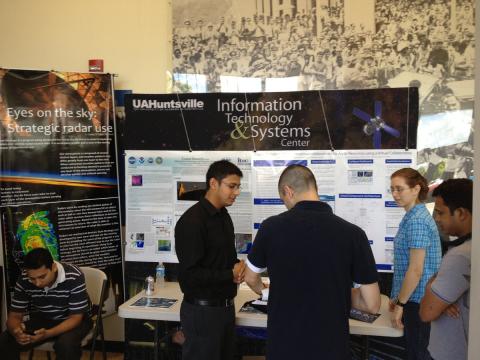
GHRC students explain their research efforts
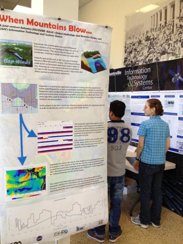
Gapwinds poster displayed at WOW

The Global Hydrology Resource Center (GHRC) DAAC was featured at the University of Alabama in Huntsville (UAH) Week Of Welcome (WOW). Week of Welcome is a campus-wide set of programs and activities intended to welcome new and returning students back to campus. The event on August 19 highlighted student research opportunities at the university. UAH’s Information Technology and Systems Center (ITSC) booth showcased several projects, including GHRC's research collaboration with Remote Sensing Systems leading to develop a mountain gap winds climatology, funded by NASA's MEaSUREs program. GHRC brochures were also available at the booth. Student presenters included Shannon Flynn, who has worked on the development of the gap winds web application and has been assisting with GHRC web site improvements in search engine optimization and 508 compliance. GHRC is a joint venture between NASA MSFC's Earth Science Office and UAH's Information Technology and Systems Center.

GeoHuntsville logo

Ken Keiser represented the GHRC at the GeoHuntsville's annual Geospatial Intelligence (GEOINT) meeting on Wednesday, August 14. The meeting highlights the use of geospatial data for decision making and intelligence community analysis activities. The GeoHuntsville organization supports several geospatial data activities addressing state, regional and local needs and interests.

MC3E logo

The GPM Ground Validation NASA S-Band Dual Polarimetric (NPOL) Doppler Radar MC3E dataset (previously published) has added files classifying hydrometeors (e.g. rain, drizzle, hail, ice crystals, wet or dry snow, graupel density) to the existing UF files measuring Doppler velocity and radar reflectivity. The new files, named HID, were created by processing UF files with the Colorado State University (CSU) Hydrometeor Identification Algorithm (HID). The NPOL HID file inventory will be updated as new files are received.


GCPEx logo

GHRC published four guides for instruments participating in GPM Cold-season Precipitation Experiment (GCPEx): GPM Ground Validation Airborne Second Generation Precipitation Radar (APR-2) GCPEx,GPM Ground Validation Conical Scanning Millimeter-wave Imaging Radiometer (CoSMIR) GCPEx, GPM Ground Validation UND Citation Navigation Data GCPEX and GPM Ground Validation DC-8 Camera Nadir GCPEx. The APR-2 is a a dual-frequency (13 GHz and 35 GHz), Doppler, dual-polarization radar system measuring doppler velocity, precipitation rate, radar backscatter and reflectivity. As an airborne high-frequency simulator emulating the GPM Microwave Imager (GMI), CoSMIR measures brightness temperature and microwave radiance. GCPEX occurred in Ontario, Canada during January-February 2012. The UND Citation Navigation dataset documents the navigation data for the cloud microphysics instruments that it carried. The DC -8 Camera Nadir dataset contains geo-located visible-wavelength imagery of the ground obtained from the nadir camera aboard the NASA DC-8 for the clear-air flight day February 20, 2012; these images may be useful for determining snow cover and lake ice cover for emissivity studies in conjunction with CoSMIR data.


Have you used our data? Register for updates