CAMEX Flight Tracks Click on an image to view it at full size.
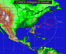 ER-2 and DC-8 Flight Tracks for CAMEX-4 Project |
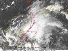
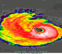 Flight Track superimposed over image of Hurricane Erin |
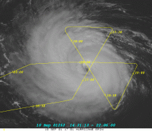 Flight Track superimposed over Satellite Image of Hurricane Erin |
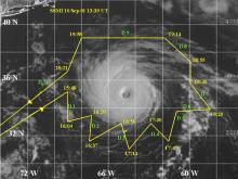 Flight Path superimposed over Satellite Image of Hurricane Erin |
||
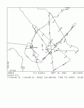 DC-8 Flight Path around Tropical Storm Gabrielle |
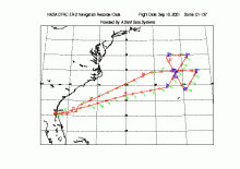
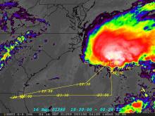 ER-2 Flight Path superimposed over Radar Image of Tropical Storm Gabrielle |
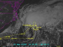 ER-2 Flight Path superimposed over Satellite image of Tropical Storm Gabrielle |
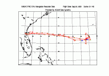
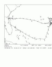 DC-8 Flight Path around Hurricane Humberto, Sept. 22, 2001 |
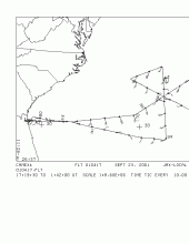 DC-8 Flight Path around Hurricane Humberto, Sept. 23, 2001 |
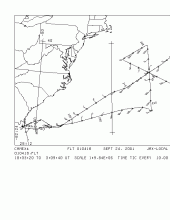 DC-8 Flight Path around Hurricane Humberto, Sept. 24, 2001 |
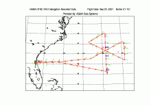 ER-2 Flight Path around Hurricane Humberto, Sept. 23, 2001 |
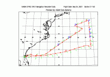 ER-2 Flight Path around Hurricane Humberto, Sept. 24, 2001 |
|
|
Date |
Flight Number |
Description |
| 09/24/2001 | 010418 |
DC-8 Nav. Data for flight #010418 on 9/24/2001 into Hurricane Humberto. |
| 09/23/2001 | 010417 |
DC-8 Nav. Data from flight #010417 on 9/23/2001 into Hurricane Humberto. |
| 09/22/2001 | 010416 |
Nav. Data for DC-8 flight #010416 for 9/22/01 into Tropical Storm Humberto. |
| 09/19/2001 | 010415 |
Nav. Data for flight #010415 (KAMP flight) over and near the Florida Keys and Florida Bay on 9/19/2001. |
| 09/15/2001 | 010414 |
Nav. Data for flight #010414 on 9/15/2001 into Tropical Storm Gabrielle. |
| 09/10/2001 | 010413 |
DC-8 Nav. Data for flight #010413 on 9/10/2001 for Optimal Data Assimilation Mission around Hurricane Erin. |
| 09/09/2001 | 010412 |
DC-8 Nav. Data for flight #010412 on 9/9/2001 over Florida Bay in stratiform precipitation. Includes spiral descent and 3 overpasses of KAMP MIPS site. |
| 09/07/2001 | 010411 |
DC-8 Nav. Data (010411) for flight of stratiform precip over the Gulf. Includes DC-8 spiral. |
| 09/06/2001 | 010410 |
DC-8 Navigation Data for flight #040410 (9/6/01) for flight over East Coast of FL and GA. TRMM overpass at 1844 UTC. |
| 09/03/2001 | 010409 |
DC-8 Nav. Data for flight #010409. KAMP flight over Gulf Storms and overflight of MIPS site on Big Torch Key. |
| 08/25/2001 | 010408 |
Flight over buoys east of Cape Canaveral. |
| 08/20/2001 | 010407 |
DC-8 Nav. files for 8/20/01 flight into Trop. Storm Chantal |
| 08/18/2001 | 010406 |
ASCII one second data for DC-8 (010406) |
| 08/15/2001 | 010405 |
Nav. Data for DC-8 flight # 010405 |
| 08/08/2001 | 010404 |
Nav. Data for DC-8 for flight 010404 |
| 08/03/2001 | 010403 |
Nav. data for DC-8 |
| 09/24/2001 | 01-142 |
ER-2 Nav. Data for flight #01-142 on 9/24/2001 over Hurricane Humberto. |
| 09/23/2001 | 01-141 |
ER-2 Nav. Data for flight #01-141 on 9/23/2001 over Hurricane Humberto. |
| 09/22/2001 | 01-140 |
ER-2 Nav. Data for flight #01-140 on 9/22/2001 over Tropical Storm Humberto. |
| 09/19/2001 | 01-139 |
ER-2 Nav. Data of flight #01-139 on 9/19/2001 for KAMP over and near the Florida Keys and Florida Bay. |
| 09/16/2001 | 01-138 |
ER-2 Nav. Data from flight #01-138 on 9/16/2001 over Hurricane Gabrielle. |
| 09/10/2001 | 01-137 |
ER-2 Nav. Data for flight # 01-137 over Hurricane Erin on 9/10/2001. |
| 09/09/2001 | 01-136 |
ER-2 Nav. Data for for flight #01-136 on 9/10/2001 for KAMP flight over FL Bay area. |
| 09/07/2001 | 01-135 |
ER-2 Nav. Data for flight 01-135 for stratiform precipitation over Gulf of Mexico. |
| 09/03/2001 | 01-134 |
ER-2 Navigation Data for flight #01-134 on 9/3/2001 over storms over Gulf and overpass of MIPS site. |
| 08/26/2001 | 01-133 |
Flight over buoys east of Cape Canaveral. |
| 08/20/2001 | 01-132 |
ER-2 Nav. for Sortie # 01-132 over Tropical Storm Chantal. |
| 08/18/2001 | 01-131 |
ER-2 Nav. Data for sortie # 01-131 for Overflight of Andros Is. and Key West. |
| 08/15/2001 | 01-130 |
ER-2 Nav. Data for Transit Flight to Jacksonville, FL |
| 08/13/2001 | 01-122 |
ER-2 Nav. Data for MAS Check out flight 8/13/01 |
| 08/09/2001 | 01-113 |
|
| 08/08/2001 |
|


