CAMEX-4 Flight Plans
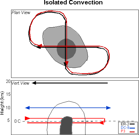
Key West Thunderstorm
- Goals:
- Evolution of mesoscale flow.
- Vertical structure of precipitation in relation to passive microwave and radar measurements.
- Statistics of hydrometeor structure and precipitation content for verification of polarimetric radar algorithms and cloud resolving models.
- Notes:
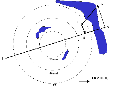
- Used for smaller, less extensive stratiform regions.
- Two endpoints are provided to each aircraft.
- Repeated linear tracks of about 50km.
- DC-8 remains at one altitude for remote sensing.
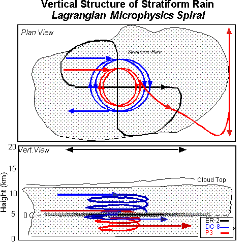
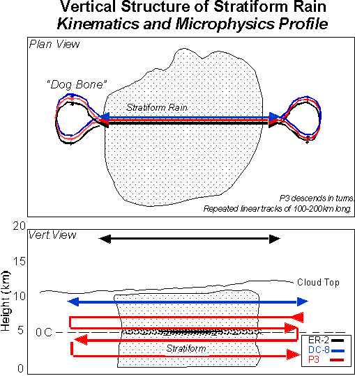
- Goals:
- Detailed vertical resolution of microphysics.
- Relation of bright band structure to passive microwave and airborne radar.
- Variation in precipitation drop size distributions.
- Verification of hydrometeor identification algorithms based on polarimetric radar characteristics.
- Notes:
- Extensive stratiform regions required.
- Center of spiral is provided to pilots.
- DC-8 turns are about 23 km in diameter and descent rate is about 1-2 ms-1. Start/end altitudes: 30kft/15Kft.
- P3 performs spiral descent with about 15 km diameter turns and then moves out of region to perform dual-Doppler scans. Start/end altitudes: 25kft/10kft.
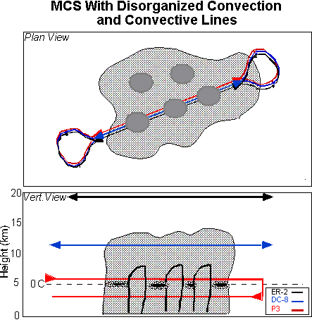
- Goals:
- Relation between passive microwave and radar characteristics to cloud microphysics.
- Vertical variation of drop size distributions.
- Character of convective drafts for verification of models and dual-Doppler retrievals.
- Storm system evolution and brightness temperature evolution.
- Documentation of supercooled cloud water and graupel co-existence.
- Notes:
- Mostly stratiform regions with embedded weak convection.
- DC-8 remains at higher altitudes.
- Not sufficiently uniform for spiral descents.
- Two endpoints are provided to pilots.
- Repeated linear tracks of about 100-200 km long.
- Goals:
- Relation between passive microwave and radar characteristics to cloud microphysics.
- Vertical variation of drop size distributions.
- Character of convective drafts for verification of models and dual-Doppler retrievals.
- Storm system evolution and brightness temperature evolution.
- Documentation of supercooled cloud water and graupel co-existence.
- Notes:
- Convection must be within safety guidelines, otherwise P3 moves to side of convection for dual-Doppler scans.
- DC-8 remains high if within safety limits; otherwise moves to safer region.
- Flight legs are about 30 km long.
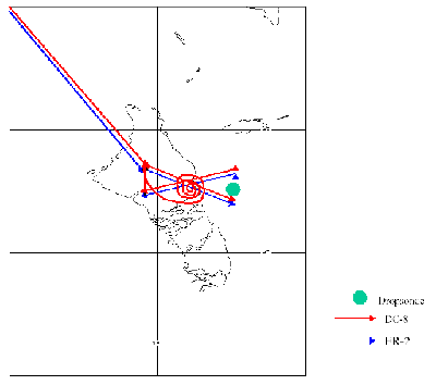
Optimal Data Assimilation Flight Plan
- Assess the impact of high resolution water vapor and wind measurements on forecasts of hurricane intensity and track
- Obtain high resolution water vapor measurements to characterize water vapor inflow regions
- Evaluate upper troposphere humidity field and investigate troposphere-stratosphere exchange
- Obtain near surface water vapor measurements and SST around hurricane
- Evaluate ER-2 and DC-8 dropsonde water vapor measurement performance performed in conjunction with NOAA HRD synoptic surveillance flights
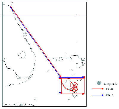
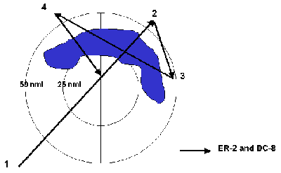
Andros Flight – Box Option
Coordinated Observations of Vortex Evolution and Structure Experiment (COVES)
Coordinated Pattern: Upper WP-3D, DC-8, and ER-2
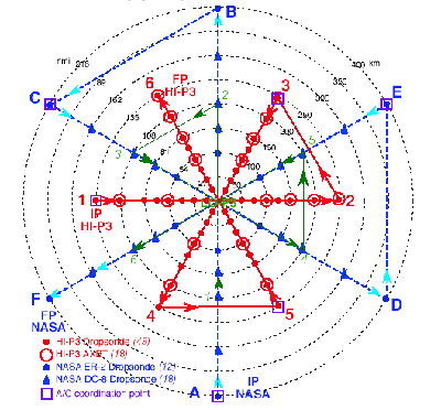
- All aircraft should reach their respective IP's as simultaneously as possible.
- Aircraft should not deviate from pattern to find the center in the eye.
- The pattern may be entered at any compass heading and the DC-8 and ER-2 entries should be along the same heading as the lower WP-3D.
- The DC-8 should attain the 250-hPa level (about 37,000 ft or FL370) as early in the mission as possible and then maintain this altitude for the duration of the pattern. Upper WP-3D aircraft should maintain maximum safe altitude.
- WP-3D tail/Doppler radar should be operated in fore-aft scanning mode, with a single PRF of 2400 or greater, and a tilt of 20°.
- GPS sondes and the downward-pointing laser on the NASA aircraft may pose a hazard to the WP-3D or WC-130 aircraft. Hence, positive communication with these aircraft must be obtained before these sondes are released.
Quantitative Precipitation Study
SYMMETRIC EYEWALL
ACTIVE SPIRAL RAINBAND AND EYEWALL