
GHRC has published the guide for the GPM Ground Validation NOAA Surface Meteorological Station MC3E dataset. The data collected for the Midlatitude Continental Convective Clouds Experiment (MC3E) at the NOAA Southern Great Plains Facility includes wind speed and direction, temperature and humidity, and precipitation. The instruments gathering this data were a propeller wind monitor located 10 meters above the ground, a temperature and humidity sensor at the ground, and a tipping rain gauge at the ground.

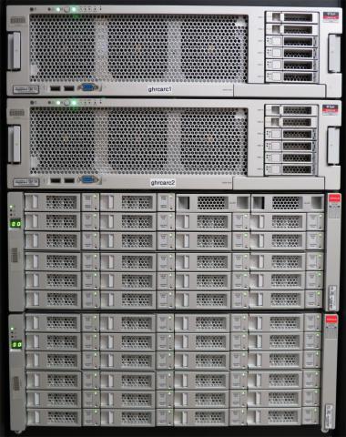 GHRC has installed and configured a new disk-based Sun Storage 720 archive. Systems administrators and data managers are planning directory layout, archive processes and migration from the existing tape-based Sun Storage L700 system. The new archive will start with 100 TB (usable) and is scalable to up to 2.6 PB raw capacity.