Dr. Sara Graves represented the GHRC at the International Council for Science : Committee on Data for Science and Technology (CODATA) Executive Committee meeting in Paris the week of April 14th as the Secretary General of CODATA. There were discussions with Dr. Steven Wilson, Executive Director of The International Council for Science (ICSU), about Future Earth and the data aspects of that large 10 year program. She also met with some representatives from the World Data System on collaborations on Future Earth and several other activities. Lastly, a presentation titled ‘Using GLIDER for Data Intensive Science’ by Sara Graves, Todd Berendes and Rahul Ramachandran was made at the European Geosciences Union (EGU) General Assembly in Vienna, Austria on April 8th, 2013.
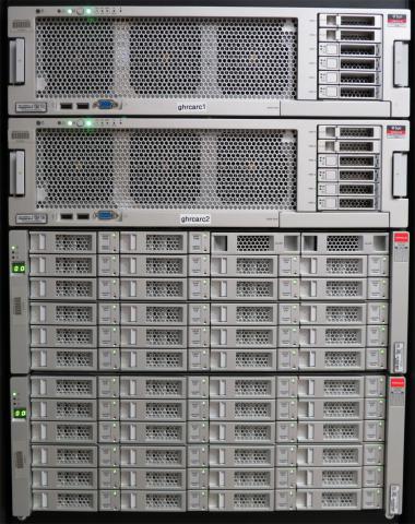 GHRC has installed and configured a new disk-based Sun Storage 720 archive. Systems administrators and data managers are planning directory layout, archive processes and migration from the existing tape-based Sun Storage L700 system. The new archive will start with 100 TB (usable) and is scalable to up to 2.6 PB raw capacity.
 The initial phase of the