GHRC News

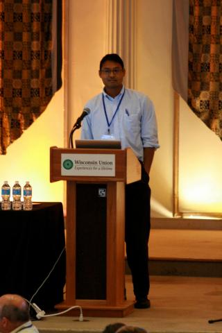
Rahul Ramachandran presenting at a recent ESIP Federation meeting

Dr. Rahul Ramachandran has been elected to serve as the chair of the IEEE Geosciences & Remote Sensing Society's (GRSS) Data Archiving and Distribution Technical Committee (DAD TC) for a two-year term.  This committee provides recommendations and responses to issues related to the archiving and distribution of remotely sensed geospatial and geotemporal data.  More information is available at the committee’s web site [http://www.grss-ieee.org/community/technical-committees/data-archival-distribution/].  Hampapuram Ramapriyan of NASA ESDIS is the outgoing DAD TC Chair.  Dr. Ramachandran is a senior research scientist with the University of Alabama in Huntsville’s Information Technology and Systems Center (ITSC) and the Global Hydrology Resource Center, a NASA data center jointly operated by Marshall Space Flight Center and ITSC.

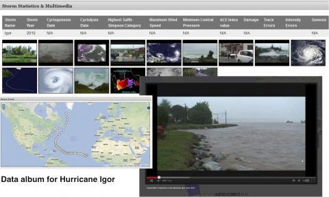
Data album for Hurricane Igor

Helen Conover and Rahul Ramachandran attended a Browse Imagery, Visualization, Data Discovery Technical Interchange Meeting in Hampton, VA, sponsored by NASA's Earth Science Data and Information Systems project.  The meeting was hosted by the NASA Langley Atmospheric Science Data Center, and involved several Earth science data centers including the Global Hydrology Resource Center, a partnership between NASA MSFC and UAH ITSC.  Ms. Conover presented systems currently in operation at GHRC, while Dr. Ramachandran showed current ITSC research slated to be adopted at GHRC in the future. Discussions with the other DAACs and the GIBS team explored possibilities for future collaboration.


GHRC has published 4 satellite simulated orbit datasets for GPM Ground Validation research as part of the Global Precipitation Measurement mission.  The GPM Ground Validation Satellite Simulator Orbits Database datasets are available for several campaigns: Light Precipitation Evaluation Experiment (LPVEX), Midlatitude Continental Convective Clouds Experiment (MC3E) , Canadian Cloudsat/Calipso Validation Project (C3VP), and Tropical Warm Pool - International Cloud Experiment (TWP-ICE).  This orbital database takes account for the atmospheric profiles, the cloud/rain profiles, and the detailed surface/terrain information from the Cloud-Resolving Model (CRM) database.  Unique geometry and antenna gain patters of each sensor (GMI imager, GMI sounder, DPR Ku, DPR Ka_MA, DPR Ka_HS) are considered.  The Orbital database consists of satellite orbit parameters, geolocation of IFOV/EFOV and satellite location, and simulated L1B/L2-like parameters in satellite orbital grid.  Orbital data covers a portion of sampling right over the Cloud-resolving model (CRM) domain.  All orbital data format is NetCDF3, and contains dimensions, parameter descriptions, and parameter units. Each project's data is distributed as a separate dataset. MC3E occurred in Oklahoma, USA in 2011; LPVEX took place in Finland in 2010; C3VP experiment was held in Canada in 2007; and TWP-ICE took place in Australia in 2006.


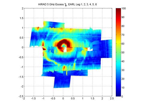
Sample browse imageGHRC has updated the GRIP Hurricane Imaging Radiometer (HIRAD) dataset with new files containing rain rates and wind speed from Hurricane Earl (September 1-2, 2010) as an addition to the original brightness temperature files. The HIRAD flew aboard the WB-57 aircraft from Houston, Texas during the Genesis and Rapid Intensification Processes (GRIP) experiment.


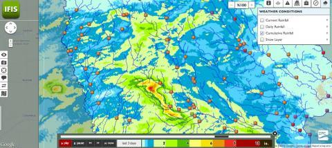
Real-Time Image

Dr. Sara Graves and Ken Keiser represented GHRC at the Earth Cube Real-time Workshop in Boulder, CO, June 17-18. The workshop was held at UCAR and sponsored by NSF. GHRC presentations covered data management, visualization and collaboration activities for GPM Ground Validation; data provenance tools developed for the AMSR-E SIPS at GHRC; and new data search and analysis technologies being developed in the GHRC Innovations Laboratory.

Have you used our data? Register for updates