GHRC News

Rahul Ramachandran (UAH/ITSC) represented GHRC at the first plenary meeting of the newly formed Research Data Alliance, March 18-23 in Gothenburg, Sweden. The goal of the RDA is to accelerate international data-driven innovation and discovery through the development and adoption of infrastructure, policy, practice, standards, and other deliverables. RDA sponsors include the RDA/US activity funded by the National Science Foundation, as well as the European Commission and Australia. Dr. Ramachandran will be leading a Big Data Working Group within RDA.

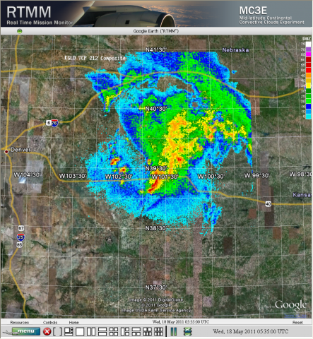
Sample browse imageGHRC has published the GPM Ground Validation Flight Summaries and Flight Tracks Imagery MC3E dataset which  provides processed summaries from University of North Dakota including sonde maps, a radar animation, parameter versus time charts, radar track graphs, as well as aircraft and instrument operational times for flights during the Midlatitude Continental Convective Clouds Experiment (MC3E) held in Oklahoma in 2011. The Flight Tracks imagery includes one animation for May 11, 2011 and five-minute snapshots of flight tracks from the Real Time Mission Monitor (RTMM). This dataset will be distributed with the MC3E ER-2 Navigation and the Citation Navigation datasets, which are also part of the GHRC collection of GPM Ground Validation data from MC3E.


GHRC has installed and configured a new data/web server for our field campaign datasets. Last week, GHRC staff completed migration of over a dozen field campaign web sites and collaboration portals as well as the online data archive for our GPM Ground Validation and Hurricane Science data collections. The new server, a Dell PowerEdge R510 with 19 TB storage capacity, replaces an aging Dell PowerEdge R710 with 4.5 TB storage capacity, providing much needed growth to support the GPM-GV Iowa Flood Studies (IFloodS) campaign this spring.


GHRC published two radar datasets in support of NASA ER-2 instrumentation data for the Midlatitude Continental Convective Clouds Experiment (MC3E) held in Oklahoma in 2011.  The GPM Ground Validation Pawnee Radar MC3E  is a single polarization (V polarization) Doppler radar and the GPM Ground Validation CHILL Radar MC3E is a dual linear polarization Doppler Radar operated by Colorado State University.  Data from both radars were collected while the NASA ER-2 aircraft conducted a series of four legs along the 090 and 120 degree CHILL azimuths when widespread rain was in progress on May 24, 2011.  The aircraft flew a series of pre-defined ground tracks that coincided with radials from the CSU-CHILL radar. The CSU-Pawnee radar maintained volume coverage of the echo system while the radial flight legs were in progress. During aircraft course reversals at the ends of the radial legs, the CHILL and Pawnee radars started volume scans in synchronization to support dual Doppler wind syntheses. CHILL and Pawnee radar data are available as separate datasets.


The NAMMA Lightning ZEUS Data at the GHRC has been updated and now contains data from Europe and Brazil as well as Africa. The NAMMA ZEUS data is provided by World-ZEUS Long Range Lightning Monitoring Network Data obtained from sferics located at thirteen ground stations spread across the European and African continents and Brazil. Lightning activity occurring over a large part of the globe is continuously monitored at varying spatial accuracy (e.g. 10-20 km within and >50 km outside the network periphery) and high temporal (1 msec) resolution. These data files were generated during support of the NASA African Monsoon Multidisciplinary Analyses (NAMMA) campaign, a field research investigation sponsored by the Science Mission Directorate of the National Aeronautics and Space Administration (NASA).


Have you used our data? Register for updates