GHRC News

The GHRC DAAC staff has published the GPM Ground Validation High-Altitude Imaging Wind and Rain Airborne Profiler (HIWRAP) IPHEx dataset (DOI: http://dx.doi.org/10.5067/GPMGV/IPHEX/HIWRAP/DATA101). This data was collected by the HIWRAP instrument on the NASA ER-2 aircraft between May 3, 2014 and June 15, 2014 during the GPM Ground Validation Integrated Precipitation and Hydrology Experiment (IPHEx) field campaign, which was held in the Appalachian region of North Carolina. HIWRAP is a Doppler radar that combines conical scan mode measurements at two different frequency bands (Ka- and Ku-band) and two different incidence angles (30 and 40 degrees). The HIWRAP data files are provided in netCDF format and contain radar reflectivity and Doppler velocity profiles along with aircraft attitude and other navigation information.

GHRC DAAC Scientist Deborah Smith has compiled the preservation information for all datasets from the MEaSUREs project Distributed Information Services for Climate and Ocean Products and Visualizations for Earth Research (DISCOVER), as specified in the NASA Earth Science Data Preservation Content Specification. A checklist with links to these documents will be posted on the GHRC web site in future.

DISCOVER page

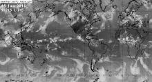
GHRC DAAC has begun providing imagery from the Infrared Global Geostationary Composite dataset, a series of global composite images from the infrared channels of multiple weather satellites in geosynchronous orbit, to the American Museum of Natural History in New York City. GHRC staff provided a Python script that automates the process of downloading the data and converting it to the format and projection needed. The museum displays these images on a video screen in the Gottesman Hall of Planet Earth to educate visitors about global weather and climate.

HIWRAP logoGHRC DAAC staff updated the Hurricane and Severe Storm Sentinel (HS3) High-altitude Imaging Wind and Rain Airborne Profiler (HIWRAP) dataset with data from the 2014 hurricane season. The HS3 HIWRAP dataset is now complete.

Dr. Chelle Gentemann, former GHRC DAAC User Working Group chair, is spotlighted on the NASA EarthData website, "Who Uses NASA Earth Science Data?" Chelle uses NASA Earth Science data to study the effects of sea surface temperature on the ocean and atmosphere. Dr. Gentemann is a Physical Oceanographer at Earth and Space Research, a nonprofit research institute. Dr. Gentemann served as the first chair of GHRC’s UWG, and was instrumental in establishing its governing principles.

Read more:  User Profile: Dr. Chelle Gentemann

Have you used our data? Register for updates