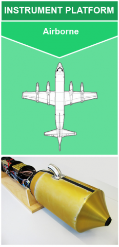
 The NASA Global Hydrology Resource Center (GHRC) DAAC published the Particle Habit Imaging and Polar Scattering Probe (PHIPS) IMPACTS dataset. This dataset consists of cloud particle imagery collected by the Particle Habit Imaging and Polar Scattering (PHIPS) probe onboard the NASA P-3 aircraft during the Investigation of Microphysics and Precipitation for Atlantic Coast-Threatening Snowstorms (IMPACTS) field campaign. IMPACTS was a three-year sequence of winter season deployments conducted to study snowstorms over the U.S Atlantic Coast (2020-2022). The campaign aimed to (1) Provide observations critical to understanding the mechanisms of snowband formation, organization, and evolution; (2) Examine how the microphysical characteristics and likely growth mechanisms of snow particles vary across snowbands; and (3) Improve snowfall remote sensing interpretation and modeling to significantly advance prediction capabilities. PHIPS allows for the measurement of particle shape, size, and habit. The browse files included in this dataset contain the post-processed particle-by-particle stereo images (2 images from different angles) collected by PHIPS during the campaign. The files are available from January 18 through February 26, 2020 in PNG format. It should be noted that the NASA P-3 aircraft did not operate each day of the campaign, therefore PHIPS data are only available for aircraft flight days.
GHRC News
The NASA Global Hydrology Resource Center (GHRC) DAAC published the Particle Habit Imaging and Polar Scattering Probe (PHIPS) IMPACTS dataset. This dataset consists of cloud particle imagery collected by the Particle Habit Imaging and Polar Scattering (PHIPS) probe onboard the NASA P-3 aircraft during the Investigation of Microphysics and Precipitation for Atlantic Coast-Threatening Snowstorms (IMPACTS) field campaign. IMPACTS was a three-year sequence of winter season deployments conducted to study snowstorms over the U.S Atlantic Coast (2020-2022). The campaign aimed to (1) Provide observations critical to understanding the mechanisms of snowband formation, organization, and evolution; (2) Examine how the microphysical characteristics and likely growth mechanisms of snow particles vary across snowbands; and (3) Improve snowfall remote sensing interpretation and modeling to significantly advance prediction capabilities. PHIPS allows for the measurement of particle shape, size, and habit. The browse files included in this dataset contain the post-processed particle-by-particle stereo images (2 images from different angles) collected by PHIPS during the campaign. The files are available from January 18 through February 26, 2020 in PNG format. It should be noted that the NASA P-3 aircraft did not operate each day of the campaign, therefore PHIPS data are only available for aircraft flight days.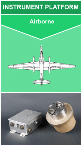 The NASA Global Hydrology Resource Center (GHRC) DAAC published the Lightning Instrument Package (LIP) IMPACTS dataset. This dataset consists of electrical field measurements of lightning and navigation data collected by the Lightning Instrument Package (LIP) flown onboard the NASA ER-2 aircraft during the Investigation of Microphysics and Precipitation for Atlantic Coast-Threatening Snowstorms (IMPACTS) field campaign. IMPACTS was a three-year sequence of winter season deployments conducted to study snowstorms over the U.S. Atlantic coast. IMPACTS aimed to (1) Provide observations critical to understanding the mechanisms of snowband formation, organization, and evolution; (2) Examine how the microphysical characteristics and likely growth mechanisms of snow particles vary across snowbands; and (3) Improve snowfall remote sensing interpretation and modeling to significantly advance prediction capabilities. These data are available from January 15 through February 27, 2020 in ASCII format. It should be noted that this dataset is not continuous as flights did not occur every day.
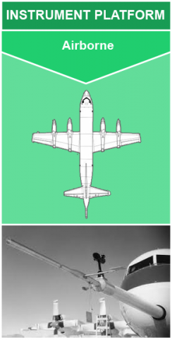 The NASA Global Hydrology Resource Center (GHRC) DAAC published the Turbulent Air Motion Measurement System (TAMMS) IMPACTS dataset. This dataset consists of wind speed, wind direction, and cross wind speed measurements from the TAMMS instrument onboard the NASA P-3 aircraft during the Investigation of Microphysics and Precipitation for Atlantic Coast-Threatening Snowstorms (IMPACTS) field campaign. IMPACTS was a three-year sequence of winter season deployments conducted to study snowstorms over the U.S Atlantic Coast (2020-2022). The campaign aimed to (1) Provide observations critical to understanding the mechanisms of snowband formation, organization, and evolution; (2) Examine how the microphysical characteristics and likely growth mechanisms of snow particles vary across snowbands; and (3) Improve snowfall remote sensing interpretation and modeling to significantly advance prediction capabilities. The files are available from January 18, 2020 through February 26, 2020 in ASCII-ict format. It should be noted that the NASA P-3 aircraft did not operate each day of the campaign, therefore TAMMS data are only available for aircraft flight days.