The NASA Global Hydrology Resource Center (GHRC) DAAC published the Advanced Microwave Precipitation Radiometer (AMPR) IMPACTS dataset. This datasets consists of passive microwave observations at four frequencies; 10.7, 19.35, 37.1, and 85.5 GHz. With high spatial and temporal resolution, AMPR can derive cloud, precipitation, water vapor, and surface properties. This dataset was collected during the Investigation of Microphysics and Precipitation for Atlantic Coast-Threatening Snowstorms (IMPACTS) field campaign. IMPACTS was a three-year sequence of winter season deployments conducted to study snowstorms over the U.S Atlantic Coast (2020-2022). The campaign aimed to (1) Provide observations critical to understanding the mechanisms of snowband formation, organization, and evolution; (2) Examine how the microphysical characteristics and likely growth mechanisms of snow particles vary across snowbands; and (3) Improve snowfall remote sensing interpretation and modeling to significantly advance prediction capabilities. The AMPR IMPACTS dataset files are stored in netCDF-4 format from January 18 through February 27, 2020. It should be noted that NASA ER-2 flights did not occur each day during the field campaign, therefore there are missing days between January 18 and February 27, 2020.
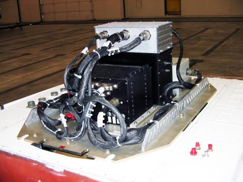
 The NASA Global Hydrology Resource Center (GHRC) DAAC published the Quality Controlled Lightning Imaging Sensor (LIS) on International Space Station (ISS) Science Data and the Quality Controlled Lightning Imaging Sensor (LIS) on International Space Station (ISS) Backgrounds datasets. These datasets were collected by the LIS instrument mounted on the ISS and are used to detect the distribution and variability of total lightning occurring in the Earth’s tropical and subtropical regions. The LIS instrument makes measurements during both day and night with high detection efficiency. The Science Data consists of quality controlled science data and can be used for severe storm detection and analysis, as well as for lightning-atmosphere interaction studies. These data are available in both HDF-4 and netCDF-4 formats, with corresponding browse images in GIF format. The Backgrounds Data consists of quality controlled background data and can be used for severe storm detection and analysis, as well as for lightning-atmosphere interaction studies. These data are available in both HDF-4 and netCDF-4 formats.
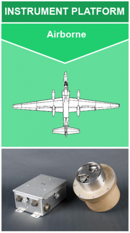 The NASA Global Hydrology Resource Center (GHRC) DAAC published the newest version of the Lightning Instrument Package (LIP) IMPACTS dataset. This dataset consists of electrical field measurements of lightning and navigation data collected by the Lightning Instrument Package (LIP) flown onboard the NASA ER-2 aircraft during the Investigation of Microphysics and Precipitation for Atlantic Coast-Threatening Snowstorms (IMPACTS) field campaign. IMPACTS was a three-year sequence of winter season deployments conducted to study snowstorms over the U.S. Atlantic coast (2020-2022). IMPACTS aimed to (1) Provide observations critical to understanding the mechanisms of snowband formation, organization, and evolution; (2) Examine how the microphysical characteristics and likely growth mechanisms of snow particles vary across snowbands; and (3) Improve snowfall remote sensing interpretation and modeling to significantly advance prediction capabilities. The V2 LIP IMPACTS data have been further filtered to remove field mill offsets that were identified in the prior V1 data. These data are available from January 15 through February 27, 2020 in ASCII format. It should be noted that this dataset is not continuous as flights did not occur every day. Also, these version 2 data have been further filtered to remove field mill offsets that were identified in the prior version 1 data.