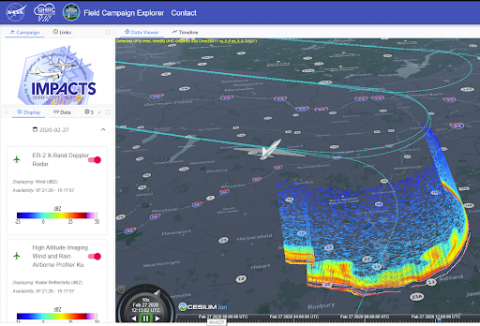
![]() The Investigation of Microphysics and Precipitation for Atlantic Coast-Threatening Snowstorms (IMPACTS) is a NASA EVS-3 mission that flies a complementary suite of remote-sensing and in-situ instruments in three deployments on the NASA ER-2 and P-3 aircraft to provide observations critical to understanding the mechanisms of snowband formation, organization, and evolution. Each deployment covers six weeks in January and February 2020-2023, with a target of 10-12 research flights per deployment. The P-3, deployed from Wallops Flight Facility (WFF), carries a suite of microphysical probes, flight-level meteorological data, and a dropsonde system. The ER-2 (based out of the Southeast US) has a suite of radars (Ka-band, Ku-band, W-Band, X-Band), microwave radiometers (frequencies flown on space-borne radiometers), and a lidar (355, 532, 1064 nm). The 2020 and 2022 deployments concluded with over 20 science flight sampling events in the Northeast, Midwest, and Southeast U.S. More general information about the project can be found at https://espo.nasa.gov/impacts , and more details of the events sampled in 2022 and quick look images can be found at http://catalog.eol.ucar.edu/impacts_2022.
The Investigation of Microphysics and Precipitation for Atlantic Coast-Threatening Snowstorms (IMPACTS) is a NASA EVS-3 mission that flies a complementary suite of remote-sensing and in-situ instruments in three deployments on the NASA ER-2 and P-3 aircraft to provide observations critical to understanding the mechanisms of snowband formation, organization, and evolution. Each deployment covers six weeks in January and February 2020-2023, with a target of 10-12 research flights per deployment. The P-3, deployed from Wallops Flight Facility (WFF), carries a suite of microphysical probes, flight-level meteorological data, and a dropsonde system. The ER-2 (based out of the Southeast US) has a suite of radars (Ka-band, Ku-band, W-Band, X-Band), microwave radiometers (frequencies flown on space-borne radiometers), and a lidar (355, 532, 1064 nm). The 2020 and 2022 deployments concluded with over 20 science flight sampling events in the Northeast, Midwest, and Southeast U.S. More general information about the project can be found at https://espo.nasa.gov/impacts , and more details of the events sampled in 2022 and quick look images can be found at http://catalog.eol.ucar.edu/impacts_2022.
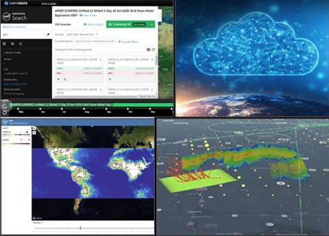
Given IMPACTS measurements will be helpful for AOS science algorithm development, sub-orbital planning, and developing applications end users, we invite you to use the IMPACTS data products for your scientific research and mission development work. IMPACTS is committed to fully and openly sharing scientific data obtained during field campaigns with all users as soon as such data becomes available. Following our post-deployment checkout period (~6 months), all data products are made available to the user community through NASA’s Global Hydrology Resource Center (GHRC) Distributed Active Archive Center (DAAC) at this web address. To this end, we are currently planning our third IMPACTS Data User Workshop that will be held virtually on 26-27 October 2022 from 12:00-2:30 ET. These open data workshops enable our IMPACTS team to present important information to you (our potential IMPACTS data users) to help with your analysis of the data. If you are interested in attending, please register here by 10/25/22.
The agenda and calendar invite will be sent out closer to the workshop date to anyone that registers. Please direct any questions or comments about the mailing list or the IMPACTS Data User Workshop to our Deputy PI for Data, John Yorks (john.e.yorks@nasa.gov).