GHRC News

2021 UWG meeting

The GHRC DAAC hosted its annual User Working Group (UWG) meeting on October 27-28, 2021. The UWG meeting is an opportunity for GHRC to share major accomplishments and activities for the year as well as to receive feedback and guidance for the future direction of the program. Major topics for this year included GHRC’s efforts to transition to cloud-only operations, publications and potential new data, as well as software systems including Earthdata Pub and the Field Campaign Explorer. Initial feedback from the UWG has been very positive and a formal report will be available by the end of the calendar year.

Join us to explore cloud-based data discovery, access, visualization, and analysis services at NASA's Global Hydrometeorology Distributed Active Archive Center.


Event Details

Presenter: Dr. Geoffrey Stano, GHRC DAAC

Event Date(s) and Time(s):

  • May 4, 2022 at 2:00 PM EDT - May 4, 2022 at 3:00 PM EDT

Location: Online

Hosted by: NASA EOSDIS

Organized by: EOSDIS Communications Team

Event Type: Webinar

More Information


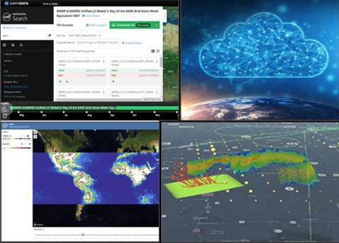
The role of NASA’s Distributed Active Archive Centers (DAACs) has rapidly evolved over the past few years. Factors include the enormous growth in data volume, NASA’s Open Science goals, growth of cloud-based architectures to address these factors, and DAACs actively promoting the scientific use of Earth science data. NASA's Global Hydrometeorology Resource Center DAAC (GHRC DAAC) is a leader in the DAAC cloud transition. As the cloud pathfinder, GHRC was the first to host all holdings in the cloud. GHRC continues to develop cloud-based user services, both internally and in collaboration with other DAACs, to enhance the use of Earth science data. This presentation highlights four cloud-based user services at GHRC DAAC. These are Earthdata Pub (improving how data get to the DAACs), Bulk Downloader (improving data access by users), as well as the Lightning Dashboard and Field Campaign eXplorer (FCX) (improving data discovery, visualization, and analysis).


Register Now!


(Image Credit: Famartin, CC BY-SA 4.0, Wikimedia Commons)
 
Image Source - Wiki Commons: https://commons.wikimedia.org/wiki/File:2016-03-08_18_09_23_Sunset_at_th...
Sunset at the WSR-88D NEXRAD Doppler Radar in Sterling, Virginia.jpg
 
 
The NASA Global Hydrology Resource Center (GHRC) DAAC published five NEXRAD IMPACTS datasets. These datasets consist of Next Generation Weather Radar (NEXRAD) Level II surveillance data that were collected at 31 NEXRAD sites from January 1 to March 1, 2020 during the Investigation of Microphysics and Precipitation for Atlantic Coast-Threatening Snowstorms (IMPACTS) field campaign. IMPACTS was a three-year sequence of winter season deployments conducted to study snowstorms over the U.S Atlantic Coast. The campaign aimed to (1) Provide observations critical to understanding the mechanisms of snowband formation, organization, and evolution; (2) Examine how the microphysical characteristics and likely growth mechanisms of snow particles vary across snowbands; and (3) Improve snowfall remote sensing interpretation and modeling to significantly advance prediction capabilities. There are currently 160 Weather Surveillance Radar-1988 Doppler (WSR-88D) or NEXRAD sites throughout the United States and abroad. These Level II datasets contain meteorological and dual-polarization base data quantities including: radar reflectivity, radial velocity, spectrum width, differential reflectivity, differential phase, and cross correlation ratio. The IMPACTS NEXRAD Level II data files are available in netCDF-4 format. It should be noted that this dataset will be updated in subsequent years of the IMPACTS campaign. It should be noted that the long range max range is 460km and the short range max range is 230km. But while the long-range config theoretically has a max range of 460km, once the beams get out that far, they are high above the Earth's surface so will only be able to detect the most intense storms and systems at the longer ranges.
 
KCLE NEXRAD IMPACTS
 
KCXX NEXRAD IMPACTS
 
KDIX NEXRAD IMPACTS
 
KDOX NEXRAD IMPACTS
 
KDTX NEXRAD IMPACTS


Image Source - Wiki Commons: https://commons.wikimedia.org/wiki/File:2016-03-08_18_09_23_Sunset_at_the_WSR-88D_NEXRAD_Doppler_Radar_in_Sterling,_Virginia.jpg Sunset at the WSR-88D NEXRAD Doppler Radar in Sterling, Virginia.jpg


(Image Credit: Famartin, CC BY-SA 4.0, Wikimedia Commons)
 
Image Source - Wiki Commons: https://commons.wikimedia.org/wiki/File:2016-03-08_18_09_23_Sunset_at_th... Sunset at the WSR-88D NEXRAD Doppler Radar in Sterling, Virginia.jpg
 
 
The NASA Global Hydrology Resource Center (GHRC) DAAC published five additional NEXRAD IMPACTS datasets. These datasets consist of Next Generation Weather Radar (NEXRAD) Level II surveillance data that were collected at 31 NEXRAD sites from January 1 to March 1, 2020 during the Investigation of Microphysics and Precipitation for Atlantic Coast-Threatening Snowstorms (IMPACTS) field campaign. IMPACTS was a three-year sequence of winter season deployments conducted to study snowstorms over the U.S Atlantic Coast. The campaign aimed to (1) Provide observations critical to understanding the mechanisms of snowband formation, organization, and evolution; (2) Examine how the microphysical characteristics and likely growth mechanisms of snow particles vary across snowbands; and (3) Improve snowfall remote sensing interpretation and modeling to significantly advance prediction capabilities. There are currently 160 Weather Surveillance Radar-1988 Doppler (WSR-88D) or NEXRAD sites throughout the United States and abroad. These Level II datasets contain meteorological and dual-polarization base data quantities including: radar reflectivity, radial velocity, spectrum width, differential reflectivity, differential phase, and cross correlation ratio. The IMPACTS NEXRAD Level II data files are available in netCDF-4 format. It should be noted that this dataset will be updated in subsequent years of the IMPACTS campaign. It should be noted that the long range max range is 460km and the short range max range is 230km. But while the long-range config theoretically has a max range of 460km, once the beams get out that far, they are high above the Earth's surface so will only be able to detect the most intense storms and systems at the longer ranges.
 

Have you used our data? Register for updates