GHRC News
GOES-R PLT ER-2 Flight Navigation DOI:
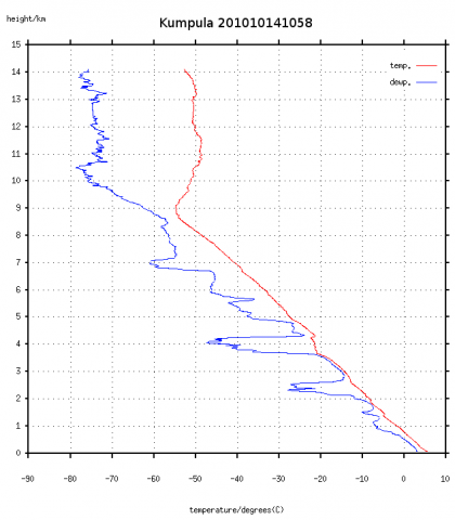 The NASA Global Hydrology Resource Center (GHRC) DAAC published the Global Precipitation Measurement (GPM) mission ground validation Light Precipitation Validation Experiment (LPVEx) radiosonde data set. The Vaisala radiosondes were used to produce vertical profiles of atmospheric temperature, pressure, humidity, and winds. The radiosondes were launched from two locations: Kumpula and Vantaa, Finland. The LPVEx field campaign took place around the Gulf of Finland in September and October, 2010. However, the Vantaa launch site record extends through January 2011. The campaign was to provide additional high altitude, light rainfall measurements for the improvement of GPM satellite precipitation algorithms. Data files are available in TSV format with PNG browse images. Data are available from September 15, 2010 through January 28, 2011.
LPVEx Radiosonde DOI:
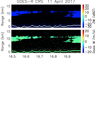 The NASA Global Hydrology Resource Center (GHRC) DAAC published the GOES-R Post Launch Test (PLT) Cloud Radar System (CRS) dataset. The CRS provides high-resolution profiles of reflectivity and Doppler velocity at aircraft nadir along the flight track. The CRS was flown aboard a NASA ER-2 high-altitude aircraft during the GOES-R Post Launch Test (PLT) field campaign. The campaign took place from March to May 2017 in support of post-launch L1b and L2+ product validation of the Advanced Baseline Imager (ABI) and the Geostationary Lightning Mapper (GLM). Data files in netCDF-3 format are available for April 11, 2017 through May 17, 2017.
GOES-R PLT Cloud Radar System (CRS) DOI:
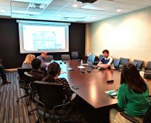
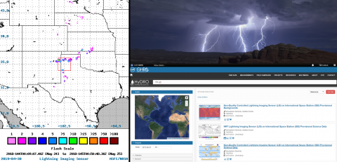 The NASA Global Hydrology Resource Center (GHRC) DAAC participated in its annual Earthdata webinar. This is an activity that each DAAC participates in to showcase updates and capabilities. This year, the GHRC presented, “Using the ISS Lightning Imaging Sensor and Release of the GOES-R Post Launch Test Observations.” The webinar started with background information about GHRC. The main body of the presentation focused on the International Space Station Lightning Imaging Sensor (ISS LIS). This included information about the importance of lightning observations and physical reasoning. Information, including a live demonstration, was provided on how to access and download these data. The final part of the ISS LIS section focused on a lightning exposure risk study in Bangladesh and Nepal through the NASA DEVELOP program. The webinar concluded with the announcement of the GOES-R Post Launch Test field campaign data and a description of this campaign.
Direct Link: http://earthdata.adobeconnect.com/p97d3r1ncr2t/
YouTube link: https://youtu.be/VkmkdLSPwJw