 The NASA Global Hydrology Resource Center (GHRC) DAAC published seven GOES-R PLT Lightning Mapping Arracy (LMA) datasets. These datasets consist of total lightning data measured from multiple LMA systems, including Colorado (COLMA), Washington DC (DCLMA), NASA's Kennedy Space Center (KSCLMA), North Alabama (NALMA), Oklahoma (OKLMA), Southern Ontario (SOLMA), and West Texas (WTXLMA), during the GOES-R Post Launch Test (PLT) airborne science field campaign. The GOES-R PLT airborne science field campaign took place in support of the post-launch product validation of the Advanced Baseline Imager (ABI) and the Geostationary Lightning Mapper (GLM). The LMA measures the arrival time of radiation from a lightning discharge at multiple stations and locates the sources of radiation to produce a three-dimensional map of total lightning activity. These data files are available in compressed ASCII files and are available from March 1, 2017 through June 1, 2017.
GOES-R PLT Colorado Lightning Mapping Array (LMA)
DOI: http://dx.doi.org/10.5067/GOESRPLT/LMA/DATA101
DOI: http://dx.doi.org/10.5067/GOESRPLT/LMA/DATA101
GOES-R PLT Washington D.C. Lightning Mapping Array (LMA)
DOI: http://dx.doi.org/10.5067/GOESRPLT/LMA/DATA201
DOI: http://dx.doi.org/10.5067/GOESRPLT/LMA/DATA201
GOES-R PLT Kennedy Space Center Lightning Mapping Array (LMA)
DOI: http://dx.doi.org/10.5067/GOESRPLT/LMA/DATA301
DOI: http://dx.doi.org/10.5067/GOESRPLT/LMA/DATA301
GOES-R PLT North Alabama Lightning Mapping Array (LMA)
GOES-R PLT Oklahoma Lightning Mapping Array (LMA)
GOES-R PLT Southern Ontario Lightning Mapping Array (LMA)
GOES-R PLT West Texas Lightning Mapping Array (LMA)
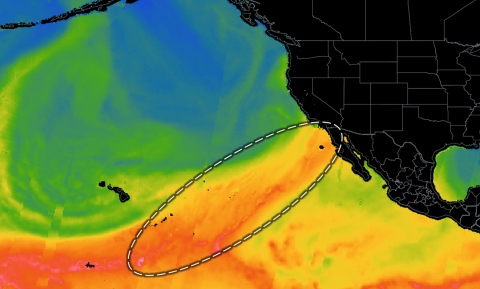 The NASA Global Hydrology Resource Center (GHRC) DAAC published a fourth phenomenon Micro Article, this one introducing atmospheric rivers. The Micro Article summarizes what atmospheric rivers are, how they occur, and where they are observed by research instruments. The new atmospheric river Micro Article is available at
  The NASA Global Hydrology Resource Center (GHRC) DAAC published the GOES-R PLT Lightning Instrument Package (LIP) dataset. This dataset consists of electrical field measurements of lightning and navigation data collected by the Lightning Instrument Package (LIP) flown aboard a NASA ER-2 high-altitude aircraft during the GOES-R Post Launch Test (PLT) airborne science field campaign. The GOES-R PLT airborne science field campaign took place between March 21 and May 17, 2017 in support of the post-launch product validation of the Advanced Baseline Imager (ABI) and the Geostationary Lightning Mapper (GLM). These data files are available in ASCII format with browse imagery available in PDF format. It should be noted that this dataset is not continuous as flights did not occur every day. Two data files for April 6, 2017 and April 27, 2017 are not included in this dataset due to missing navigation information; however, they are available upon request.
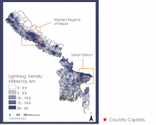 The NASA Global Hydrology Resource Center (GHRC) DAAC published a new Micro Article about NASA DEVELOP’s Hindu-Kush Himalayan Disasters project GHRC collaborated with. A Micro Article is a short, interesting document that brings together data and key science concepts. This study investigated the lightning risks in the HKH region and the correlation between precipitation and lightning. Lightning flash point data collected by the Lightning Imaging Sensor (LIS) onboard both the Tropical Rainfall Measuring Mission (TRMM) satellite and the International Space Station (ISS) from January 2001 to December 2017 were plotted to determine the locations where the highest concentrations of lightning strikes occurred. Data from the United Nations Office for Disaster Reduction (UNISDR) Global Assessment Report for 2015 (GAR15), Oak Ridge National Laboratory (ORNL) Landscan 2016 global population dataset, and NASA’s Shuttle Radar Topography Mission (SRTM) were used to assess the factors that contribute to a population’s vulnerability to lightning activity. Additionally, the team used the TRMM Precipitation Radar (PR) data to identify areas with the highest precipitation rates over Bangladesh and Nepal. A Lightning Risk Map (LRM), created to highlight lightning-prone areas and regions with vulnerable populations, showed that communities in western Nepal and northern Bangladesh are at an increased risk for lightning related injury. A Precipitation and Lightning Correlation was calculated to verify whether areas experiencing heavier precipitation also experienced higher lightning totals. These end products will assist the BMD and the DHM to increase hazard awareness and issue earlier warning times to reduce lightning casualties. You can find this Micro Article at
 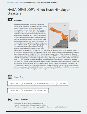 The GHRC has developed a new type of Micro Article. A Micro Article is a short, interesting document that brings together data and key science concepts. GHRC has now developed 6 types of micro articles: Instrument, Event, Phenomenon, Publication, Field Campaign, and now Applications. The Application Micro Article provides a summary of projects and applications utilizing GHRC data, highlighting objectives and findings, points users to relevant publications, and lists published data with links to landing pages. All currently available Micro Articles can be accessed from the GHRC website at