GHRC News

GHRC User Working Group

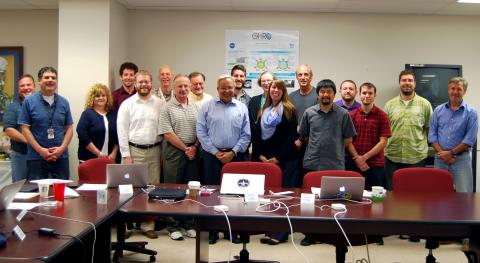
The Global Hydrology Resource Center DAAC hosted its first User Working Group meeting September 25 - 26, 2014 in Huntsville, Alabama. Key scientists from GHRC’s major discipline areas - the hydrologic cycle, severe weather interactions, lightning, and atmospheric convection – were invited to represent GHRC’s user community.Members of the GHRC gave presentations on DAAC data holdings, operations, and services. These presentations focused on the GHRC’s data stewardship activities including management of the GHRC’s data assets and knowledge augmentation services such as infrastructure, tools, and user services. In addition, members of the UWG were invited to give presentations on their individual research topics in GHRC’s major science areas. The UWG will provide guidance to the GHRC on topics such as pursuing new data holdings, developing new research ideas, and enhancing the overall user experience. Pictures can be found on our Facebook page at https://www.facebook.com/media/set/?set=a.529391120528912.1073741832.328055457329147&type=3.

The USWG meeting was hosted by ASF DAAC

Sherry Harrison represented the GHRC DAAC at the annual DAAC User Services Working Group (USWG) Technical Interchange Meeting in Fairbanks, AK, September 9-11, 2014. The annual meeting was hosted by the Alaska Satellite Facility. Sherry presented on the major accomplishments and activities of the GHRC DAAC over the last year.

GCPEx logo
IFloodS logo

GHRC has published the GPM Ground Validation Dual-frequency Dual-polarized Dopper Radar (D3R) guide for two missions: Iowa Flood Studies (IFloodS) and the GPM Cold Season Precipitation Experiment (GCPEx). The D3R is a fully polarimetric, scanning weather radar system operating at the nominal frequencies of 13.91 GHz and 35.56 GHz covering a maximum range of 30 km. The Doppler velocity, radar reflectivity, and spectrum width are provided in the data in the netCDF format. Browse images are also available in .png format.


GCPEx logo

GHRC has published the guide for the GPM Ground Validation Environment Canada Snow Depth Surveys GCPEx dataset including dataset specific citation and DOI. The dataset was manually collected during the GPM Cold-season Precipitation Experiment (GCPEx) which occurred in Ontario, Canada, January 20, 2012 through February 27, 2012 across four sites (CARE, Steamshow, Huronia Airport, and Skydive-Jump). Snow depth, water equivalent and density transects were surveyed weekly at each of the GCPEx sites in order to provide baseline information on the distribution of snow on the ground. Pairs of bulk density and snow water equivalent measurements were made every 25 m along the same transect using an ESC-30 (30 cm2 cross sectional area) snow corer. Snow depth measurements were made every 50 cm along a 100 m transect using a GPS equipped snow depth probe.


HS3

NASA's Hurricane and Severe Storm Sentinel (HS3) begins its third season of observations this week. Two unmanned Global Hawk aircraft carry instruments to monitor tropical storms and the surrounding environment to investigate the processes that underlie hurricane formation and intensity change in the Atlantic Ocean basin. Data from the HS3 mission will be archived at and available from the Global Hydrology Resource Center (GHRC). GHRC is supporting the 2014 mission by providing requested ancillary data products to the science team, including brightness temperature, cloud top height, and overshooting tops datasets from the Cooperative Institute for Meteorological Satellite Studies (CIMSS) at the University of Wisconsin. Also available are the Dust AOT product from NASA GSFC Global Modeling and Assimilation Office (GMAO) and the NOAA SHIPS Intensity Forecast data from the NOAA Hurricane Research Division. These data will be made publicly available when the mission datasets are released.

Have you used our data? Register for updates