GHRC News
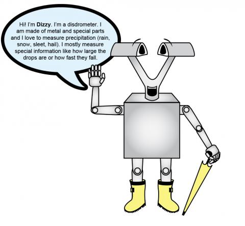 The NASA Global Hydrology Resource Center (GHRC) DAAC just published a new ESRI Story Map titled ‘Dizzy the Disdrometer: A story of how Dizzy the Disdrometer participated in the Global Precipitation Measurement (GPM) Ground Validation field campaigns’. This story map is a fun and interactive way to learn about the disdrometer instrument, the GPM Ground Validation project, GHRC, the different field campaigns performed during the project, and where the reader can find these data. This story map can be found at https://www.arcgis.com/apps/Cascade/index.html?appid=7a5a77a504d54a478c329304242c1ce3.
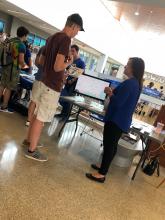
Leigh Sinclair and Rebecca Kollmeter from the Global Hydrology Resource Center (GHRC) DAAC participated in the University of Alabama in Huntsville’s (UAH) Week of Welcome, where they described the DAAC and handed out materials for the interested students. The UAH students enjoyed the lightning visualization from the GHRC DAAC.

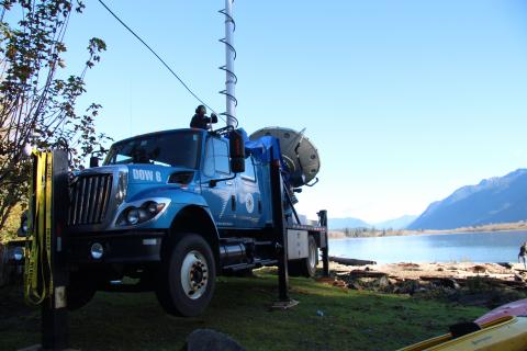 The NASA Global Hydrology Resource Center (GHRC) DAAC published the GPM Ground Validation Doppler on Wheels (DOW) OLYMPEX V2 dataset. This dataset was obtained by a dual-polarization and dual-frequency X-band mobile radar operated by the Center for Severe Weather Research (CSWR) during the Olympic Mountain Experiment (OLYMPEX) campaign. The DOW was deployed in the Chehalis Valley for the OLYMPEX field campaign with the goal of obtaining radar reflectivity and Doppler velocity observations in order to better understand the orographic enhancement of precipitation during frontal passages over mountain ranges. The DOW radar uses two 250 kW transmitters with a measurement range of roughly 60 km. These data are available in CFradial netCDF-4 format from November 6, 2015 through January 15, 2016. It should be noted that this new version of DOW OLYMPEX data was created due to a discrepancy between DOW and the NASA S-Band Dual Polarimetric Doppler radar (NPOL), which was also used in the OLYMPEX field campaign. A new and more appropriate calibration method was determined and the data were reprocessed.
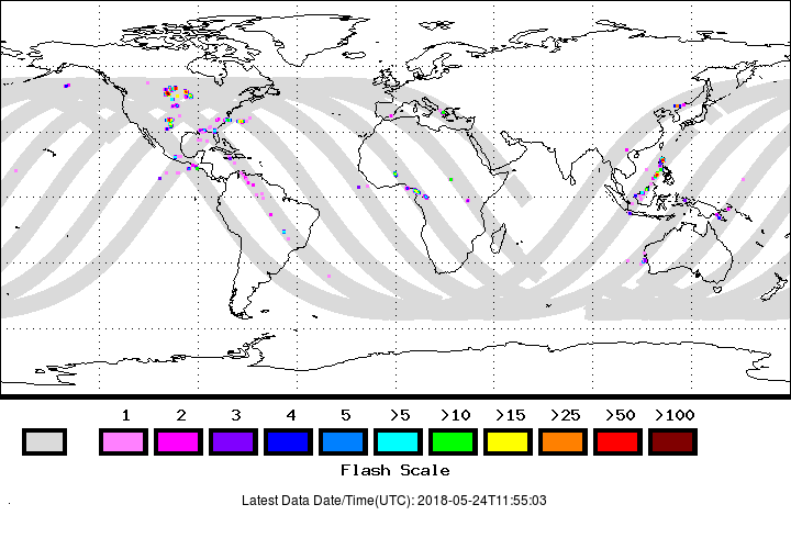
The NASA Global Hydrology Resource Center (GHRC) DAAC just published a new version (P0.2) of four different datasets from the Lightning Imaging Sensor (LIS) onboard the International Space Station (ISS):
- NRT Lightning Imaging Sensor (LIS) on International Space Station (ISS) Provisional Science Data
- NRT Lightning Imaging Sensor (LIS) on International Space Station (ISS) Provisional Backgrounds
- Non-Quality Controlled Lightning Imaging Sensor (LIS) on International Space Station (ISS) Provisional Science Data
- Non-Quality Controlled Lightning Imaging Sensor (LIS) on International Space Station (ISS) Provisional Backgrounds
The new P0.2 ISS LIS data contain geolocation improvements of lightning flash locations. This data collection can be used for severe storm detection and analysis, as well as for lightning-atmosphere interaction studies. The LIS instrument makes measurements during both day and night with high detection efficiency. The data are available in both HDF-4 and netCDF-4 formats, with corresponding browse images in GIF format.
It should be noted that these ISS LIS data are considered provisional files indicating that the algorithm is still under development and the data may contain errors. Use the data with caution and do not use for research leading to publications or presentations without consent of the data provider. Please give feedback directly to the data provider. Quality controlled data are currently unavailable, but are expected to be available later this year.
