 The NASA Global Hydrology Resource Center (GHRC) DAAC published the GPM Ground Validation Airborne Precipitation Radar 3rd Generation (APR-3) OLYMPEX V2 dataset (http://dx.doi.org/10.5067/GPMGV/OLYMPEX/APR3/DATA201).
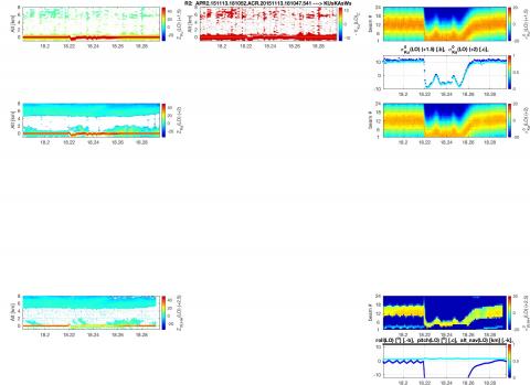
This dataset was collected from November 12, 2015 to December 19, 2015 during the GPM Ground Validation Olympic Mountains Experiment (OLYMPEX) field campaign held in the Pacific Northwest. This dataset is version -2 (V2) of the APR-3, an enhanced and upgraded instrument derived from the APR-2 used in previous field campaigns. APR-3 has the addition of W-band measurement capability, and scans cross-track from +/- 25° to the right and left of nadir. Ku-band, Ka-band, and W-band frequency Doppler measurements are made by APR-3 from the DC-8 aircraft at 10 km altitude during OLYMPEX. The APR-3 dataset files are in HDF-5 format with JPG format browse images. This dataset contains radar reflectivity, Doppler velocity for all bands, linear depolarization ratio at Ku-band, and normalized radar cross section measurements at Ka and Ku-bands. It should be noted that this dataset is version 2, replacing the previous APR-3 dataset published by GHRC in 2017 (DOI for previous version: http://dx.doi.org/10.5067/GPMGV/OLYMPEX/APR3/DATA101). This APR-3 dataset is intended for research and users should contact the APR-3 team regarding data use, especially before publication or public presentation. This dataset is still undergoing validation and quality control. Users are invited to address questions and provide feedback to the Data Provider.
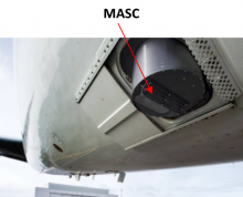 The NASA Global Hydrology Resource Center (GHRC) DAAC published the GPM Ground Validation Microwave Atmospheric Sounder on Cubesat (MASC) OLYMPEX dataset (http://dx.doi.org/10.5067/GPMGV/OLYMPEX/MASC/DATA101).
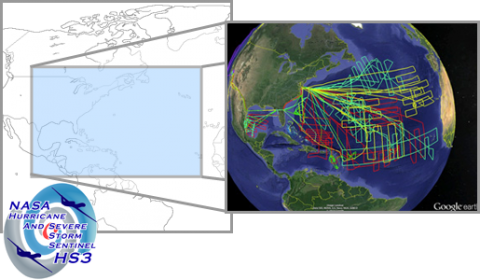 The NASA Global Hydrology Resource Center (GHRC) DAAC has published its first Field Campaign Micro Article. This Micro Article features the Hurricane and Severe Storm Sentinel (HS3) Field campaign. This campaign was a NASA mission that studied Atlantic Ocean hurricane formation using a pair of NASA Global Hawk unmanned aircraft. The mission occurred over 5 northern hemisphere late summers, with the primary focus on 2012, 2013, and 2014.
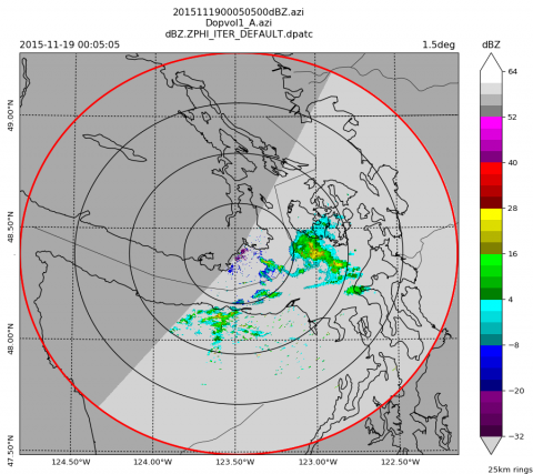 The NASA Global Hydrology Resource Center (GHRC) DAAC published the GPM Ground Validation CAX1 Radar RB5 format OLYMPEX dataset (